Download
1 / 19
190 likes | 322 Views
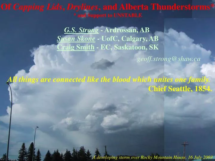
Of Capping Lids , Drylines , and Alberta Thunderstorms* * and Support to UNSTABLE G.S. Strong - Ardrossan, AB Susan Skone - UofC, Calgary, AB Craig Smith - EC, Saskatoon, SK geoff.strong@shaw.ca.

E N D
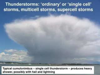
Of Capping Lids, Drylines, and Alberta Thunderstorms* * and Support to UNSTABLE G.S. Strong - Ardrossan, AB Susan Skone - UofC, Calgary, AB Craig Smith - EC, Saskatoon, SK geoff.strong@shaw.ca All things are connected like the blood which unites one family. Chief Seattle, 1854. A developing storm over Rocky Mountain House, 16 July 2003
The basic large-scale Conceptual Model • What to Look for: • 1) Synoptic conditions 6-18 hours preceding • - subsidence preceding upper ridge • - ascent preceding upper trough • - orographic subsidence/ascent • - location - location - location • (where/when cyclogenesis?) • What’s going on between the synoptic • and meso-γ scales?
cm s-1 Storm formation ~ 18:30Z Pre-storm period)
Critical changes occur in the BL during late-morning (1400-1600 UTC) . . .HOW?
Proposed Modification to the Multi-scale Conceptual Model of Alberta Thunderstorms to account for dryline initiation of storms.
GPS Precipitable Water Trend on 20 July 2003 Storm peak moves by ~ 2200Z Earliest radar echoes 2030Z 1730Z
How important is local evapotranspiration to storm formation? • Some background for this from a study of moisture contrast between • prairie grass and a wheat field in St. Denis, SK, July-August, 1992 • (previously unpublished data). St. Denis, SK Fieldsite, July-August, 1992
St. Denis, SK Crop/Grass ET Field Tests, July-Aug., 1992 (18-day average for each half hour) • grass • transition • wheat - after Hrynkiw & Strong (1992)
Conclusions/Recommendations for UNSTABLE: • Preceding (6-18 hours) synoptic conditions. • What’s going on between scales? • 2a) Everyone: Documented cloud photography and manual observations!! • 3) Document mesoscale conditions over foothills 2-6 hours preceding storm initiation. • 4) Note foothills topography. • 5) Need high temporal resolution soundings (2-hour intervals recommended during morning); • tethered balloons and/or instrumented towers (100-m) would be great assets. • 6) Document storm initiation & life cycle (radar/satellite). • 7) Mobile surface transects deep into the foothills (late morning and mid-afternoon). • 8) High spatial/temporal resolution GPS PW data, concentrate on -4 to +2 hours of storm initiation. • 9) Need reliable soil moisture (and ET) data in major soil zones regions. • Analyses: • Precedent synoptic conditions, 6-18 hours. • Precedent mesoscale conditions, 2-6 hours. • Everything for storm initiation period (-1 to + hours)! • Storm-scale (meso-gamma) for storm life cycle. • Diurnal trends in all variables.
UNSTABLE Proposal to CFCAS, Feb 2002 • To investigate synoptic to micro-scale interactions with thunderstorms at • three interfaces as indicated, • - Focus on the pre-storm to storm initiation periods.
Sundre (WAV) (Skew-T) Soundings 20 July 03 at1530Z &2352Z Precipitable Water 1530Z - 19.9 mm 2352Z - 20.9 mm EA3 18Z - 15.9 mm EA2 00Z - 15.7 mm EF4 12Z - 15.6 mm EF4 17Z - 16.2 mm
Climatological Trend of Mixing Ratio (YXD, YXE, YWG) - after Strong (2005)