Download
1 / 33
330 likes | 422 Views
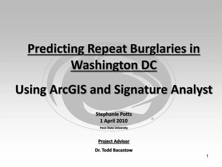
Predicting Repeat Burglaries in Washington DC Using ArcGIS and Signature Analyst

E N D
Predicting Repeat Burglaries in Washington DC Using ArcGIS and Signature Analyst Stephanie Potts 1 April 2010 Penn State University Project Advisor Dr. Todd Bacastow
Problem • Law enforcement is poor at predicting and therefore preventing repeat burglaries because criminology has focused primarily on understanding the criminal rather than the crime’s location. vs.
Summary of Approach • Will address possible human ecological factors that may determine why criminals target the same homes or blocks numerous times in one year. • Will explore the “routine activity theory” in relation to burglary events within the District of Columbia (DC) • Will attempt to measure various “behavior settings (places)” to determine their level of attractiveness to repeat burglary events. Other “Behavior Settings” like distance to police stations, street lights, alleyways, and open areas. Street Network Permeability Type of Housing Rossmo, D.K. (2000). Geographic Profiling. CRC Press.
Purpose • Investigate the importance of spatial signatures for repeat burglary events within DC. • Determine the possibility of providing actionable intelligence to law enforcement on where and when burglary events may take place in the future. • Determine how spatial information may help to establish crime prevention programs and highlight flaws in urban design.
Literature ReviewGrounding in the Problem • Summary of findings by Johnson et. al of the Jill Dando Institute of Crime Science, University College London, UK • Repeat burglaries often emerge independently of the overall crime density in an area. • Affluent areas are more often victim to planned burglary spates than opportunities taken by criminals during their routine activities. • The opposite is true for deprived areas where the criminal probably lives near his victim and has plenty of opportunities to find suitable targets. Johnson and Bowers (2004). The Burglary as Clue to the Future: The Beginnings of Prospective Hot-Spotting. European Journal of Criminology. Volume 1, (2): 237–255. SAGE Publications.
Australia: Canberra and Beenleigh Netherlands: Hague and Zoerermeer New Zealand: Aukland and Palmerston North United Kingdom: Wirral and Bournemouth United States: Pompano Beach and Philadelphia Literature ReviewGrounding in the Problem • Summary of findings by Johnson et. al continued… • By using statistical techniques, historically used to study disease contagion, confirmed that burglaries cluster in space and time. • Problem is not unique to the US. In other countries, following an initial burglary, the communication of risk for nearby homes is elevated for two weeks and within 200m of the initial event. Johnson and Bowers (2004). The Burglary as Clue to the Future: The Beginnings of Prospective Hot-Spotting. European Journal of Criminology. Volume 1, (2): 237–255. SAGE Publications. Johnson et. al (2007). Space–Time Patterns of Risk: A Cross National Assessment of Residential Burglary Victimization. Journal of Quantitative Criminology Volume 23, Number 3: 201-219. Springer Netherlands. Johnson and Bowers (2009). Permeability and Burglary Risk: Are Cul-de-Sacs Safer? Journal of Quantitative Criminology. Springer Netherlands Publications.
Literature ReviewGrounding in the Problem • Summary of findings by Johnson et. al continued… • Methods Used to Determine Spatial Temporal Clustering • Results tested against chance expectation via a Monte Carlo simulation and the Knox Method (1964). • But used a Lorenz plot to examine the differences between expected spatial clustering at the street segment level and the observed spatial clustering at the street segment level. • Finally, they used a Gini coefficient to determine the level of statistical significance • Their method performed better than the expected results and was able to account for edge effects.
Literature ReviewGrounding in the Problem Summary of findings by Johnson et. al continued… • Burglaries are significantly more clustered at the street segment level than what would be expected by chance. • Determined level of permeability by… • Classifying street segments within their study area. • Quantified the number of links between each. • Used a gamma index to determine the rate of burglaries per 1,000 homes per annum for each type of street segment. Cul-de-sacs had a much lower rate of burglary, especially those that had a sinuous geometry. Johnson and Bowers (2009). Permeability and Burglary Risk: Are Cul-de-Sacs Safer? Journal of Quantitative Criminology. Springer Netherlands Publications. Grubesi TH, Matisziw TC, Murray AT, Snediker D (2008) Comparative approaches for assessing network vulnerability. Int Reg Sci Rev 31:88–112. As used in Johnson and Bowers (2009).
Literature ReviewGrounding in the Problem Arguments Against Johnson and Bowers’ Study Graphic 1 This cycle route creates a connection between a supermarket and an upper school to the once safe cul-de-sac neighborhood, which is now plagued with burglaries. • Stephen Town of Bradford District, England argues that Cul-de-Sacs are not always safer if urban planning is flawed and introduces opportunities for burglars to enter a private neighborhood. • Oftentimes, having a walking or cycling route traverse through neighborhoods can make areas more susceptible. Town, S. (2005). Permeability, Access Opportunities and Crime. Telegraph & Argus, Bradford ODPM and Home Office. (2004) Safer Places: The Planning System and Crime Prevention (London: Thomas Telford). As Used by Town (2005) Used here for educational purposes only.
Literature ReviewGrounding in the Problem Stephen Town’s Arguments Continued Graphic 1 “A Radburn Layout: a well-intentioned attempt to separate people from cars. Originating from the United States in the 1920s, this open plan layout was still being built until the 1970s. Unfortunately, and predictably, ‘open plan’ proved open to abuse.” (Town(2005)) • Open common areas can also cause problems by permitting offenders and the anti-social to walk through neighborhoods without being challenged. • Sometimes what would be considered flaws in today’s urban design was a planned feature in years past. • The UK has particular problems with alleyways that were originally designed for coal and other deliveries, but are now being plagued with criminals. Crouch, Steve. Henry Shaftoe and Roy Fleming. (1999) Design for Secure Residential Environments (Harlow: Longman). As Used by Town (2005) Used here for educational purposes only. Town, S. (2005). Permeability, Access Opportunities and Crime. Telegraph & Argus, Bradford
Literature ReviewGrounding in the Problem • The type and variability of housing within a street network has also been hypothesized as a determining factor in burglary rates. • Analysis of the 1996 and 1998 British Crime Survey concluded that living in a detached house increases the risk of burglary. (Kershaw et. al (2000)) Kershaw, C., Budd, T., Kinshott, G., Mattinson, J., Mayhew, P. and Myhil, A. (2000). The 2000 British Crime Survey: England and Wales. Home Office Statistical Bulletin 18/00. London: Home Office. Acquired on 24 February from http://www.homeoffice.gov.uk/rds/pdfs/hosb1800.pdf
Grounding in the Problem Preliminary Findings • An examination of burglary events in DC suggests that repeat burglaries are taking place most often in impoverished areas, but not necessarily in areas with the highest risk of crime. • These density and neighborhood risk maps compare the results of a kernel density analysis of all the burglary events in DC from 2006 through 2009 to burglary risk statistics provided by the Washington Post (Data acquired from the DC Data Catalog (2010) and the DC GIS Data Clearinghouse/Catalog (2010)) (Data acquired from the Washington Post – 2010)
Grounding in the Problem Preliminary Findings (Data acquired from the Washington Post – 2010) According to the Washington Post, within the areas where Washington has high burglary densities, the highest level of burglary risk is within the Atlas District. In fact, within the high burglary density areas, the Atlas District also has the highest overall level of crime risk.
Grounding in the Problem Preliminary Findings • Within the Bellevue neighborhood (red box) Martin Luther King Jr. Ave SW alone had a total of 78 burglaries between 2006 and 2009. • MLK was consistently the street with the highest number of repeat burglaries for all four years. • Study will test the validity of the “routine activity theory” within the neighborhoods that have the highest number of repeat burglary events. • Particular attention will be paid to the Bellevue neighborhood. (Data acquired from the DC Data Catalog (2010) and the DC GIS Data Clearinghouse/Catalog (2010))
Grounding in the Problem Preliminary Findings The Routine Activity Theory • What makes particular areas susceptible only to single instance burglaries and others susceptible to repeat burglaries? • One of the most germane theoretical approaches to studying environmental criminology is the “routine activity theory”, which states • Offenders “consistently commit crime in neighborhoods they personally know well or that are very similar in physical, social and economic characteristics to their homes neighborhoods “for a direct-contact predatory crime to occur, the paths of the offender and the victim must intersect in time and space, within an environment appropriate for criminal activity” (Rossmo, D.K. (2000). Geographic Profiling. Pg 112, CRC Press). Brantingham, P.L., & Brantingham, P. J., (1995). Criminality of place: Crime generators and crime attractors. European Journal on Criminal policy and Research: Crime Environments and Situational Prevention, 3(3), 5-26. As referenced by Rossmo (2000).
Research Approach • Analysis will be conducted via Signature Analyst, a GIS plug-in created by Spadac Incorporated. • Traditional geospatial predictive models are dependent on assumptions and subject matter expertise, which can introduce bias into a suitability model. • Signature Analyst, however, creates a model by automatically discovering the causal relationships between events and their environment. Density shows only the areas which are already known. Signature Analyst shows areas known and unknown. Spadac Inc. (2010). Signature Analyst Key Features. Acquired 24 February from http://www.spadac.com/SignatureAnalyst/Features/ Used here for educational purposes only. Spadac Inc. (2010). Signature Analyst Key Features. Acquired 24 February from http://www.spadac.com/SignatureAnalyst/Features/
Research Approach Analytic Steps in Signature Analyst STEP 1: Factor Type Function (FTF) must be defined for each study factor. “FTFs define the measurement type used to characterize the relationship between an event and a factor”(Signature Analyst User Guide, pg 13, Spadac, 2009).
Research Approach • Analytic Steps in Signature Analyst Continued… • STEP 2: Once measurements have been defined Raw Factor Data (RFD) will be combined as the building blocks of the Signature Analyst Assessment. • The first stage in the assessment process is to create the Events RFD and the Area of Interest (AOI) RFD. (Signature Analyst User Guide, pg 15, Spadac, 2009).
Research Approach • Analytic Steps in Signature Analyst Continued… • STEP 3: An examination of the relationship of events and the AOI to a factor will be done via Signature Analyst’s Probability Density Function (PDF). • The Events PDF curve (in red) is plotted using the Events RFD table for every Factor. • The AOI PDF curve (in blue) is plotted using the AOI RFD. • Factors will be identified as either a repellor or an attractor to a repeat burglary event. Attractor Repellor (Signature Analyst User Guide, pgs 15 -17, Spadac, 2009).
Research Approach Analytic Steps in Signature Analyst Continued… • STEP 4: The final step is to build factor assessment layers, which “represent the likelihood that an event will occur relative to an individual factor”(Signature Analyst User Guide, pg 18, Spadac, 2009). • Assessment layers are then aggregated together to create an overall geospatial assessment. (Signature Analyst User Guide, pg 19, Spadac, 2009). Factor Assessment Layer for 2004 population per square mile. (Signature Analyst User Guide, pg 19, Spadac, 2009).
Research Approach Analytic Steps in Signature Analyst Continued… When the geospatial assessments are created Signature Analyst also creates three analytic outputs that can be used to calibrate and validate a model. 1.) Factor metrics 2.) K-fold Cross-Validation 3.) Dendrograms Graphics From: Signature Analyst Users Guide, pg 174 and 185 Spadac, 2009 (Signature Analyst Users Guide, pg 173,178 and 184, Spadac, 2009).
Research Approach • Signature Analyst has two different models that can be used against the repeat burglary problem: • These models are Geospatial Preference Models • Based on an intelligent site selection (ISS) process • Measured by feature space rather than geographic coordinates. • The site selection process is based off environmental criminology theory, which • Feature Space Preference Model • Naive Bayes Model • “focuses on criminal patterns within particular built environments and analyzes the impacts of these external variables on people's cognitive behavior” (Wikipedia, 2010). (Dalton and Porter, White Paper: Geospatial Preference Models in Signature Analyst, Spadac, 2009).
Research Approach • The Feature Space Model (FSP) • Constructs a kernel density estimate in order to create a multivariate factor profile for each event (repeat burglary). • Profiles are then combined to develop an overall assessment score of the actor’s (burglar) site selection preferences, which can be portrayed on a map via a choropleth map of likelihood values in the AOI. • FSP assumes… • 1. Smooth densities over site selection decision space • 2. Discontinuous in the geographic space. • 3. The actor’s site preferences are regional and remain stationary (Dalton and Porter, White Paper: Geospatial Preference Models in Signature Analyst, Spadac, 2009).
Research Approach • Naïve Bayes • Based off of Bayes Theorem • But assumes that all factors are independent. • Currently investigating how it and other geospatial preference models manage spatial autocorrelation. • May have to run a test to see how it performs against our problem of repeat burglaries. (Dalton and Porter, White Paper: Geospatial Preference Models in Signature Analyst, Spadac, 2009).
Research Approach Subject Matter Expert Suitability Model Based Off Literature Review Signature Analyst’s Overall Geospatial Assessment Combined Choropleth Map • To increase accuracy, a suitability model, based solely on the expertise provided in the literature review, will be combined with Signature Analyst’s overall geospatial assessment.
Outlook • Initial hypothesis … • Theses results could eventually lead to an automated predictive model that will help police to allocate resources properly against the problem of repeat burglaries before they occur. • street network permeability are attractors to repeat burglaries • detached housing are attractors to repeat burglaries • “behavior settings (places)” such as street lights and police stations are repellors to repeat burglaries
Next Steps • Prepare Data • Categorize Buildings in DC Study Area • Categorize each factor into FTFs • Process Signature Analyst Assessment • Build Suitability Model Workflow • Process Suitability Model • Combine models into one map.
Monte Carlo Simulation • Used to locate n events randomly in the study area, perhaps 100, 500, or 1000 times. • Results may be used to calculate an expected frequency distribution for the independent random process. • Results can also be used to determine how unusual is an observed pattern. • Problem: Very computationally intensive. O’Sullivan and Unwin, (2003). Geographic Information Analysis. John wiley and Sons Inc, pg 106
Knox Method • Statistical technique used for testing space time interaction. • The distances between burglary events are calculated in terms of time and space • If burglar events are close in time and close in space then there is space time interaction. Kulldorf, Martin (1999). The Knox Method and Other Tests for Space-Time Interaction. Biometrcics, pg 544
Lorenz Plot and Gini Coefficient Graphic Acquired from Johnson and Bowers (2009). Permeability and Burglary Risk: Are Cul-de-Sacs Safer? Journal of Quantitative Criminology. Springer Netherlands Publications.
Gamma Index • In network analysis the gamma index is a measure of the connectivity in a network. • It is a measure of the ratio of the number of edges in a network to the maximum number possible. • The index ranges from 0 (no connections between nodes) to 1.0 (the maximum number of connections, with direct links between all the nodes). http://www.answers.com/topic/gamma-index