Download
1 / 13
130 likes | 229 Views
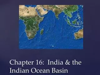
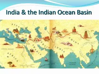
Indian Ocean Basin. Map Link: Portuguese/Spanish Spice Routes : < http://upload.wikimedia.org/wikipedia/commons/thumb/9/9c/ 16th_century_Portuguese_Spanish_trade_routes.png/ 1280px-16th_century_Portuguese_Spanish_trade_routes.png >. Horn of Africa and east coast

E N D
Indian Ocean Basin Map Link: Portuguese/Spanish Spice Routes: <http://upload.wikimedia.org/wikipedia/commons/thumb/9/9c/ 16th_century_Portuguese_Spanish_trade_routes.png/ 1280px-16th_century_Portuguese_Spanish_trade_routes.png>
Horn of Africa and east coast Berbera and Land of the Zanj 8th c. Start of Muslim settlement on east coast of Africa Map Link: Africa in 979: <http://www.timemaps.com/store/timemaps/2012/12/ newafrica_ad979.jpg>
8th c. Start of Muslim settlement in S. Asia 10th c. Muslim traders on Malabar coast 11th c. Muslim states in S. Asia Map Link: South Asia in 1215: <http://www.timemaps.com/store/timemaps/2012/4/ newsouthasia_ad1215.jpg>
“The Lands below the winds” Strait of Melaka (Malacca) Sunda Strait Map Link: Southeast Asia: <http://upload.wikimedia.org/wikipedia/commons/ thumb/f/fc/Southeast_asia.svg/506px- Southeast_asia.svg.png>
Themes: Trade Conversion Conflict
Activities of merchants Bantu Swahili (Sahel) Intermarriage Deeper spread in Horn of Africa Map Link: Africa in 1453: <http://www.timemaps.com/store/timemaps/2012/4/ africa_ad1453.jpg>
Activities of merchants End 15th c. Many conversions on Malabar coast Mappilas (Moplahs) Map Link: South Asia in 1453: <http://www.timemaps.com/store/timemaps/2012/4/ newsouthasia_ad1453.jpg>
Activities of merchants in 13th-16th c. Aceh Java “Orthodoxy” vs. custom Tolerance Map Link: Southeast Asia in 1453: <http://www.timemaps.com/store/timemaps/2012/4/ seasia_ad1453.jpg>
1492 Spanish take Granada, end Muslim states in Iberia 1498 Vasco de Gama rounds Cape of Good Hope, reaches Malabar Coast Portuguese/Spanish crusade against Islam 1570 Spanish take Manila. Conquest of Philippines follows (Philip II, r. 1556-98)
Early 17th c. English and Dutch fight for dominance in Southeast Asia (Dutch win) Monopoly, through force if necessary Map Link: Southeast Asia in 1648: <http://www.timemaps.com/store/timemaps/2012/7/ seasia_ad1648.jpg>
Reactions: 16th c. Mappilas respond to Portuguese crusade with modified jihad Islam as symbol of resistance
Decline of Southeast Asian Islam under Dutch: Cutting out the middlemen – decline of Muslim merchant class Controlling prices – impoverishment of cities Breakdown of communications
Sidi (Seydi) Ali Reis (1498-1563) Ottoman admiral commissioned by sultan to fight Portuguese in Indian Ocean Unintended travels in India and elsewhere in 1553-56, incl. meeting Mughal Emperor Humayun (r. 1530-56) Mir’at al-Memalik (The Mirror of the Countries, 1557)