Download
1 / 35
420 likes | 955 Views
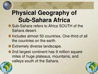
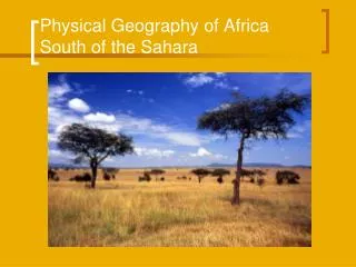
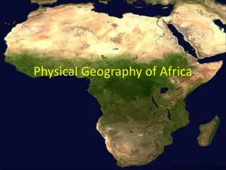
Chapter 19 Physical Geography of Africa South of the Sahara. 7 th Grade Geography. Section 1. Physical Features. Africa South of the Sahara. 2.5 times bigger than the United States. Madagascar. Largest island off mainland. Plateaus. Most of the land consists of high plateaus.

E N D
Chapter 19Physical Geography of Africa South of the Sahara 7th Grade Geography
Section 1 Physical Features
Africa South of the Sahara • 2.5 times bigger than the United States
Madagascar • Largest island off mainland.
Plateaus • Most of the land consists of high plateaus.
Escarpments • Steep, jagged cliffs. • Create waterfalls on many African rivers.
The Congo Basin • Largest lowland
Ethiopian Highlands • Kilimanjaro: Highest Mountain in Africa • Mt. Kenya • Located in East Africa
Drakensberg Range • Southern Africa • Barrier of Pointed Spears
The Great Rift Valley • Natural wonder of East Africa. • Formed by shifting tectonic plates.
Lakes • Most are found in the Great Rift Valley
Lake Tanganyika • Longest freshwater lake in the world.
Lake Victoria • Africa’s largest lake. • 2nd largest freshwater lake in the world.
Lake Chad • Changes size every year. • From 10,000-3,800 square miles.
Rivers • Escarpments prevent use for shipping.
Congo River • More than 30 waterfalls on it. • Found in Congo Basin
Zambezi River • Forms Victoria Falls.
Resources • This region has many resources.
Oil • Principal export in many coastal countries.
Natural Gas • Found in Central Africa
Coal • Found in Nigeria and DRC.
Hydroelectric • Result of the many fast rivers.
Iron Ore • Large deposits in Zimbabwe.
Uranium • Used to make nuclear weapons
South Africa • Half of the world’s gold and diamonds here.
Section 2 Climate Regions
Mainly found in tropics. • Receives year-round direct sunlight
Rainforests • Dense stands of trees found along the Equator.
Ecotourism • Preserves rainforests and boosts economies.
Savanna • Grasslands with scattered woods. • Elephants, lions, giraffes found here.
Steppe • Rainfall is scarce. • Clearing trees leads to desertification.
The Kalarahi Desert • Sandy desert in Southern Africa
The Namib Desert • Rocky desert along southwestern coast.
Southwestern Africa • Mediterranean Climate