Download
1 / 130
1.35k likes | 1.64k Views
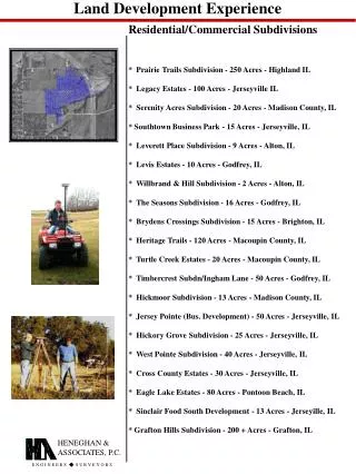
LAND DEVELOPMENT. MAKING LAND USEFUL WITH PROFIT. TYPES OF DEVELOPMENT. Residential: Single family, duplex, townhouse, apartments, and condominiums. Commercial: Professional office, stores, malls. Industrial: single developments and industrial parks. Recreational:

E N D
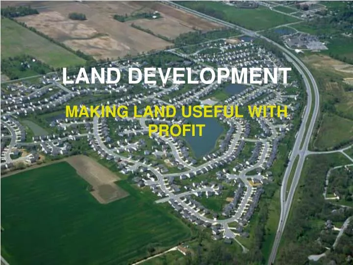
LAND DEVELOPMENT MAKING LAND USEFUL WITH PROFIT
TYPES OF DEVELOPMENT • Residential: Single family, duplex, townhouse, apartments, and condominiums. • Commercial: Professional office, stores, malls. • Industrial: single developments and industrial parks. • Recreational: • Amusement - land use, local impact, access, liability, population supply. • Recreation - private clubs and sporting • Parks – state and federal • Resorts – complete facility • Use or ownership shared • Residential – incorporate a residential development around recreational site.
CONCEPTS AND ROLES OF THE LAND SURVEYOR Purpose of land development is to make the environment more useful and comfortable for humanity. • Must be done in an organized and planned manner. • Most often must be able to create a profit. • Must meet political; economic; and aesthetics, while maintaining solid engineering principles.
CONCEPTS AND ROLES OF THE LAND SURVEYOR • Land Use Controls: exist to protect public health, safety and welfare. • Enabling Acts: passed in 1920’s – federal laws permitting states to pass zoning and subdivision laws. • Zoning Regulations: use of land-use controls to protect the rights of the individual property owner and rights of others with in the community • 3 Basic areas: residential, commercial, and industrial • Changed through exceptions and variances can occur – must shoe individual and public both benefit
CONCEPTS AND ROLES OF THE LAND SURVEYOR • Land Subdivision Regulations: • State, county, municipal: Provides legal definition of a subdivision • Who can prepare • Monument requirements • Procedures for approval; design standards; construction requirements • Designed to protect individual to assure that access, utilities, drainage, open space, adequate building space, are all provided.
LAND SURVEYOR’S ROLE • The role of the land surveyor varies depending on state – some on design (Indiana) • At minimum: boundary survey; create subdivision; topographic survey and construction stakeout. • Can include: speaking for developer and limited design • State dependent: horizontal and vertical street alignment; sanitary and storm sewer, etc.
STEPS FOR A LAND DEVELOPMENT PROJECT • Est. at least 2nd order control traverse near boundary. • Complete boundary survey • Est. benchmark system • Prepare topographic map • Determine plan for streets, lots, utilities, etc. • Develop preliminary drawing • Obtain approval of preliminary design • Compute direction and distance of lots and streets, also engineering design
STEPS FOR A LAND DEVELOPMENT PROJECT • Prepare plat of subdivision; final topo map and engineering plans • Set all monuments • Obtain final approval • Have developer record plat and topo map
APPROVAL BY MUNICIPAL AUTHORITIES • Make sure zoning laws and subdivision ordinances are met. • Permits must be obtained • Streets and access entrance permits • Sewage facilities – sanitary and storm • Water system - EPA • Others as needed • Owner sill want municipality to take over maintenance of streets, sewer, water, etc. • Any items not to be dedicated – establish maintenance methods
TWO MAJOR REQUIREMENTS FOR APPROVAL • Development must contribute to the value of adjacent tracts; comply to master plan and add to tax base. • All street and utility construction information provided.
OVERALL, LAND DEVELOPMENT PROJECTS INCLUDE: • Boundary and Topographic Surveys • Construction Surveys • Design and Construction of: • Access • Flood Control and Drainage Facilities • Potable Water • Collection and Treatment of solid and waterborne waste • Utilities • Recreation facilities • Coordination and Communication with Interest Groups
EACH PROJECT IS DIFFERENTSome of these differences include: • What developer wants • Economic (available funds) • Existing conditions (large factor) • Develop project to use existing in best way • Never accept existing maps - check
INTEREST GROUPS TO BE WORKED WITH: • Governing bodies: municipal and county (planning commission) • Developer: Range from those who take pride in quality and a profit to those only interested in profit • Minimize delays and unneeded costs • Don’t let desire for profit overshadow duty • Contractor: Develop a plan that can be built • Home Buyer: create safe and pleasant area • Account for special populations
INTEREST GROUPS TO BE WORKED WITH: • Public and Community: Increase overall value • Affects: traffic, taxes, schools, etc. • Environmentals: Concern with protecting and preserving natural environment • Environmental Impact Statements – large projects • Professionals: Engineers, Architects, etc. • Work for interest of client and are controlled and limited by regulations, codes, ethics, and standards.
PLATTING PROCESS • PRE APPLICATION • PRELIMINARY PLAT • FINAL PLAT
RESIDENTIAL PLANNING CONCEPTS The actual planning of a subdivision is much more than just following a set of regulations. • Development Concepts: • Traditionally individual lots for single family dwellings with access streets • Other needs require dedication and each are zoned for single purpose
RESIDENTIAL PLANNING CONCEPTS • PUD’s (Planned Unit Developments) • Integrated plan of residents, community shopping, recreation, open space, schools all mixed into small communities • Requires changes in zoning concepts • Generally large scope developments • Neighborhood Unit concept: residential neighborhood created around a central focus • Pattern based on lot arrangement • Conventional lot and block • Lots and streets with no open or recreation areas • Most intense land use, small lots
RESIDENTIAL PLANNING CONCEPTS • Cluster Development • Lot and block system but side and/or back yard are developed for common parks or open spaces • Must have home owners association to care for commons areas • Pattern Based on Street Arrangement • Street location can dictate lot pattern • Rectangular – most common • Lot and block with square corners • Pattern is visually monotonous and disregards topo • Easy to design and develop
RESIDENTIAL PLANNING CONCEPTS • Curvilinear: similar to rectangular but streets are curved to fit topography • Relieved repetition, slows speed, overall development can meet terrain • Radial: resembles spokes of a wheel • Useful if some central focus is needed or exists • Can cause problems with triangular lots • Linear: development along both sides of single road
RESIDENTIAL PLANNING CONCEPTS • Loops and Cul-De-Sacs • Loop – U shaped, Cul-de-sac • Used to minimize repetition in rectangular or curvilinear systems • Also provides additional access • Can also be used to create small cluster communities within a development • Coving and Bayhome Concept • Purpose – developing land at a lower cost while creating superior communities • Provides more desired density • Increased safety • Decreased run off
COVING • Coving combines both the bending of streets and setbacks creating more open space; generally the ROW is reduced 35% • The Basics: • Winding street pattern reduces or eliminates side streets and total number of individual streets • Lineal feet of streets typically reduced 20-40% while maintaining density and four way intersections minimized • Open space within entire community increased • Pedestrian walkways positioned to follow a curvilinear path separate from streets
COVING • Road remains at widths recommended • Layout reduces views of home sides or rears and homes rarely face another home front or rear which gives enhanced privacy • Streetscape consists of park like green space which meander from one side of the street to the other • Average lot size increases by 10-20% with extra typically in home fronts
BAYHOMING • Bayhoming uses the same concepts as coving but with more density • Coving is based on single family ownership, while with bayhomes the land and all items outside the home are held in common ownership with a homeowners association • Coving incorporates townhouses in a staggered format • Requirements: • Bayhomes have no individual lot, this allows for larger infrastructure reduction • While coving provides smooth curves with no staggering, Bayhomes can be greatly staggered creating more panoramic views from within homes • Parking is in rear with screened walls and landscaping hiding vehicles from public collector streets • Bayhomes have large front porches • Front of home is toward common areas
BENEFITS AND CONCEPTS OF COVING AND BAYHOMING • PRESERVING THE SENSE OF THE COMMUNITY • PRIORITIZE VIEW • REDUCE INFRASTRUCTURE • AFFORDABILITY • SAFER STREETS • FEWER INTERSECTIONS • OPEN SPACES • MINIMIZE ERROSION AND SEDIMENT POLLUTION • MORE TREE SPACE • NO SQUARE LOTS
ADVANTAGES TO MUNICIPALITY • LESS INFRASTRUCTURE TO MAINTAIN • LESS LAW ENFORCEMENT DUE TO INCREASED SECURITY AND LACK OF INTERSECTIONS • DUE TO AVAILABLE SPACE, PEOPLE DO NOT FLEE URBAN SPRAWL
DENSITY • Population Density – density affecting quality of life. • To many creates noise, lack of privacy, and increased conflicts • To few can create lack of socialization, excess travel, and high cost of community services • Most commonly expressed as “Dwelling Units/Acre” (DC/Ac) • Gross density – units/acre of total land • Residential density – units/acres of land including streets, public facilities, etc. • Net density – units/acre of land devoted only to residence • Can also be a variable using people/acre • Typical residential density – below 2 DU/Ac is low with common design value of 2 – 5 DU/Ac
EXAMPLE 3 DU/AC IS DESIRED 25% LAND AREA IS STREETS AND OPEN AREA THUS 75% OF 43560 OR 32670 ft² GOES INTO 3 LOTS THUS 10890 ft²/ LOT TYPICAL LOT SIZE COULD BY 90’x120’ ¾ x 43560 = 32670ft² 32670/ 3 = 10890ft²/lot
SITE ANALYSIS AND SUITABILITY • USGS topo’s provide a rough source for this • Also check SCS and others for maps • Site Suitability: depends on viewpoint of person • Includes: • use which provides most profit • Use that provide maximum enjoyment and highest life quality • Use that preserves or improves the balance of nature and is least disruptive to the environment
TOPOGRAPHY AND DRAINAGE PATTERNS • Affects: streets, drainage, views, earthwork, erosion, environmental • Gently rolling terrain best - 2-5% slopes • 5-10% can also provide good sites with increased cost • Slopes over 20% require special considerations • Matching the topo is essential • Soils and geology: soil type and presence of rock • Depth of water table • Environmental factors: orientation and shape of sites • How to use natural features as a benefit • Sun angle, trees, noise, wildlife and aesthetic character of site
SUBDIVISION DESIGN PRINCIPLES AND STANDARDS • Usual standards, develop a checklist • Geometric Principles • Streets, sidewalks, intersections, lots and easements all depend on geometric principles • Following them simplifies design and layout and balance and symmetry prevail • Follow terrain • Front lot lines should be straight or arcs and side lines should be either perpendicular or radial to street ROW
BLOCK AND LOT STANDARDS • Blocks: directly relates to streets; not required • Length, shape, slope and general arrangement normally regulated • Max length normally between 1000’ – 1500’ • Shape dependent on terrain and tract shape • Lots: must have satisfactory building site and be properly related to topography • Must have vehicle access to local street • Standards can specify minimum width and depth • Min width 70’ typical • Depth normally approx. 3 times width • 20’ – 50’ setback at front with 5’ – 10’ side and back • Avoid double frontage
LAND USE: CREATE BALANCE • Urban Land Institute • Large development – 35% non-residential • Small development – 25% non-residential • Streets: ROW dedicated – acceptance • Collector – 60’ ROW – 70’ ROW • Minimal individual access – purpose is to move traffic to arterial streets • Local – 50’ ROW – 60’ ROW • Access to lots, services and collector streets • Low speed (20 – 30 mph) • Allow for plantings, pedestrians, and bikeways • Alignment • Cul-de-sac streets normally have max length of 600’ – 1000’ with minimum radius of 50’ ROW and 40’ paved • Jogs (T-intersections) – prefer min of 125’ between • Reverse Curves – keep to min and use larger curve radius • Sight distance – hilly area – 100’; local streets – 200’; collector streets – 250’
LAND USE: CREATE BALANCE • Vertical curves must have a minimum length equal to 10 – 20 times the algebraic difference in grades (%) • Max grade is normally 15% and minimum is 0.5% • Minimum radius for circular curves range from -200’ on local streets and 300’ for collector streets • Street alignment should minimize need for storm sewers • Follow ridges, parallel or perpendicular to contours, and along shallow swales. • Naming • Street: North – South streets • Avenue: East – West streets • Drive or Boulevard: Meandering streets • Road or Way: street that runs other than cardinal directions • Lane or Place: North – South Cul-de-sac streets • Circle or Court: East – West Cul-de-sac streets
LAND USE: CREATE BALANCE • Intersections: Junctions of more than 2 streets, avoided • T intersection is preferred • Offsets between 4way intersections: • 150’ min local and 300’ collector • Angles: centerline intersect should be close to 90° with 75° being minimum • Streets should remain in tangent for 100’ min prior to PC • Grade should be relatively flat with max being 0.5% - 4% • Minimum sight distance at intersections = 90’ • Minimum curb radius = 20’ local; 30’ collector • Sidewalk and Bikeway: one or both sides if needed – 4’ width minimum, 6’ better. • Easements: 15’ – 30’ minimum
DESIGN • Roadway • Locate Centerline • Direction and distance (PI-PI) • Develop Centerline Profile • Plot existing ground and special features • 1”-5’ or 10’ vertical and 1”-50’ or 100’ horizontal • Design proposed centerline: 0.4%-15% slopes • Stay as close as possible to existing ground • Avoid roller coaster • Balance cut and fill • Identify culvert locations and allow clearance • 20MPH – 10’ LENGTH / 1º CHANGE • 30MPH – 20’ LENGTH / 1º CHANGE • 40MPH – 35’ LENGTH / 1º CHANGE • MIN. VERTICLE CURVE LENGTH 75’-100’
DESIGN • Pavement: Thickness based on AASHTO and Soil design based upon the lowest soil support values. • Normal: Rigid – PCC – 6”-10” dependent on loads • Flexible: Bituminous Concrete • Surface: 2 ½” – 4” • Base: 6” – 8” • Sub-base (Stone): 6” – 12” • A-3 (Oil and Chip) • Base 8”-12” granular with asphalt 3 times with chips • General alleys at most
DESIGN • Roadway design: • Site study by traffic engineer to determine needs on site and effect of development on existing system • Site access; traffic circulation; traffic flow • Take care using one way streets • Streets often have other uses: bicycles; play and minimal on street parking • Streets have slow design speeds: 20-35 mph • Sight distance-critical Stopping distance: d= V2/30f d= braking distance in feet V=vehicle speed in MPH f=coefficient of friction
DESIGN • Local street design guidelines (local streets) • Curb: Barrier; Mountable; V (depressed) • Parking: off street parking • Space width 9’-11’ • Space length 18’-20’ • Recreational vehicles (boat/trailer) 10’ x 40’ • Make parking areas aesthetically pleasing
DRAINAGE SYSTEMS • Retention – No runoff • Detention – Controlled, limited runoff • Development will always cause additional runoff • Utilize topography to minimize amount to be handles • Drainage design based on average and 5-50 yr rainfall • Charts and info: West of 103°W longitude – NOAA Atlas 2; East of 103°W longitude – USWB TP-40 and/or NWS Hydro 35 • Runoff depends on: permeability of soil; slope; topography; climate; and amount of rainfall