Download
1 / 11
110 likes | 118 Views
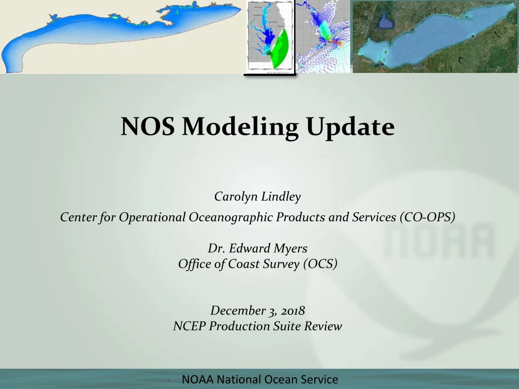
Utilizing high-resolution 3-D forecast guidance, this modeling system provides essential information for safe and efficient navigation, including water levels, currents, temperature, and salinity. It also supports ecological modeling, particle trajectory applications, and search and rescue operations.

E N D
NOS Modeling Update Carolyn Lindley Center for Operational Oceanographic Products and Services (CO-OPS) Dr. Edward Myers Office of Coast Survey (OCS) December 3, 2018 NCEP Production Suite Review
Operational Forecast Systems (OFS) • Forecast guidance for high priority ports and approaches to ensure safe and efficient navigation to head of tide (high-resolution 3-D forecast guidance of total water levels, currents, water temperature and salinity) • Water levels for under keel clearance • Currents for USCG right-of-way decision-making and pilot maneuverability • Establish modular infrastructure to enable other types of forecasts – “national backbone” • Ecological, water quality modeling (EFR, NWI) • Search and rescue, particle trajectory applications (USCG, NOS ORR) • All models meet an accepted standard of performance and stability
Storm Surge Modeling • Extratropical Surge and Tide Operational Forecast System (ESTOFS) provides storm surge and tide guidance (2-D) to provide: • Offshore marine forecast information to forecasters at OPC and NHC’s Tropical Analysis and Forecast Branch • Coastal inundation forecast information to WFOs • Water level boundary conditions to EMC’s NWPS for coastal wave predictions • Hurricane Surge On-Demand Forecast System (HSOFS) provides total water level information for evaluation within NWS to support response and recovery activities
FY18 Program Accomplishments • OFS • Completed implementation of the Gulf of Maine Operational Forecast system (January, 2018) • Completed major upgrade to the Coastal Ocean Modeling Framework (COMF) which updates the community versions of ROMS and FVCOM • Completed testing and delivery of the Cook Inlet Operational Forecast System (Implementation scheduled for FY19 Q2) • Storm Surge • Completed implementation of the Extratropical Surge and Tide Operational Forecast System in Micronesia (ESTOFS-Micronesia) (February, 2018) • Delivered code for new version of the Hurricane Surge On-demand Forecast System (HSOFS V2.5.1). New version will have a bias correction, customizable ensemble perturbations and updated bathymetry/topography. • NEMS coupling enabled between ESTOFS and WAVEWATCH III • Coordination on coupling ESTOFS and National Water Model
FY19 Program Priorities • OFS • Work with NCO to transition the 10 OFS supported by the COMF from Phase 2 to Phase 3 • Implement Cook Inlet OFS (CIOFS) and Lake Michigan and Huron OFS (LMHOFS) • Develop overall NOS Modeling Strategy to support diverse missions • Establish sustainable operational framework to support data assimilation for coastal ocean models (WCOFS, SIP WGs) • Provide technical POCs to advise development partners working within the Coastal Ocean Modeling Testbed (COMT) (R20 transitions) • Begin coupling 3D OFS (ROMS and FVCOM) with the National Water Model in NEMS in support of Integrated Water Prediction and Water Quality • Implement ice forecasting capabilities in FVCOM-based OFS in the Great Lakes and collaborate with NWS (OPC) on service delivery for ice forecasts
FY19 Program Priorities • Storm Surge • Bundle ESTOFS-Atlantic, ESTOFS-Pacific, and ESTOFS-Micronesia into single package • Evaluate developing a global ESTOFS grid with high resolution in US waters • Continue work towards coupling of ESTOFS with WAVEWATCH III and the National Water Model • Coordinate with universities on Water Initiative, Hurricane Supplemental, Coastal Ocean Modeling Testbed, Joint Technology Transfer Initiative, and Ocean Technology Transition projects to advance modeling capabilities and transition them into operations. Projects are addressing topics such as: • Model and grid improvements to connect ESTOFS with NWM • Evaluation of different coupling mechanisms between NOS coastal models and NWM • 3D model connections to NWM • Alaska storm surge modeling • Improved efficiency of model run times
Programmatic Challenges • Balancing FY19 and FY21 HPC moratoriums to support critical infrastructure upgrades with necessity to deliver models as scheduled to meet the National Ocean Service’s mission priorities (Precision Navigation, Coastal Coupling, DA) • Sustained observations for model skill assessment and data assimilation • Continued access to R&D supercomputing resources to support mission requirements • Ability to support user needs for storm surge, especially during an event (ongoing 2-year evaluation)
Programmatic Opportunities • NOAA Water Initiative • Coupling of coastal models with the National Wave Model to predict combined effects of surge, tide, wave action and freshwater in coastal zone • Integration of ecosystem components for water quality forecasting • Delivery of Integrated Water Level forecast products • NOAA Precision Navigation • OFS will provide a critical source of oceanographic information for integrated navigation services in top priority ports • Data assimilation (UMC, SIP) • Invest in key technologies, such as critical observation systems and cloud computing (UMC, NWI) • Increase ensemble simulations and investigate other enhancements for storm surge models
Storm Surge Modeling ESTOFS-Pacific: • starting in 2018, Q1 upgrades every 2 years ESTOFS-Micronesia • FY2017 Q4 implementation • starting in FY2017, Q4 upgrades every 2 years HSOFS: • FY2017 Q4 upgrade • afterwards, annual Q3 upgrades ESTOFS-Atlantic: • FY2017 Q3 upgrade • starting in FY2019, Q2 upgrades every 2 years