Download
1 / 40
420 likes | 504 Views
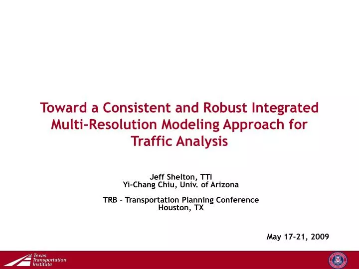
Toward a Consistent and Robust Integrated Multi-Resolution Modeling Approach for Traffic Analysis. Jeff Shelton, TTI Yi-Chang Chiu, Univ. of Arizona TRB – Transportation Planning Conference Houston, TX. May 17-21, 2009. Outline. Introduction Mesoscopic Microscopic

E N D
Toward a Consistent and Robust Integrated Multi-Resolution Modeling Approach for Traffic Analysis Jeff Shelton, TTI Yi-Chang Chiu, Univ. of Arizona TRB – Transportation Planning Conference Houston, TX May 17-21, 2009
Outline • Introduction • Mesoscopic • Microscopic • Multi-Resolution Modeling • Concept • Conversion Process • Modeling Issues • Case Study • Applications
Outline • Introduction • Mesoscopic • Microscopic • Multi-Resolution Modeling • Concept • Conversion Process • Modeling Issues • Case Study • Applications
Introduction • Integrating mesoscopic dynamic traffic assignment (DTA) and microscopic traffic simulation and assignment models can be advantageous for region-wide operational planning projects • DTA – region-wide estimation of traffic redistribution • Microscopic – local operational analysis • The integration synergizes the strengths of both models. • Challenges remain in model translation and interface • Modeling issues to be addressed • Consistency • Situation in which feedback is needed
Simulation-Based Dynamic Traffic Assignment (SBDTA) • Address issues that may fall beyond the reach of both: • Microscopic models: (dynamic but small-scale) typically used by traffic engineers for project traffic studies • Macroscopic models: (large-scale but static) typically used by transportation planners for long-range planning • SBDTA – dynamic and large-scale • The scenarios of interest may result in shifts of network or corridor-wide traffic flow patterns. • Significant change to roadway configuration • Certain corridor management strategies
Mesoscopic Dynamic Traffic Assignment • DynusT v2.0 • Free version available for DYNASMART-P users • Dynamic simulation and assignment tool for regional operational planning analysis • Equilibrium-based Dynamic Traffic Assignment • Assigned paths are based on experienced (actual) travel time • Applications • Assess impacts of ITS technologies • Work zone planning and traffic management • Evaluate HOV/HOT lanes • Congestion pricing • Special event/emergency evacuation
Microscopic • VISSIM 5.1 • A driver-behavior-based simulation tool capable of performing multiple applications including • Analyzing complex intersections • Border crossings inspection booths • Managed lanes • University campus settings • Fined-grained analysis • Vehicle interactions • Individual lane analysis • Simulate multiple modes of transportation simultaneously 3-D graphics
Outline • Introduction • Mesoscopic • Microscopic • Multi-Resolution Modeling • Concept • Conversion Process • Modeling Issues • Case Study • Applications
Concept • What is multi-resolution modeling? • Integrating mesoscopic and microscopic models for the purpose of achieving a specific goal • Analyze network at both the system-wide and localized levels • Why is multi-resolution modeling so important? • Mesoscopic & microscopic models are not mutually exclusive • They are complimentary to one another and can accomplish optimal modeling capabilities. • Retain the best characteristics of both • Realistic representation of regional traffic • Detailed interactions
Mesoscopic Model Sub-area Cut Concept Model Conversion Process Microscopic Model Integration Tool
Concept DynusT Sub-Area VISUM VISSIM
Multi-Resolution Modeling Framework Field Data Regional Travel Demand Model Initial Network Conversion (DynusT) • Calibration • Speed Profile • OD • Traffic Model Sub-Area Cut DVC VISSIM Calibration Yes Rerun DTA Detailed Analysis Network Modification No
DTA Model Preparation • Convert the GIS layer of the Travel Demand Model to Mesoscopic format. • Disaggregate 24-hour matrix based upon car & truck • Home to work • Work to home • Home to private • Private to home • Thru • External Local • Non-home based external local • Multiply each matrix by corresponding hourly factor
DTA Model Preparation Multiply each matrix by hourly factor H-W W-H H-P P-H THRU EXLO NHBEXLO Summation of matrices gives you directional 1-hour matrix
DTA Model Preparation 24 - one hour matrices
Calibration • Traffic flow model • Traffic simulation in DynusT is based upon the Anisotropic Mesoscopic Simulation (AMS) model • Moves vehicles based upon speed-density (v-k) relationship • v-k relationship is derived from Greenshields equation
Calibration Traffic Network Traffic Flow Model Intersection Controls Estimated Time-Dependent OD Matrices • Time-Dependent OD • Minimize the deviation between simulated and actual screen line counts & speed profile • Iterative process • Program solves linearized quadratic minimization problem • Results in updated OD matrices Traffic Assignment/ Simulation Assignment Results Update Demand Linear Optimization Model Results Optimized Affected, Time-Dependent OD Pairs
Conversion Process • Sub-area cut • Remove unneeded sections of network • Renumbering of new zones, nodes and links • Retains paths and flows that travel through the sub-area
Conversion Process • DynusT-VISSIM Converter • Developed by researchers from TTI and UA • Converts roadway network to VISUM network • Retains network geometry • Converts all time-dependent paths and flows • Creates separate transportation systems (car, truck)
Conversion Process • Microscopic model • Calibrate VISSIM model to reflect realistic roadway conditions • Perform detailed “fine-grained” analyses • Speed profile for individual lanes • Lane-changing behaviors • Vehicle interactions at merge areas • Create 3-D graphics for presentations
Modeling Issues • Consistency • Network • Lane configuration • Geometric design • Paths and flow • Verify same origin/destination paths • Verify number of vehicles generated • Speed profile • Perform field data collection to determine speed and vehicle counts • Obtain v-k curve from simulation output • Calibrate models with field data
Modeling Issues Speed (mph) Density (veh/mi)
Modeling Issues Field Data Regional Travel Demand Model Initial Network Conversion (DynusT) • Calibration • Speed Profile • OD • Traffic Model Sub-Area Cut DVC VISSIM Calibration Yes Rerun DTA Detailed Analysis Network Modification No When Feedback is Necessary
Outline • Introduction • Mesoscopic • Microscopic • Multi-Resolution Modeling • Concept • Conversion Process • Modeling Issues • Case Study • Applications
Case Study Model entire 22-mile corridor Freeway grade affects truck acceleration City Council proposes ordinance to restrict trucks from using left lane on I-10 corridor Analyze during peak hour traffic Use separate truck demand How does the ordinance affect the freeway and surrounding arterials?
Case Study Which type of model do I use? Microscopic Macroscopic Mesoscopic
Case Study • Truck restricted lanes • A case study to analyze the effectiveness of restricting trucks from left-most fast lane on freeway • 22-mile corridor of I-10 in El Paso, TX • Analyze a.m. peak, p.m. peak, & mid-day • Determine benefits • Speed on left-most lane • Acceleration/Deceleration patterns • Vehicle interactions at merge areas • DynusT estimates region-wide truck trajectories (route and flows) • VISSIM models detailed IH-10 truck lane operations given truck trajectories
Model Development 106 Origin/Destination links - 1895 Routes created
Model Development GPS unit was used to input freeway grading information
Model Development Field data collection-freeway speed profile (PM peak hour)
Model Development Data provided by TxDOT Automatic Traffic Recorder Stations
Case Study Speed Accel/Decel
Case Study Speed Accel/Decel
Case Study Speed – Left vs. Right Lane
Outline • Introduction • Mesoscopic • Microscopic • Multi-Resolution Modeling • Concept • Conversion Process • Modeling Issues • Case Study • Applications
Applications • Managed lanes • Truck restricted lanes • HOV lanes • HOT lanes • Time-dependent variable pricing
Applications • Geometric design alternatives • Freeway direct connect • Various design configurations • Ramp reconfiguration • Braided ramps • “X” ramps
Applications • Traffic impact studies • New retail shopping centers • Driveways • Pedestrian crossings • University campus planning • Integrating various modes of transportation (e.g. student, faculty, staff, pedestrians, transit) • New parking facilities • Campus core closure • Traffic calming