Download
1 / 16
160 likes | 375 Views
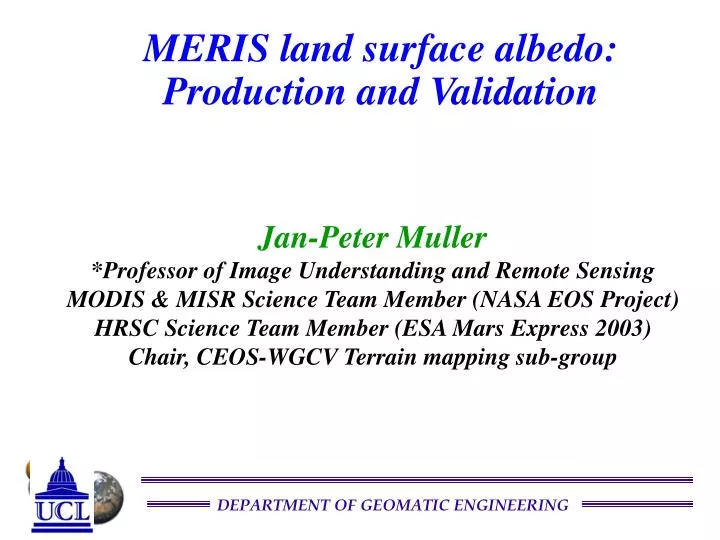
MERIS land surface albedo: Production and Validation. Jan-Peter Muller *Professor of Image Understanding and Remote Sensing MODIS & MISR Science Team Member (NASA EOS Project) HRSC Science Team Member (ESA Mars Express 2003) Chair, CEOS-WGCV Terrain mapping sub-group. Overview. Objectives

E N D
MERIS land surface albedo: Production and Validation Jan-Peter Muller *Professor of Image Understanding and Remote Sensing MODIS & MISR Science Team Member (NASA EOS Project) HRSC Science Team Member (ESA Mars Express 2003) Chair, CEOS-WGCV Terrain mapping sub-group
Overview • Objectives • BRDF/Albedo retrieval approach • Moving vs Static time window issue • Validation approach • Wish-list
Objectives • Derivation of a one-year land surface albedo from MERIS for • 13 of the 15 MERIS wavelengths (2 inside O2 absorption bands) • 2 broadband albedos (0.4-0.7µm, 0.7-1.0µm) • MONTHLY time step (see later) for 2003 • Input Level 2 Rayleigh+O3 corrected • 10km sinusoidal and 0.1º spatial resolutions • Publication of MERIS albedo browse images (as Web Map Services layers) within CEOS-WGISS EO Data Portal (http://iceds.ge.ucl.ac.uk) • Main driver is to improve the retrieval of atmospheric parameters from MERIS. Hence, we need spectral albedos at the MERIS wavelengths • Extremely limited resources (JPM) for validation by inter-comparison with other EO sensors and BRSN data
BRDF/albedo approach • Novel algorithms developed at Freie Universität by • Thomas Schröder for aerosol correction • Réné Preusker for cloud masking/detection • Brockmann Consult responsible for • algorithm coding, implementation and test (both production system and subsets as part of a new release of BEAM) • Production processing of MERIS level 2 • Previous experience in development of cal/val database for MERIS ocean products • BRDF retrieval will NOT be performed as sampling of the bi-directional plane insufficient for most land surfaces given the narrower swath (1130km) and lower temporal sampling (every 3 days at the equator) of MERIS • Instead BRDF will be taken from MOD43C2 (0.05º) and magnitude inversion employed for each cloud-free pixel directional spectral reflectance sample and average taken over appropriate monthly period. Would like to test use of Maignan et al (RSE04) for months when sufficient POLDER-2 samples available • Unresolved issues with high reflectance areas: snow and desert
Meris L2 SDRs Albedo retrieval scheme MOD43C2 BRDF (0.05º) + QA#1 flags BIN/AVERAGE MERIS SDRs (0.05º) MOD43C3 NBAR (0.05º) QA#2 Nsamps, ± stddev DAILY MAGNITUDE INVERSION with MOD43C2 CALCULATE <MERIS> NBAR OVER MODIS 16 DAY PERIOD INTERCOMPARE WITH MOD43C3 MERIS 0.05º 16- DAY NBAR CALCULATE MERIS NBAR 0.05º DAILY CALCULATE <MERIS> ALBEDO OVER 6 DAY DAILY MERIS ALBEDO CALC. MERIS 0.05º 16- DAY ALBEDOS INTERCOMP-ARE WITH MOD43C1 DIFF STATS MONTHLY/ SEASONAL AVERAGE RE-PROJECT TO 10KM QA3 Nsamps, ± std.dev. MOD43C1 ALBEDO (0.05º) N.B. Status: ATBD completed, coding underway, production due to start in June, completed by MERIS user workshop in Sep05 INTERPOLATE ALBEDO VALUES AT 9 OTHER BANDS + INTEGRATE TO VIS AND NIR Broadband MERIS 10KM 13- SPECTRAL +2 BROADBAND MONTHLY+ SEASONAL ALBEDOS
Moving vs Static window • Dr David Roy (MODIS Land QA/LDOPE Facility) has analysed global cloud statistics from Terra and Aqua separately and Terra+Aqua for fixed 16-day window and Terra-only (equivalent to Terra) with a moving 32-day window • Results indicate that a MOVING 32-day time-step with daily updated calculations will lead to MUCH higher retrievals of cloud-free pixels and many more FULL INVERSIONS of MOD43 • Schaaf et al (BU) have shown that TERRA+AQUA will improve the number of FULL INVERSIONS of MOD43 • Analysis by Roy using Terra+Aqua (fixed 16-day vs moving window) show excellent improvements in cloud-free samples • Plan to extend this to cloud statistics from MERIS to assess which approach will yield better statistics • N.B. POLDER-2 uses a 30-day moving window approach, reported at an unequal time interval (5th, 15th and 25th of each month)
Global 10 degree tile-level analysis of the mean annual probability of obtaining >=7 non-cloudy MODISTerraobservations in 16-day windows moved in daily steps through 366 days of 2004 Global mean annual probability = 0.636 (1s 0.26) [computed over the illustrated 143 non-polar tiles containing >25% land] droy@kratmos.gsfc.nasa.gov mean annual probability of obtaining >=7 non-cloudy observations
Global 10 degree tile-level analysis of the mean annual probability of obtaining>=7 non-cloudy MODIS Aqua observations in 16-day windows moved in daily steps through 366 days of 2004 Global mean annual probability = 0.595 (1s 0.26) [computed over the illustrated 143 non-polar tiles containing >25% land] droy@kratmos.gsfc.nasa.gov mean annual probability of obtaining >=7 non-cloudy observations D. Roy UMD
Global 10 degree tile-level analysis of the mean annual probability of obtaining>=7 non-cloudy MODIS Terra andAqua observations in 16-day windows moved in daily steps through 366 days of 2004 Global mean annual probability = 0.895 (1s 0.14) [computed over the illustrated 143 non-polar tiles containing >25% land] droy@kratmos.gsfc.nasa.gov mean annual probability of obtaining >=7 non-cloudy observations D. Roy UMD
Percentage of windows over the year where the probability of obtaining >=7 non-cloudy observations is > 0.9 Global analysis of the availability of >=7 non-cloudy MODIS Terra observations 32-day window moved in daily steps through 366 days of 2004 D. Roy UMD
Validation approach(1) • Difference statistics between MERIS-Albedo and MOD43C1 will be analysed • Overlapping MERIS swath NBARs (Nadir-equivalent BRDF Adjsuted Reflectance) will be used to assess how accurate the BRDF correction has performed as well as detect poorly corrected aerosol correction and poorly masked clouds • Inter-comparisons will be performed with • MISR 0.5º “true monthly” level-3 product (2003) • POLDER2 0.1º resampled 6km sinusoidal gridded 30-day products reported on the 15th of each month (Apr03-to-Oct03 • MOD43C1 sampled for “best albedo value” of two 16-day time periods within the months of Jan, Feb, Sep, Oct, Nov-03
Validation issues wish-list (if time available) • Scaling issues for MERIS albedo validation using in situ (SURFRAD/BSRN) • Assessing the impact of topography (elevation and slope) from SRTM (ICEDS) • Assessing the impact of urban areas on visible albedo variations (ICEDS)
-0.25 -0.20 -0.15 -0.10 -0.05 -0 Albedo over urban areasNile Delta (JD305 31.10.2000) • Distinctly higher albedo over urban areas in the Nile Delta • Can be hard to get full inversions over urban areas as they are frequently misidentified as cloudy Albedo
Night-time lights (1995-6):Cities around The Great LakesSenses light sources down to 10-9 W/cm2/sr/m (Elvidge et al., 1999) Radiance: x 10-10 W.m-2.sr-1.μm-1