Download
1 / 12
120 likes | 305 Views
“Crowd-sourcing” Highway and Street S peeds. 2013 American Dream Conference. C. Patrick Zilliacus Transportation Engineer. Why?.

E N D
“Crowd-sourcing” Highway and Street Speeds 2013 American Dream Conference C. Patrick Zilliacus Transportation Engineer
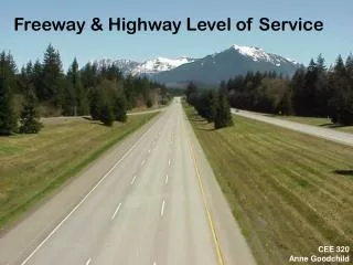
Why? To measure the existing speeds on many sections of the highway network. How well is the system performing, and have capital or operational improvements speeded-up traffic?
In the past, engineers have had to collect these data with expensive field work (travel time runs) that provide very small, very limited datasets. This approach allows the use of a much larger (and anonymous sample size over many days to provide better results by reducing day-to-day variation in travel conditions.
Sources Usually from the private sector. Two competing source of such data are Inrix and TomTom. There are probably others as well. My experience up to now is with Inrix, but I am not endorsing them over any other others. Google also displays such information on their maps, but is not apparently in the business of providing such data at this time.
Some uses In real time - to inform drivers of speeds on the highway network ahead (typically on variable message sign panels, but also with in-vehicle electronics (GPS) and through radio traffic reports). Also useful for traffic management purposes. To assess how well the highway network is working by looking back in time. Data are available for the past 5+ years now. This is what I will be discussing today.
Where do the data come from? Fleet vehicles (this was where Inrix got their start); GPS users; Other electronic devices.
How Studies can be at the statewide, region-wide, county-wide or city-wide level, or can be scaled down to a part of any of these, or to a specific corridor. A range of days to be analyzed should be determined as well as the time periods of interest. This could be before a transportation improvement was opened, and after the improvement had been open for use. Data for smaller streets with relatively low volumes of traffic are not usually available. Newly-built or newly-reconstructed sections of the network may not be immediately available.
Some current limitations Analysis of roads (and especially freeways) with heavy volumes of traffic are possible, and will yield accurate and credible results. BUT – it may not be possible to break-out managed lane traffic (HOV/Toll Lanes, Express Toll Lanes or HOV Lanes) from adjoining non-managed lanes of traffic. Validation research has shown that speeds on congested arterial roads may currently be over-stated under some conditions. However, is still possible to identify congested conditions, but caution is needed. Data for smaller streets with relatively low volumes of traffic are not usually available. Newly-built or newly-reconstructed sections of the network may not be immediately available.
This is evolving technology, and will likely get better in the future. There may come a day when most vehicles on the public highway network are equipped with the ability to report their speed and location (anonymously) to central locations.
Tools and skills required A warning – datasets are huge, and cannot be analyzed or processed with Excel or other spreadsheet programs, though such software are useful for post-processing and formatting of the final results. • At least some professional knowledge of the area or corridor to be studied is • very helpful; • - Geographic information system (GIS) software and supporting street networks • are usually needed; and • - “Industrial-strength” data analysis packages such as SAS or SPSS (and ability • to program in them) – and again – I emphasize - current spreadsheet • technology cannot cope with the size of these datasets.
So what do we get? • Factual, unbiased results – not anecdotal or samples limited • by small size • Using GIS technology, maps showing current conditions • Maps showing conditions before an improvement opened • Maps showing conditions after an improvement opened • Analysis recently completed for Maryland’s Route 200 (InterCounty Connector): • Intercounty Connector (ICC)/MD 200 Saving Time • http://www.mdta.maryland.gov/ICC/Saving_Time.html • http://www.mdta.maryland.gov/ICC/Documents/Memo_ICC%20Before%20and%20After%20Study_2013-03-15-3.pdf
Questions? I can be reached by e-mail at CPZ@OS2BBS.COM or by phone +1 (301) 509 9438. Thank you!