Download
1 / 42
420 likes | 842 Views
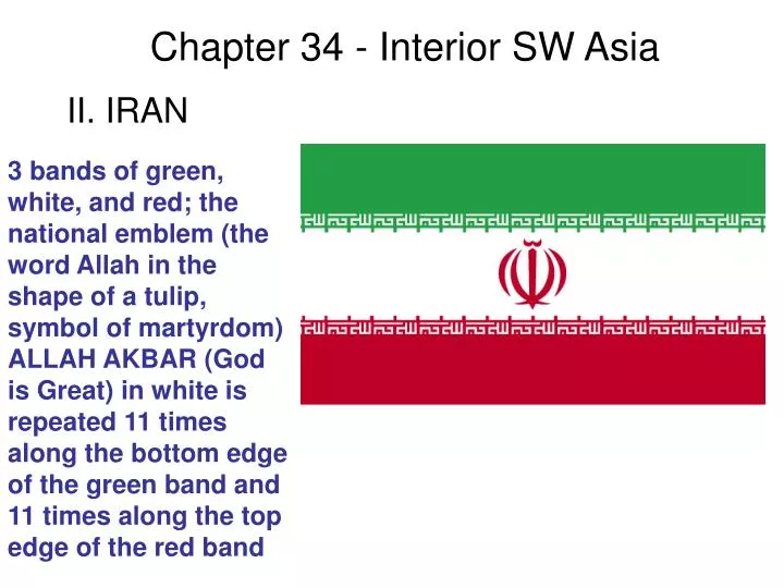
Chapter 34 - Interior SW Asia. 3 bands of green, white, and red; the national emblem (the word Allah in the shape of a tulip, symbol of martyrdom) ALLAH AKBAR (God is Great) in white is repeated 11 times along the bottom edge of the green band and 11 times along the top edge of the red band.

E N D
Chapter 34 - Interior SW Asia 3 bands of green, white, and red; the national emblem (the word Allah in the shape of a tulip, symbol of martyrdom) ALLAH AKBAR (God is Great) in white is repeated 11 times along the bottom edge of the green band and 11 times along the top edge of the red band II. IRAN
II. IRAN A. Physical geography
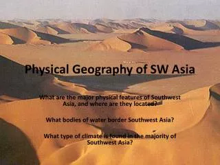
A. Physical geography The heart of the country is the Plateau of Iran An immense area covering 1,648,000 km2 in the center of Iran and encompassing a great variety of climates, soils and topography. It is almost completely surrounded on all sides by mountain ranges.
A. Physical geography Mountains: Zagros Mountains to the southwest
A. Physical geography Elburz and Kopet mountains to the north
The area can be divided into two major deserts A. Physical geography Great Kavir, one of the greatest deserts of the world in the central Iran
A. Physical geography The Dasht-e-Kavir (Great Salt Desert) in the north Salt Cover in Central Iran Desert
A. Physical geography The Dasht-e-Lut in the south Dasht-e-Lut, a sand and stone desert of eastern Iran and one of the hottest deserts in the world
Climate: Steppe and desert climates are typical A. Physical geography
Agriculture - About 1/3 of the people are farmers B. Economic geography
B. Economic geography Barley and wheat are the major grains Iran Forecast to Become World's Largest Wheat Importer
B. Economic geography Iran is of the world’s largest producers of pistachios
B. Economic geography Fruits, tea, cotton, rice, and mulberry trees are grown along the shore of the Caspian Sea
B. Economic geography Mountain water must be diverted to the fertile valley soils
B. Economic geography Qanats are tunnels that carry water from springs at the foot of mountains to the plains
B. Economic geography Low technology methods and tools are still used
Refineries, petrochemical plants, and ports provide jobs B. Economic geography
Wool, silk, and metals are used in handmade products are sold around the world B. Economic geography
Persian rugs have been prized for centuries B. Economic geography
Rural-to-urban migration is typical in Iran C. Urban geography
A central marketplace and a mosque are characteristics of Iranian cities C. Urban geography Iran - Esfahan main square and mosque
Tehran is the capital of Iran and the most industrialized city C. Urban geography
Other important cities include Abadan, Tabriz, Isfahan, and Qom C. Urban geography Masjid-i Shah Mosque Isfahan View of Qom Tabriz City Hall
The Shi‘a branch of Islam is the dominant religion D. Human geography
The Shah, Iran’s ruler, launched a program of modernization and industrialization D. Human geography Mohammad Reza Shah Pahlavi
In 1979, the Shah fled Iran after unrest and violence D. Human geography
A fundamentalist Islamic government, led by Ayatollah Khomeini, came to power D. Human geography
In 2005, Iranians elected Mahmoud Ahmadinejad as president D. Human geography President Mahmoud Ahmadinejad
A mountain range called the Hindu Kush cuts across northern Afghanistan E. Afghanistan Hindu Kush Mountains extend for 1,000 km (600 mi) in Afghanistan, Pakistan, and Tajikistan. About two dozen peaks surpass 7,000 m (23,000 ft)
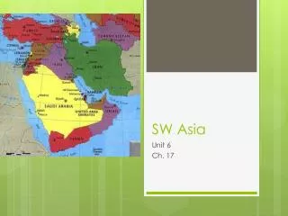
E. Afghanistan It is situated between Iran, Pakistan, China, and the Central Asian Republics
E. Afghanistan Afghanistan is one of the world’s least developed countries Purchasing power parity - $700 (2003 est.) Life expectancy at birth: (2004 est.) male: 42.27 years female: 42.66 years Infant mortality rate: 165.96 deaths/1,000 live births
E. Afghanistan Agriculture is the main occupation Agriculture 80% Industry 10% Services 10%
E. Afghanistan The mountains are mineral-rich, but deposits are undeveloped natural gas, petroleum, coal, copper, chromite, talc, barites, sulfur, lead, zinc, iron ore, salt, precious and semiprecious stone
Kabul is the capital and largest city E. Afghanistan
E. Afghanistan Almost all Afghans are Muslims Sunni Muslim 80%, Shi'a Muslim 19% other 1%
The Soviet Union invaded in 1979, but was forced to withdraw 10 years later E. Afghanistan Islamic guerrillas stand on top of a Soviet helicopter they brought down in Afghanistan’s Panjsher Valley, north of Kabul, in 1979.
The Communist government collapsed in 1992, civil war broke out, and the Taliban seized power in 1996 E. Afghanistan
After the September 11, 2001 terrorist attacks, US-led military action toppled the Taliban for sheltering Osama Bin Ladin
E. Afghanistan Presidential elections were held in October 2004 and a new constitution was adopted Hamid Karzai