Download
1 / 13
150 likes | 324 Views
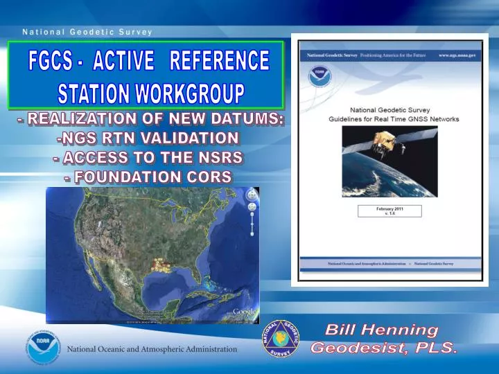
FGCS - ACTIVE REFERENCE STATION WORKGROUP. - REALIZATION OF NEW DATUMS: NGS RTN VALIDATION ACCESS TO THE NSRS - FOUNDATION CORS. Bill Henning Geodesist , PLS. MAJOR RTN IN THE USA (MAR 2011). ≥107 RTN USA ≥35 DOT. ACADEMIC/SCIENTIFIC SPATIAL REFERENCE CENTERS

E N D
FGCS - ACTIVE REFERENCE STATION WORKGROUP • - REALIZATION OF NEW DATUMS: • NGS RTN VALIDATION • ACCESS TO THE NSRS • - FOUNDATION CORS Bill Henning Geodesist, PLS.
MAJOR RTN IN THE USA (MAR 2011) ≥107 RTN USA≥35 DOT • ACADEMIC/SCIENTIFIC • SPATIAL REFERENCE CENTERS • VARIOUS DOTS + MACHINE GUIDANCE • COUNTY • CITY • GEODETICSURVEYS(NC,SC) • MANUFACTURERS • VENDOR NETWORKS • AGRICULTURE • MA & PA NETWORKS
RTN AND NGS “FOUNDATION CORS” WILL BE THE PRIMARY ACCESS TO THE NSRS CORS Network continued growth • Active sites 1700+ • 1250 used in NAD 83(2011)
FOUNDATION CORS • Link to ITRF at sites co-located with VLBI, SLR, DORIS, then geographic gaps • ~10 in CONUS + AK, HW and US terr. Limited international • Drilled braced monuments • Time-line: ~2 sites/year start FY10-11 Possible sites magenta ovals
IN TEN YEARS……. • 115+ SATELLITES • 1.5 DM AUTONOMOUS POSITIONING • NEW GEOMETRICAL DATUM – ITRF ALIGNED GEOCENTER BUT PROBABLY FIXED ON NORTH AMERICAN PLATE. NSRS ENTIRELY REALIZED BY ACTIVE STATIONS OF THE FOUNDATION CORS • NEW NATIONAL GEOPOTENTIAL DATUM – 1 CM GRAVIMETRIC GEOID, ORTHOMETRIC HEIGHT SITE CONTROL TO 2 CM RELATIVE TO THE NATIONAL DATUM. • MORE REMOTE SENSING: 2 - 3 DM SATELLITE IMAGERY /MAPPING POSITIONS , Mobile Mapping Systems • INDOOR AND UNDERGROUND POSITIONING
2022 NEW PROJECT CONTROL – ACCESS TO NSRS RTN ALIGNED TO CORS AT 1 CM IN EACH COMPONENT (X,Y,Z) & 2 CM ORTHOMETRIC 100 KM (NOT TO SCALE) 20 KM NEW PROJECT CONTROL EXISTING PASSIVE MARKS- HORIZONTAL WITH OR WITHOUT VERTICAL EXISTING PASSIVE BENCH MARKS 70 KM (NOT TO SCALE) NATIONAL CORS = GEOMETRICAL & GEOPOTENTIAL TRUTH
NGS GOALS FOR RTN’s • All real-time positioning services available in the U.S. provide coordinates that are consistent with the National Spatial Reference System, and hence, with each other • User equipment can operate with services from different RTN’s to the greatest extent possible. Promote the use of NTRIP software and RTCM 3.x format • Reference stations contained in each RTN meet prescribed criteria in terms of stability and data quality. CORS guidelines: http://www.ngs.noaa.gov/PUBS_LIB/CORS_guidelines.pdf • Best methods for RTN users may be advanced
HOW WILL NGS VALIDATE RTN? NGS 2011 STRATEGIC PLAN / 1.7 & 1.8: “Develop guidelines for both the administration and use of real-time GNSS networks and especially for ensuring that these networks are compatible with the NSRS.” 1. TOP DOWN: OPUS POSITIONS ON RTN REFERENCE STATIONS AT APPROPRIATE INTERVALS COULD PRODUCE GRAPHICS THAT WOULD SHOW BIASES AT A GLANCE. RTN 2. USER UP: PHYSICAL MONUMENTATION, ESTABLISHED WITH BEST TECHNOLOGY, COULD BE USED AS FIDUCIAL STATIONS TO HELP THE USER VERIFY THAT RTN ARE PRODUCING ACCURATE COORDINATES,
POSSIBLE METHODS OF RTN VALIDATION • OPUS-PROJECTS – NGS approved program to validate a RTN adjustment that was perhaps accomplished with GNSS manufacturer’s software or another program. • OPUS-DB– 3 or 10% of RTN are NGS CORS which then generate OPUS-DB solutions on all other rtn reference stations. These can be pushed to NGS and published as 60 day plots, or maintained on a public site at the rtn administration locale. • FIDUCIAL STATIONS - High stability marks are constructed within a rtn. Gnss static provides X,Y,Z. Geodetic leveling provides navd 88. Stations may be blue booked. Users can then test their rovers at the marks to compare their results from the RTN with the published values. Pilot programs planned in Oregon, Florida, Connecticut and Louisiana. • LETTER OF CERTIFICATION- RTN administrator sends a statement certifying that as of a particular date the rtn is aligned to the national datum at a certain level (2 cm lat/long, 4 cm h ?) • NGS REVIEW- NGS does a periodical review of the RTN stations and adjustments
USING OPUS-PROJECTS SHOW FOR EACH RTN: -MAX. RESIDUALS TO NSRS -AVG. RESIDUALS -LINK TO STATIONS 60 DAY PLOTS?
NGS RT GNSS STREAMS- OPERATIONAL PROTOTYPE http://beta.ngs.noaa.gov/CORS/NGSRealtimeGNSS/index.shtml
CONTINUING INVESTIGATION BY NGS • CURRENT SITUATION: • DATA OPENLY, FREELY AVAILABLE TO ALL UPON REGISTRATION • 150+ REGISTERED • RTCM 3.0 STREAMS VIA NTRIP CASTER • NO CORRECTORS • 19 STATIONS • COAST GUARD TESTS - NDGPSISSUES & THOUGHTS: • PERCEPTION OF COMPETITION- CAN BE USED FOR SINGLE BASE POSITIONS IN REAL TIME AT CERTAIN DISTANCES (BUT DEFINITELY NOT INTERPOLATED CORRECTIONS AS IN A RTN) • REDUNDANCY – 24/7/365 RELIABILITY IF PUT INTO SERVICE • STREAM JUST TO FEDERAL AGENCIES? • PBO HAS 310 STATIONS STREAMING BINEX & RTCM FOMATS