Download
1 / 25
250 likes | 343 Views
Data Archiving and IT Issues for PBO. Douglas Neuhauser UC Berkeley Seismological Lab Northern California Earthquake Data Center. Plate Boundary Observatory. Measure broadband deformation across the western US. Measure strain rate in 4D.

E N D
Data Archiving and IT Issues for PBO Douglas Neuhauser UC Berkeley Seismological Lab Northern California Earthquake Data Center EarthScope CSIT Workshop
Plate Boundary Observatory • Measure broadband deformation across the western US. • Measure strain rate in 4D. • Determine forces responsible for plate boundary deformation. EarthScope CSIT Workshop
PBO Instrumentation • Continuous GPS. • Borehole strainmeters and related sensors. • Surface strainmeters and related sensors. • Borehole seismometers. EarthScope CSIT Workshop
Borehole Installations • 3 component tensor strainmeter • Pore pressure sensor. • Barometric pressure sensor. • Borehole seismometers. EarthScope CSIT Workshop
PBO Borehole Installation • Borehole contains strainmeters, seismometers, and other geophysical sensors. • GPS attached to borehole casing. EarthScope CSIT Workshop
Surface Strainmeter Installations • Laser interferometer for horizontal distance measurement. • Laser interferometers for pier anchors. • State-of-health sensors for data correction (vacuum pressure, laser frequency, etc.) EarthScope CSIT Workshop
Data Archive Issues for EarthScope • 1. What standard data processing should be performed on EarthScope data to create “standard products”? EarthScope CSIT Workshop
Seismic Data Processing • Minimal processing required (clock timing corrections). • Sensors directly measure ground motion (velocity or acceleration). • Sensors have well defined instrument responses. • SEED standard for data archiving and data distribution include data and response. EarthScope CSIT Workshop
GPS Data Processing EarthScope CSIT Workshop
Strain Data Processing • Multiple stages involved in processing strain data. EarthScope CSIT Workshop
Data Archive Issues for EarthScope • 2. How do we establish procedures for different stages of data processing? • Correct strain from pore pressure and atmospheric pressure channels? • Remove tides from strain data? EarthScope CSIT Workshop
Strain Data Processing Procedure EarthScope CSIT Workshop
Data Archive Issues for EarthScope • 3. How do we organize the data so that users know which data channels for an experiment are associated with each other, where there are several raw channels of the same type? • Tensor strain • Pore pressure • Barometric pressure • Temperature channels • Seismic channels • Various voltage / State-of-Health channels EarthScope CSIT Workshop
USGS Low Frequency Geophysical Network (UL) • Diverse set of geophysical experiments: • Strain (tensor, volumetric, wire) • Creep • Tilt (lake level, long baseline) • Well water levels • Electric potential • Each experiment has primary and auxiliary data channels. EarthScope CSIT Workshop
USGS Low Frequency Geophysical Network (UL) • Data used by and distributed to other researchers by the PI. • Data available in “raw” and “processed” versions. • Instrument responses often not well known. EarthScope CSIT Workshop
UL Data Archiving issues • 1. What format(s) to use for archive and distribution for raw and processed data? • How many versions of the data (“raw” and “processed”) should be archived? • How to make the data readily available to the community for use with other data sets? EarthScope CSIT Workshop
Data Archive Issues for EarthScope • 4. What data format(s) do we need for the various types of data? • How do we indicate what processing has been done to data channels? • SEED naming convention of NET, STATION, CHANNEL, and LOCATION may not provide sufficient diversity. EarthScope CSIT Workshop
UL Data Archive at NCEDC • Raw data time series archived in SEED format at NCEDC. • NETWORK name is UL. • STATION name is geographic site. • CHANNEL name designates type of measurement (instrument, sample rate, instrument bandwidth). • LOCATION name signifies experiment type and instance at the site. EarthScope CSIT Workshop
UL Data Archive at USGS • Automated “cleaned” data available from USGS in simple ASCII format. • Glitch and offset removal. • “Cleaned” primary data channels may be corrected by data from auxiliary data channels. • Minimal info about “cleaning” process provided with “cleaned” data. • Data distributed with USGS 4 character channel name. EarthScope CSIT Workshop
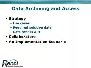
Data Archive Issues for EarthScope • 5. What data archive and distribution models are needed to provide users with integrated access to the complementary data sets? For example: • Will people want to integrate GPS data and strainmeter data? • What are data format and metadata requirements to accomplish this? EarthScope CSIT Workshop
NetDCArchiveModel EarthScope CSIT Workshop
NetDCArchiveModel EarthScope CSIT Workshop
GSAC Archive Model EarthScope CSIT Workshop
FISSURESArchiveModel EarthScope CSIT Workshop
Data Archive Issues for EarthScope • 6. How do we address these issues in a framework that allows both people and inference or processing systems to make intelligent use of EarthScope data? EarthScope CSIT Workshop