Download
1 / 16
160 likes | 247 Views
Weekly Weather Briefing. NWS Peachtree City, Georgia January 30, 2014. Storm Total Snowfall. Storm Total Ice Accumulation. Southeast Modeled Snow Depth. Observed Minimums (Thurs. AM). Snow Cover Effect. 10 AM Satellite and Temps . Lingering Snow. Exiting Clouds.

E N D
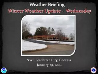
Weekly Weather Briefing NWS Peachtree City, Georgia January 30, 2014
Observed Minimums (Thurs. AM) Snow Cover Effect
10 AM Satellite and Temps Lingering Snow Exiting Clouds
Black Ice Will Result in Continued Treacherous Roadways!!! • Watch out for dangerous black ice on the roadways across North and Central Georgia! • Partial melting yesterday with re-freezing overnight has created a very dangerous situation. • Afternoon temps will warm above freezing but lingering ice is still possible • Anything left by evening will re-freeze • Travel is strongly discouragedon roadways ! • Situation similar to 2011 with stretches of dry roadway followed quickly by ice covered stretches.
Forecast Temps 1 PM Afternoon Max
Forecast Temps 7 PM – Below Freezing Overnight Min
Black Ice Possible Overnight Tonight • Dependent on how roads improve this afternoon • Shaded areas and untreated roadways likely to have greater chance of lingering ice
Friday Forecast Temps 10 AM Afternoon Max
Moving Forward… (Weather Doesn’t Stop)
Next Chance of Precipitation • Good chance/likely showers by Saturday night through Sunday night • Increasing instability and marginal wind shear ahead of cold front Sunday PM • Mostly showers but cannot rule out some strong thunderstorms (central GA) SW Moisture Sunday PM
Stronger System Next Week • Best chances Tues Wed • Tues Night: Approaching cold front with lifting warm front ahead and increasing instability (stronger wind shear) • Severe potential • Main threats - tornado & damaging winds possible (still high uncertainty this far out) SW Moisture Tues Night
SummaryRoller Coaster Winter Continues • Lingering ice on roadways (also possible overnight into Fri. morning) Recommend consulting local officials for final determination as some areas may clear up due to afternoon temps and sunshine • Warm up for weekend, but increased RAIN chances (cannot rule out some Sunday PM storms south) • More potent system early next week (Tues. night looks to be best chance for storms – severe potential with possible tornado/damaging wind threats)