Download
1 / 15
150 likes | 227 Views
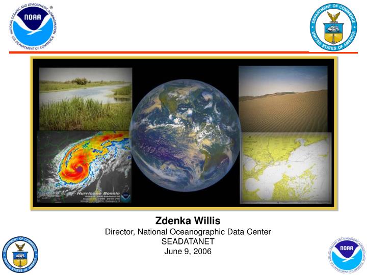
Zdenka Willis Director, National Oceanographic Data Center SEADATANET June 9, 2006. World Data Center - Oceanography. World Ocean Database 2005: global, comprehensive, integrated, scientifically quality-controlled ocean profile-plankton databases, Global ocean climatologies,

E N D
Zdenka Willis Director, National Oceanographic Data Center SEADATANET June 9, 2006
World Data Center - Oceanography World Ocean Database 2005: global, comprehensive, integrated, scientifically quality-controlled ocean profile-plankton databases, Global ocean climatologies, e.g., World Ocean Atlas 2005 Conducts scientific analyses of oceanographic data, e.g., “Warming of the World Ocean”.
World Ocean Database 2005 (WOD05) Online now WOD05 contains an additional 900,000 temperature profiles compared to WOD01 as well as additional data for other variables; 2) New variables added to WOD05: 1) CFCs 11, 12, and 113 (freons) 2) Tritium (isotope) 3) Helium (noble gas) 4) ΔHe-3 (isotope) 5) ΔC-13 (isotope) 6) ΔC-14 (isotope) 7) Argon (noble gas) 8) Neon (noble gas) 9) O-18 (isotope) 10) transmissivity from WOCE, GEOSECS, TTO, and other cruises. History of the growth of the number Of temperature and salinity profiles available from NODC.
Accessing WOD • World Ocean Database 2005 (WOD05) is an update of World OceanDatabase 2001 (WOD01). All data are available online presorted by 10 degree geographic squares, by year or by user specified criteria. If you would like to receive the entire data set on DVD please contact NODC Services. • The WODselect retrieval system allows a user to search World Ocean Database 2005 using a user-specified search criteria. A distribution map and cast count of these search criteria will give the user the option to have the data extracted and placed on the NODC FTP site in the WOD05 native and ".csv" data format
IOOS: According to Ocean.US The IOOS is a coordinated national and international network of observations and data transmission, data management and communications (DMAC), and data analyses and modeling that systematically and efficiently acquires and disseminates data and information on past, present and future states of the oceans and U.S. coastal waters to the head of tide. - From the IOOS Development Plan [Adopted by ICOSRMI] Backup: 30
Background – IOOS the Big Picture • The US Ocean Action Plan calls for IOOS • GEOSS is a comprehensive, coordinated, and sustained international network of observations • IOOS contributes to GOOS which is the ocean component of GEOSS Backup: 31
NOAA’s Observation System Target Architecture Target Architecture Principles: • Builds on existing systems • Requirements-based • Leverages new technology • Full and open data sharing • All data archived and accessible • Interoperable • Affordable & efficient • Standards-based • Sustainable Partnerships National International
IOOS Components • U.S. IOOS has three interdependent components: • Global Ocean • Coastal Ocean • Data Management & Communication (DMAC) Partners: Federal Agencies • NOAA • NSF • Navy • NASA • EPA • USGS • MMS • USACE Regional Associations State Agencies WMO/IOC Coastal Ocean Component Global Ocean Component National Backbone GLs NE GoA DMAC* NW MA Regional Observing Systems C&No Cal SE Pac Isl So Cal Lower Go Mex Resolution Higher * Ocean Component of NOAA GEO IDE
Thirteen ecological observing systems serving discrete living marine resource management missions NOAA Ocean Observing Systems are not meeting customer needs to the fullest extent possible, nor operating at maximum efficiency The Issue Not optimized to meet multiple missions No interoperable or interactive analytical capability in near real-time Coastal inundation information available from various sources and formats for different for time periods Inconsistent standards of operations Marine observing systems planned and operated independently for discrete operational and research missions, not optimized.
Commerce & Transportation Hydrographic Surveys (includes bathymetry) National Current Observations National Water Level Observation Network (NWLON) Physical Oceanographic Real Time System (PORTS) Shoreline Surveys NOAA’s IOOS Observing Systems By NOAA Mission Goal (As defined in the NOAA Observing System Architecture) Coastal Total Systems: 23 Global Total Systems: 8 Climate • IOOS Arctic Observing System • IOOS Argo Profiling Floats* • IOOS Drifting Buoys • IOOS Ocean Carbon Networks* • IOOS Ocean Reference Station* • IOOS Ships of Opportunity • IOOS Tide Gauge Stations • IOOS Tropical Moored Buoys Ecosystems • Coastal Change Analysis Program (C-CAP)* • Coral Reef Ecosystem Integrated Observing System (CREIOS) • Commercial Fisheries-Dependent Data • Economic/ Sociocultural Observing System* • Ecosystem Surveys • Fish Surveys • National Observer Program • Protected Resource Surveys • Recreational Fisheries-Dependent Data • System-Wide Monitoring Program (SwiM) for Marine Sanctuaries* • System-Wide Monitoring Program (SWMP) for National Estuarine Research Reserves • Passive Acoustics Observing System* • National Status and Trends Program* Weather & Water • Coastal Marine Automated Network (C-MAN) • DART • Voluntary Observing Ships • Weather Buoys • SEAWIFS* Mission Support • NOAA Ships • NOAA Aircraft* • NOAA Satellite (managed outside of IOOS) * - NOAA is working to update Interagency IOOS documentation Backup: 38 Backup: 39
IOOS Components: Global • Designed to meet climate requirements but also supports: • Weather prediction • Global and coastal ocean prediction • Marine hazards warning • Transportation • Marine environment and ecosystem monitoring • Naval applications • Homeland security • Coordinated nationally and internationally. • System 55% complete • IOOS Tide gauge stations • IOOS Drifting Buoys • IOOS Tropical Moored Buoys • IOOS Argo Profiling Floats • IOOS Ships of Opportunity • IOOS Ocean Reference Stations • IOOS Ocean Carbon Networks • IOOS Arctic Observing System • Dedicated Ship Support • Data & Assimilation Subsystems • Management and Product Delivery • Satellites (managed outside of IOOS)
IOOS Components: Coastal - National Backbone • Supports other agency and partner efforts to manage our Nation’s oceans, coasts, and Great Lakes • Coordinated nationally and regionally focusing on partnerships. • System 25 – 35% complete.
IOOS Components:DMAC Definition The IOOS is a coordinated national and international network of observations and data transmission, data management and communications (DMAC), and data analyses and modeling that systematically and efficiently acquires and disseminates data and information on past, present and future states of the oceans and U.S. coastal waters to the head of tide. - From the IOOS Development Plan [Adopted by ICOSRMI] The DMAC is: Information technology infrastructure such as national backbone data systems, regional data centers, and archive centers connected by the Internet, and using shared standards and protocols. - From the DMAC Plan (March 2005)
DMAC Challenges • Standards & Protocols for: • Metadata • Discovery • On-Line Browse • Transport • Access • Archive • IT Security