Download
1 / 30
300 likes | 309 Views
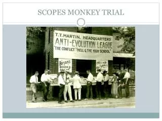
3.6 SCOPES. PJHS 2018-2019 Grade 8 Science. Day 1. 3.6 SCOPES. Day 1. The theory that the continents drift, or move, around the planet. The formation of new ocean crust along mid-ocean ridges. A large supercontinent 250 million years ago.

E N D
3.6 SCOPES PJHS 2018-2019 Grade 8 Science
Day 1 3.6 SCOPES
Day 1 The theory that the continents drift, or move, around the planet The formation of new ocean crust along mid-ocean ridges A large supercontinent 250 million years ago A massive slab of lithosphere that travels along the mantle, and tectonic activity happens at the border The flow of warmer, less dense fluid (magma) up through the mantle, from the core to the crust. Convection currents move the plates in plate tectonics.
Cut it out! https://www.youtube.com/watch?v=LD4hSW2mys0&list=PL6B82CA6C8466C529&index=9
High Pressure • The atmospheric pressure is greater than its surrounding environment. • Happy Weather! • Sunny Days! • Wide range of temperatures H
Low Pressure • The atmospheric pressure is lower than its surrounding environment. • Lousy weather • Rainy, cloudy, snowy • Narrow range of temps L
Cold Front • A leading edge of a cooler mass of air, replacing a warmer mass of air, which lies within a trough of low pressure. Looks like Icicles hanging
Cold Front Back to activity • A cold air mass is replacing a warmer air mass. • Shown on a weather map by a blue line with triangles pointing the direction the cool air is moving.
Cold Front Back to activity • Thunderheads can form as the moisture in the warm air mass rises, cools, and condenses. As the front moves through, cool, fair weather is likely to follow.
Warm Front • A leading edge of a warmer mass of air, replacing a cooler mass of air. Typically slower than cold fronts. Looks like rising suns
Warm Front Back to activity • Warm air mass replacing a cooler air mass. • Shown on a weather map by a red line with half circles pointing the direction the warm air is moving. Weather Fronts
Warm Front Back to activity • As the warm air mass rises, it condenses into a broad area of clouds. A warm front brings gentle rain or light snow, followed by warmer, milder weather. Weather Fronts
Comparing Warm and Cold Fronts • Cold fronts move faster than warm fronts. • The weather activity in a cold front is often violent and happens directly at the front (after the front has passed). • Cold fronts have sudden gusty winds high in the air creating turbulence. • In a warm front the cloud formation is very low (altitude wise) often creating situations of poor visibility. Weather Fronts
Stationary Front • A boundary between 2 different air masses, neither of which is strong enough to replace the other (stationary means “doesn’t move). Mixture of warm and cold since they do not replace each other.
Back to activity Stationary Fronts • A front that stops moving or is moving very slowly. • Shown on a weather map with alternating red semicircles pointing away from the warm air and blue triangles pointing away from the cold air.
Back to activity Stationary Fronts • Where the warm and cold air meet, clouds and fog form, and it may rain or snow. Can bring many hours or days of clouds and precipitation.
Occluded Front • Formed when a cold front overtakes a warm front. Usually forms around areas of low atmospheric pressure. “Suns” are now on the same side as the “icicles”.
Occluded Fronts Back to activity • When a warm front is trapped by 2 cold fronts. • Shown on a weather map by a purple line with alternating triangles and semicircles pointing the direction the front is moving. Weather Fronts
Occluded Fronts Back to activity • The temperature drops as the warm air mass is occluded, or “blocked,” from the ground and pushed upward. Can bring strong winds and heavy precipitation. Weather Fronts
Write these next definitions down on the next page in your notebook. Rain • Clouds form when 2 different types of air masses run into each other. • The warm air mass gets pushed up over the cold air mass.
Hurricanes • Mainly form over the Atlantic or Eastern Pacific Oceans. • Use warm water as fuel. http://video.nationalgeographic.com/video/101-videos/hurricanes-101
Wind • Wind blows because of differences in air pressure from one location to another. • Wind blows from areas of high pressure toward areas of low pressure. https://www.youtube.com/watch?v=D52rTzibFRc
Locate the 4 types of fronts on this weather map. Hint 1 Hint 2 Hint 3 Hint 4
Low pressure = clouds/snow/low temps High pressure = sunny/clear The low pressure will continue to move and cause temperatures to drop. Maybe even snow in Chicago.
Stationary front = it will stay rainy/cloudy for a few days Warm front moving out = not as warm as yesterday/somewhat cloudy High pressure = clear skies/happy weather