Download
1 / 8
80 likes | 208 Views
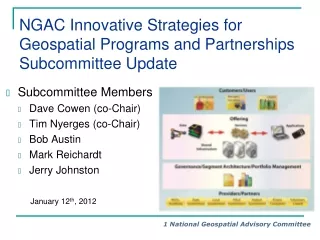
NGAC Geospatial Workforce Development Subcommittee Update. Subcommittee Members Dave DiSera (Chair) Joanne Gabrynowicz Randy Johnson Don McKay Matt O’Connell Cindi Salas Tony Spicci. January 12 th , 2012. Subcommittee Activities Following the NGAC December Meeting.

E N D
NGAC Geospatial Workforce Development Subcommittee Update • Subcommittee Members • Dave DiSera (Chair) • Joanne Gabrynowicz • Randy Johnson • Don McKay • Matt O’Connell • Cindi Salas • Tony Spicci January 12th, 2012
Subcommittee Activities Following the NGAC December Meeting • Held Joint Subcommittee Meeting on December 8th • Reviewed changes to the paper and recommendations • Discussed the idea of using forums to engage organizations on recommendations • Prepared for the NGAC January meeting • Updated the final draft Report • Completed minor reformatting of the document • Added a Table Of Contents (TOC) • Created a standalone paper of the STEM White Paper for Anne Castle
Activity 1 Draft Recommendations 1.1 FGDC leadership should work with and encourage CoSTEM to include geospatial technology and geomatics as components of the STEM disciplines. 1.2 The FGDC Secretariat and agency members should review and comment on the results of the CoSTEM Inventory of Federal STEM Programs and the CoSTEM Report on Federal Coordination. 1.3 The FGDC leadership should encourage awareness among FGDC member agencies regarding the importance of opportunities for geospatial technology related grants, such as the NSF’s Geography and Spatial Sciences Program and NOAA’s Cooperative Remote Sensing Science and Technology Center. Consider inviting NSF and NOAA to brief FGDC on how this model may be applied at other departments and agencies.
Activity 1 Draft Recommendations 1.4 The FGDC leadership should encourage FGDC member agencies to establish internship, fellowship programs, cooperative education, or exchange programs that give students practical understanding and real-world experience with geospatial technology and applications. 1.5 The FGDC leadership should encourage FGDC member agencies to support geographic literacy through their respective education and outreach programs.
Activity 2 Draft Recommendations 2.1 The FDGC should collaborate with UCGIS and AAG to determine if the Body of Knowledge for GI Science and Technology’s knowledge areas encompasses the breadth of the geospatial technology field from a government perspective. 2.2 The FGDC should work with the geospatial community to develop a communication infrastructure and methods to facilitate geospatial information exchange, such as a website to improve communication. 2.3 The FGDC Secretariat should follow up with UCGIS and the Department of Labor on the status of the partnerships for developing mutual goals and programs to establish a clearinghouse for internship, work experience, and service learning programs; and the GeoTech Center on building partnerships for developing a competency model for a program of study that provides guidelines for geospatial education programs.
Activity 3 Draft Recommendations 3.1 The FGDC should partner with the DOI Office of Human Resources to engage OPM in an effort to review, update, and modernize the geospatially-oriented Federal Occupational Series Codes (including the Cartography, Cartographic Technician, Surveying and Geodesy series). The revisions to the Federal Occupational Series Codes should incorporate themes and approaches from the Competency Model. 3.2 FGDC, DOL, and the Federal human resource management community should collaborate with non-federal partners to encourage the use and adoption of the Geospatial Technology Competency Model and the updated Occupational Classification Codes and Series. 3.3 FGDC partner agencies should communicate with their academic partners about the revised occupational codes and competency model to facilitate development of appropriate training and curricula to address emerging geospatial workforce needs.
Subcommittee Next Steps • Finalize White Paper and post on the NGAC website. • Identify briefing opportunities at upcoming FGDC meetings. • Assess the need for forums to discuss, refine, and focus the white paper recommendations, including opportunities to work with geospatial industry associations and educational institutions. • Available for ongoing discussion and support of the White Paper recommendations