Download
1 / 23
350 likes | 757 Views
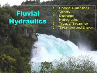
Fluvial Geomorphology. Environmental Hydrology Lecture 20. Fluvial Geomorphology. Study of the role of running water in shaping the landscape. Key concepts in fluvial geomorphology. Characteristics of rivers as function of landscape position (geography) How rivers accomplish “work”

E N D
Fluvial Geomorphology Environmental Hydrology Lecture 20
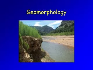
Fluvial Geomorphology Study of the role of running water in shaping the landscape
Key concepts in fluvial geomorphology • Characteristics of rivers as function of landscape position (geography) • How rivers accomplish “work” • How rivers respond to change
Geomorphic Work Running water exerts force Landscape offers resistance
Geomorphic Work Lane’s Balance, Ward & Trimble, Fig 9.20 Q S a Qs d Where: Q = discharge Qs = sediment discharge S = slope d = median sediment size Q*S = stream power
frequency x rate ~ “work” Rate of movement Frequency of occurrence Applied stress When does geomorphic work occur? after Wolman, M. G. and J. P. Miller, 1960. Magnitude and Frequency of Forces in Geomorphic Processes. Journal of Geology, 68(1): 54-74.
When does geomorphic work occur? see Ward & Trimble, Fig 6.14
Geomorphic work expressed in channel characteristics • Channel dimensions (cross-section) • Channel profile (longitudinal view) • Channel pattern (plan view) Winooski Falls, Photo by Jim Westphalen
Channel dimensions Geometry or cross-sectional shape of the channel see also Ward & Trimble, Fig 6.13 • Width, depth • Bankfull width, depth (i.e. “effective”) • Floodplain • Terrace (abandoned floodplain)
Helical flow creates variations in shear stress across the cross section
Channel dimensions see also Ward & Trimble, Fig 6.13
Pre-Development Downcutting Widening Restored Floodplain Channel evolution Graphic from A. Ward after Schumm
Uniform rate of work Minimum rate of work Channel Profile Longitudinal relationship between elevation and distance downstream (slope) Elevation Distance downstream
Channel Profile Ward & Trimble, Fig 6.8
“Alluvial Channels” “Colluvial Channels” Channel Profile Ward & Trimble, Fig 6.27 (from Montgomery & Buffington, 1997. GSA Bulletin, 109, 596-611.)
Channel Pattern Plan (aerial) view of channel geometry Meandering Stream Braided Stream Ward & Trimble, Fig 6.10
Channel Pattern Sinuosity (S) = Lc / Lv where Lc = channel length Lv = valley length
Helical flow induces meander formation Cut banks
Meander Geometry Ward & Trimble, Fig 6.11
How do these concepts scale? Graphic from A. Ward
How do these concepts scale? “Hydraulic Geometry” of stream channels Ward & Trimble, Fig 6.15