Download
1 / 31
310 likes | 390 Views
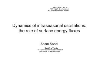
Tropical intraseasonal oscillations. Adam Sobel. DEES Noon Balloon, September 19 2011. Outline . What is an intraseasonal oscillation? a) monsoons b) their fluctuations within a season Dynamics - why do they exist? Role in long-range weather forecasting. Upcoming field program.

E N D
Tropical intraseasonal oscillations Adam Sobel DEES Noon Balloon, September 19 2011
Outline • What is an intraseasonal oscillation? a) monsoons b) their fluctuations within a season • Dynamics - why do they exist? • Role in long-range weather forecasting. • Upcoming field program.
Westerlies are associated with the rainy season June-Sep rainfall (cm) (Gadgil 2003) July winds
It’s not only India. Much of the tropics is monsoonal. Annual range in rain rate (June-Aug minus Dec-Feb) Annual mean rain rate
It’s not only India. Much of the tropics is monsoonal. Annual range in rain rate (June-Aug minus Dec-Feb) Annual mean rain rate Equatorial regions are monsoonal too, just with different phase
The rainy and dry phases are coherent and propagate from south to north as well as west to east Wang et al. 2006
In southern sumer, the propagation is mostly west-east and confined closer to the equator Equatorial (15S-15N) outgoing longwave radiation, a measure of deep, high cloudiness (shading) – annual cycle & ENSO removed time Figure courtesy Australian Bureau of Meteorology longitude
The “Madden-Julian oscillation” (MJO) propagates eastward in a belt around the equator Statistical composite MJO in outgoing longwave radiation and lower tropospheric wind (Wheeler and Hendon 2004) time latitude longitude
The “Madden-Julian oscillation” (MJO) propagates eastward in a belt around the equator Statistical composite MJO in outgoing longwave radiation and lower tropospheric wind (Wheeler and Hendon 2004) Note rain coincides with westerlies, just like in normal monsoon time latitude longitude
The intraseasonal oscillations modulate tropical cyclones Maloney and Hartmann 2000 Leroy and Wheeler 2008
Questions • Why do intraseasonal oscillations exist? • What is the energy source? • What sets the scales: spatial scale, and frequency or phase speed? • We focus here on the energy source.
There is no agreement on the basic mechanisms despite ~3 ½ decades of study Surface pressure spectrum, Nauru Island, tropical Pacific Helium spectral lines as seen through diffraction grating http://hyperphysics.phy-astr.gsu.edu/hbase/quantum/atspect.html Madden and Julian 1994
Variance of rainfall on intraseasonal timescales indeed maximizes over ocean Intraseasonal rain variance Northern Summer Southern Summer Sobel, Maloney, Bellon, and Frierson 2008: Nature Geosci.,1, 653-657.
Climatological patterns resemble variance, except that the mean doesn’t have localized minima over land Intraseasonal rainfall variance, nov-apr Climatological mean rainfall, nov-apr
Net = 0 W/m^2 land Over land, there can be no significant net surface flux variations, because surface can’t store heat - so there seems to be correspondence between flux and convection ocean
There is a definite suggestion that better MJO simulation corresponds to larger role for surface fluxes control Simulations with NOAA GFDL AM2 climate model No-WISHE (const sfc wind speed) Sobel et al. 2010, J. Adv. Model Earth Sys.
But then why does it go eastward? Strongest fluxes are to the west of convection, and would tend to make it go westward Observed cloudiness and wind from TOGA COARE Strongest winds and fluxes are in phase with or lag precipitation, and lie in westerlies Chen, Houze and Mapes 1996
The Australian monsoon February August Darwin Melbourne
Florence Falls, Litchfield Nat’l Park, Northern Territory, Australia September February
I bought my plane ticket 2 weeks ahead of time, wanting to see it rain in Darwin
I got to Darwin just in time for the rain to start Daily rainfall at Darwin airport Feb. 11 Total rainfall from 11-22 Feb. = 495 mm
Ed Lorenz taught us that because of chaos, there is an inherent limit to how far ahead we can predict the weather, around 2 weeks…
Apparently sometimes we can beat that in the tropics! E.g., with a statistical forecast assuming the MJO will evolve in the typical way, once it has started. Hovmoeller plot and statistical forecast courtesy Matt Wheeler
So we have a big field program this fall to study MJO initiation.
Climate models’ simulations of intraseasonal variability are flawed, but improving Lin et al. 2006
The MJO is a translation of the planetary-scale zonal overturning (Walker) circulation Madden and Julian 1971