Download
1 / 3
50 likes | 69 Views
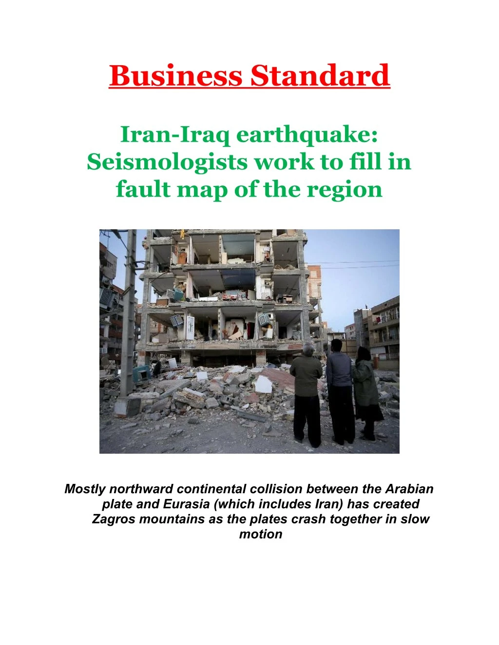
Iran-Iraq earthquake: Seismologists work to fill in fault map of the region on Business Standard. Mostly northward continental collision between the Arabian plate and Eurasia (which includes Iran) has created Zagros mountains as the plates crash together in slow motion<br>

E N D
Business Standard Iran-Iraq earthquake: Seismologists work to fill in fault map of the region Mostly northward continental collision between the Arabian plate and Eurasia (which includes Iran) has created Zagros mountains as the plates crash together in slow motion
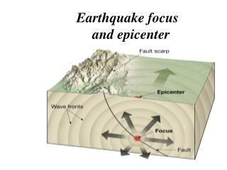
Originally from Iran, I’m a seismologist who studies earthquakes, tsunamis and landslides. I’ve been thinking a lot about potential seismic activity and the consequent hazard in this area. My earth sciences colleagues have been examining these faults for years in order to better understand the fault systems in the region. However, the Earth sometimes surprises us, and this time the rupture did not happen on a previously known major fault. Our lack of knowledge about the specific fault causing this earthquake is mainly because seismologists know only about faults that have already caused earthquakes. Only after new earthquakes can we update our fault maps to be more complete. It’s learning from past earthquakes that lets us better understand and prepare for future seismic hazards. Tectonic plates in motion The outer rigid surface of the Earth is divided into chunks known as tectonic plates. These plates move around at the rate of a few centimeters per year – by coincidence, the same rate at which your fingernails grow. The Arabian Peninsula and Iran are on separate adjacent plates in this region. The mostly northward continental collision between the Arabian plate and Eurasia (which includes Iran) has created the Zagros mountains as the plates crash together in slow motion. Collision energy is also released in the form of earthquakes at fault lines along or close to these boundaries. Many researchers are studying what portions of this region’s collision energy are spent building mountains versus causing earthquakes. Seismologists do know the Zagros mountains host many active fault lines, and the tectonic wiggles on these faults cause a significant number of earthquakes in Iran and Iraq. In fact, about 25,000 earthquakes have been recorded in the Zagros mountains over just the past 11 years. Although these earthquakes are usually small in size, the data show that every now and then moderate to large events also occur; these can result in significant destruction. The main fault responsible for the Nov. 12 earthquake has yet to be identified. As located by the Iranian Seismological Center, the quake took place in a zone between
two major known faults: the High Zagros Fault and the Mountain Front Fault…..read more