Download
1 / 19
220 likes | 445 Views
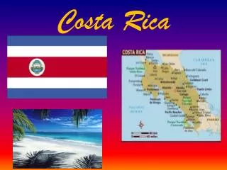
Conserving Costa Rica: Geography. Debora Tolliver. Geography. Area: Total area: 51,100 sq. km [51,060 sq. km (land ), 40 sq. km (water ), includes Isla del Coco, slightly smaller than West Virginia] Total coastline: 1,290 km Total land boundaries: 639 km

E N D
Conserving Costa Rica:Geography Debora Tolliver
Geography Area: Total area: 51,100 sq. km [51,060 sq. km (land), 40 sq. km (water), includes Isla del Coco, slightly smaller than West Virginia] Total coastline: 1,290 km Total land boundaries: 639 km Border Countries: Nicaragua (land boundary: 309 km) and Panama (land boundary: 330 km) Terrain: coastal plains separated by rugged mountains including over 100 volcanic cones, of which several are major volcanoes Highest elevation: 3,810 m (Cerro Chirripo Mountain) Land use: arable land 4.4%, permanent crops 5.87%, other 89.73% (2005) Natural hazards: active volcanoes, occasional earthquakes, hurricanes along Atlantic coast, frequent flooding of lowlands at onset of rainy season and landslides
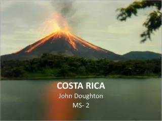
Volcanoes • 11 official volcanoes of Costa Rica • Turrialba Volcano • Tenorio Volcano • Ricon de La Viejo • Poas Volcano • Platanar Volcano • Orosi Volcano • Miravalles Volcano • Irazu Volcano • Barva Volcano • Arenal Volcano • Cerro El Porvenir • 7 active volcanoes • 61 dormant or extinct volcanoes Costa Rica Vacation Rentals (2002-2011)
Volcanoes ITA (1995-2010) • Rincón de la Vieja • located in the Guanacaste region of Costa Rica • has 9 craters (highest is Santa Maria Volcano at approximately 6,385 feet above sea level) • Von Seebach crater is currently active, venting steam and the occasional hiccup on a regular basis • visitors can see natural hot springs around the volcano but they can not bath in them • Tenorio Volcano and Miravalles Protected Zone • located in the Guanacaste region of Costa Rica • approximately 6,286 feet above sea level • area surrounding volcano is characterized by an enchanting blend of forest, hot springs, and geysers • Irazú Volcano • located in the Central Highlands of Costa Rica • last known eruption in 1965 and lasted for 2 years • the highest active volcano in Costa Rica at approximately 11,260 feet above sea level • Has several active craters (largest is 900 ft. deep & smallest (Diego de la Haya) dips 300 ft. beneath the surface) • from the summit, visitors can see both the Pacific and Caribbean coasts
Volcanoes Cosmic E.I.R. (n.d.) • Poás volcano • located in the Central Highlands of Costa Rica • approximately 8,885 feet above sea level • one of Costa Rica’s largest and most active volcanoes • more than 40 eruptions since 1828 (erupted in 2008 but the last major eruption was in1910) • 3 craters (one is known as the largest active crater in the world) • visitors can see geysers, sulfuric pool bubbles, smoke and from the summit, you can see both the Atlantic and the Pacific coasts • Turrialba Volcano • located in the Central Highlands of Costa Rica along the southeast corner of the Central Volcanic Corridor • approximately 10,919 feet above sea level • last major eruption occurred in 1866 but fumarolic activity (smoke and gas) remains constant from the highest peak • has 3 craters and tourists can go down one of them • visitors can see the Atlantic coast and the Varva, Poás and Irazú Volcanoes on a clear day • Arenal Volcano • located between La Fortuna and Lake Arenal (province of Alejuela) • approximately 5,479 feet above sea level • erupted in 2010 but last major eruption was in 2003 • dormant for nearly 400 years prior to 1968 major eruption • the youngest and most active all of Costa Rica’s volcanoes
Mountains and Volcano's Costa Rica Study (n.d.) Geology.com (2005-2011)
National Parks & Nature Reserves • Costa Rica has been a world leader in conservation policies with protected areas that encompass over 25% of its total landmass- the highest percentage in the world. • Costa Rica’s National Park System is a network of protected rainforests, tropical dry forests, cloud forests, marine areas, and wetlands. • The National Parks and Wildlife Refuges of Costa Rica are managed by MINAE, the Ministerio de Ambiental y Energia. • Besides Costa Rica's National Parks there are dozens of private nature reserves that have been established to protect. Preserve, and rehabilitate Costa Rica’s natural habitat, tropical ecosystems, and their biodiversity. • Reserves differ from National Parks in that community and conservationist groups manage their land.
National Parks & Nature Reserves There are eleven Conservation Areas that were established in 1998 to oversee and manage the public lands of Costa Rica. These 161 conservation areas are known as the Sistema Nacional de Areas de Conservacion, or SINAC. CCSA (2005)
National Parks & Nature Reserves Anywhere Costa Rica SA (2007-2011)
Forests: Plant Biodiversity Costa Rica Information (n.d.) Costa Rica has the greatest diversity of plants in the world (9500 described species of vascular plants and 1100+ species of ferns & lycophytes) • Trees: about 1900 species • National tree is Guanacaste (Enterolobium cyclocarpum) • Orchids & Flowers: about 1500 species of orchids • National flower is the la Guaria Morada (Guarianthe skinneri) • Plants serve as an important source of food, housing for animals, and oxygen • Aquatic Plants: six different associations with water: • Wetland plants: plants that you see living in flooded areas • Emergent plants: plants that start their life in water but after they have grown enough to flower, they are above the water • Amphibious plants: plants that can live in both earth and water • Floating plants that are rooted in the ground: plants have the stem or leaves above the water surface but their roots go down to the ground • Floating plants: plants that truly float free on the water surface • Submerged plants: plants that are often rooted in the ground and live submerged in the water
Forests: Animal Biodiversity Destination 360 (2011) • Fish: Costa Rica has one of the fish richest waters in the world • Birds: There are 850+ species that are relatively well studied and of those, 600 species remain in Costa Rica permanently. • Some permanent birds: macaws, parrots, toucan, three-wattle bell-birds, ducks, ibises, herons, storks, other aquatic birds, Hummingbirds (around 50 species), raptors (birds of prey), quetzals, and trogons) • Some migrant birds: warblers, vireos, thrushes, tanagers, flycatchers, orioles • Mammals: There are about 240 species (about 6% of the worlds mammals) which include shrew, spiny pocket mouse, deer mouse, four pocket gophers, woolly olingo, coatis, deer, sloths, opossums, monkeys (4 species), agoutis, raccoons (2 species), peccaries (2 species), bats (109 species), wild cats (6 species including jaguars), whales, and dolphins • Reptiles: There are 14 species of turtles, 70 species of lizards, 200+ species of snakes, and 2 species of crocodiles • Amphibians: There are about 130 species of frog, 37 species of salamander, and 4 species of caecilian • Insects & other Arthropods: Costa Rica has the most diverse groups of insects in the world and it is impossible to describe them all. The Biodiversity National Institute keeps record of them and some of those include beetles, flies, wasps, bees, ants, butterflies, and true bugs.
Forests: Ecosystem • Ecosystem is made up of twelve major life zones that are named according to the latitudinal belt, humidity, and the elevation belt. They are also defined by the variation of temperature and precipitation in a given area. • Dry forest: have less than 2 meters of rainfall per year with 6 months of dry season • Forest of the lowlands (0-500 meters): most abundant forests in Costa Rica, with some of the highest rainfall in the country (up to 8 meters) • Highland ecosystems (1500->3500 meters): there are several life zones that are separated by the amount of rainfall received, creating different habitats for a variety of species; the highland forests are evergreen • Middle-elevation forests (500-1500 meters): typically consists of evergreen or semideciduos trees; tree heights vary between 25-40 meters • Coral reefs & wetlands • Although Costa Rica’s territory is only 0.03% of the earth’s surface, it is considered to be a country with more diversity than many other areas in the world. The country is home to about 4% of the species on Earth. Costa Rica Information (n.d.) 6
Forests: Deforestation • More than two-thirds of Costa Rica’s original forests have been destroyed during the last 45 years • The rate of destruction has significantly dropped because of public and private efforts, and Costa Rica’s laws restricting cutting. • Forest destruction produces as much as 15% of the world’s greenhouse gas emissions. • 1986 National Bamboo Project of Costa Rica: reduce deforestation by replacing timber with bamboo as a primary building material and providing low cost housing for Costa Rica’s rural poor • Organization working to save the forests and Rain Forests of Costa Rica Pax Natura: www.paxnatura.org Jane Goodall Institute: www.janegoodall.org Instituto Nacitional de Biodiversidid (INBio): www.inbio.ac.cr/en/ The Fondo Nacioal de Financiamiento Forestal (FONAFINO): www.fonafifo.com/english.html FundeCoR: www.fundecor.org Rainforest Alliance: www.rainforest-alliance.org The Nature Conservancy: www.nature.org Ian Giddy (2004) Nature Conservancy (2011)
Urban & Rural Areas • Cities • Capital is San Jose (population: 920,000) • greater metropolitan area as defined by the Ministry of Planning and Economic Policy (population 2.1 million) • includes the cities of Alajuela, Cartago, and Heredia • Other major cities outside the San Jose capital area • include Puntarenas, Limon, and Liberia • Population density: 72.53 people per sq. km • Rural areas • Population density: 730.96 people per km of arable land • The Foundation for Rural Housing Costa Rica - Canada (created in 1983) • Main objective: support development in rural areas of Costa Rica, through programs based on financing housing construction, social infrastructure and other complementary works, in order to reduce migration to urban areas • Aims to promote and execute programs and projects for economical and social development of the most needed families located in rural areas • Financed about 13,500 houses during 1983 to 1995 • Today the Foundation works with approximately 188 rural organizations: 47% cooperatives, 28% development associations, 8% agricultural centres, 5% regional unions, 4% mutual associations, and 8% other types of rural organizations
Climate • Temperature: closely related to the elevation and only varies 2 degrees Celsius from summer to winter • Low lying Pacific coast: generally very hot and dry; however, during the rainy season, it is common to have rain in the afternoon and occasionally a cloudy, humid day • Caribbean climate zone (includes Tortuguero, Arenal, Puerto Viejo and Sarapiqui): warm and humid nearly year-round and has less rigid rainy and dry seasons • Central Highland area (borders Costa Rica's Central Valley): characterized by cooler temperatures and a variety of elevations (from about 3,000-5,000 ft. above sea level) • Weather: most important factors are the fairly even amounts of solar radiation received throughout the year, topography and the prevailing northeasterly winds (Papagayo Winds) • Seasons: differentiated by rainfall rather than temperature change • Rainy Season: May until November, however September and October are the rainiest months • Dry season: November to April are the driest months but there is still occasional rainfall especially in the South Pacific and Caribbean coastal regions • Summer: December through March • Winter: June through August Costa Rica Information (n.d.)
Standards Addressed • Connecticut Social Studies Curriculum Framework • 1.4.10: Examine geographic factors that help explain historical events or contemporary issues. • 2.5.8: Create maps of areas, regions or nations and provide relevant information. • Common Core State Standards • CCSS.RH.6-8.7: Integrate visual information (e.g., in charts, graphs, photographs, videos, or maps) with other information in print and digital texts. • CCSS.RST.6-8.3: Follow precisely a multistep procedure when carrying out experiments, taking measurements, or performing technical tasks. • CCSS.RST.6-8.9: Compare and contrast the information gained from experiments, simulations, video, or multimedia sources with that gained from reading a text on the same topic.
Pictures Referenced Anywhere Costa Rica SA. (2007-2011). Costa Rica national parks, rivers, and reserves map. Retrieved on 8/2/11 from http://www.anywherecostarica.com/maps/parks-reserves-rivers Cosmic E.I.R. Ltda. john. (n.d.). Poas volcano, Doka Coffe Estate and Sarchi arts and graft. Retrieved on 8/2/11 from http://www.tourscostarica.org/packages/view/san-jose/tours/poas-volcanodoka-coffe-estate-and-sarchi-arts-and-graft.html Costa Rica Information. (n.d.). Climate. Retrieved on 8/3/11 from http://costarica-information.com/nature/geology/climate Costa Rica Information. (n.d.). Costa Rica nature. Retrieved on 8/3/11 from http://costarica-information.com/nature/plants/plants Costa Rica Information. (n.d.). Ecosystems of Costa Rica. Retrieved on 8/3/11 from http://costarica-information.com/nature/ecosystems-of-costa-rica Costa Rica Study. (n.d.). Costa Rican geography. Retrieved on 8/2/11 from http://www.costaricastudy.com/general/geography/geography.htm Costa Rica Vacation Rentals. (2002-2011). Costa Rica volcano's. Retrieved on 8/2/11 from http://www.costarica-vacation-getaway.com/vacation_rentals/169/costa_rica_volcano_s Destination 360. (2011). Costa Rican frog. Retrieved on 8/3/11 from http://www.destination360.com/central-america/costa-rica/costa-rican-frog Geology.com. (2005-2011). Arenal volcano: Introduction. Retrieved on 8/2/11 from http://geology.com/volcanoes/arenal/ Ian Giddy. (2004). Cloudbridge Nature Reserve – Nature notes no. 2: Deforestation. Retrieved on 8/3/11 from http://cloudbridge.org/deforestation.htm ITA. (1995-2010). Volcano photos. Retrieved on 8/2/11 from http://www.geographic.org/photos/volcanoes/volcano_photos_252.html The Nature Conservancy. (2011). Climate change = What we do: Creating incentives to stop deforestation. Retrieved on 8/3/11 from http://www.nature.org/ourinitiatives/urgentissues/climatechange/howwework/creating-incentives-to-stop-deforestation.xml
References Anywhere Costa Rica S.A. (2007-2011). Geography and weather table of contents. Retrieved on 8/3/11 from http://www.anywherecostarica.com/faq/topic/geography-weather Anywhere Costa Rica SA. (2007-2011). National parks of Costa Rica. Retrieved on 8/2/11 from http://www.anywherecostarica.com/attractions/national-park?gclid=COGjzpWZsqoCFYnd4AodYXtQ-Q Anywhere Costa Rica SA. (2007-2011). Nature reserves of Costa Rica. Retrieved on 8/2/11 from http://www.anywherecostarica.com/attractions/reserve Arenal.net. (2002-2011). arenalnet. Retrieved on 7/30/11 from http://www.arenal.net/ Blog Oh Blog. (n.d.). Top 10 Costa Rica: Costa Rica information, activities and news – Volcanoes. Retrieved on 7/30/11 from http://www.top10costarica.com/costa-rica-volcanoes/ CCSA. (2005). Costa Rica national parks: National system of conservation areas. Retrieved on 8/2/11 from http://www.costarica-nationalparks.com/ Central Intelligence Agency (CIA). (2011). The world factbook: Central America and Caribbean-Costa Rica geography. Retrieved on 8/3/11 from https://www.cia.gov/library/publications/the-world-factbook/geos/cs.html Common Core State Standards Initiative. (2010). Common core state standards for English language arts & literacy in history/social studies, science, and technical subjects. Retrieved on 7/28/11 from http://www.corestandards.org/assets/CCSSI_ELA%20Standards.pdf Connecticut State Department of Educaiton. (2009). Connecticut social studies curriculum framework grades PK-12. Retrieved on 7/28/11 from http://www.sde.ct.gov/sde/lib/sde/pdf/curriculum/socialstudies/ssfrmwk_10-6-09.pdf Costa Rica Information. (n.d.). Costa Rica nature. Retrieved on 8/3/11 from http://costarica-information.com/nature Ian Giddy. (2004). Cloudbridge Nature Reserve – Nature notes no. 2: Deforestation. Retrieved on 8/3/11 from http://cloudbridge.org/deforestation.htm
References Most Clearing House: Best Practices. (n.d.). Housing program for rural areas (Foundation Costa Rica – Canada): Costa Rica. Retrieved on 8/3/11 from http://www.unesco.org/most/centram5.htm NationMaster.com. (2003-2011). Central America and the Caribbean: Costa Rica-Geography. Retrieved on 8/3/11 from http://www.nationmaster.com/country/cs-costa-rica/geo-geography U.S. State Department, Bureau of Western Hemisphere Affairs. (2011). Background note: Costa Rica. Retrieved on 8/3/11 from http://www.state.gov/r/pa/ei/bgn/2019.htm