Download
1 / 27
270 likes | 313 Views
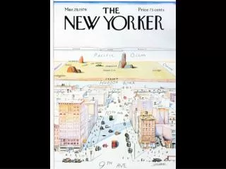
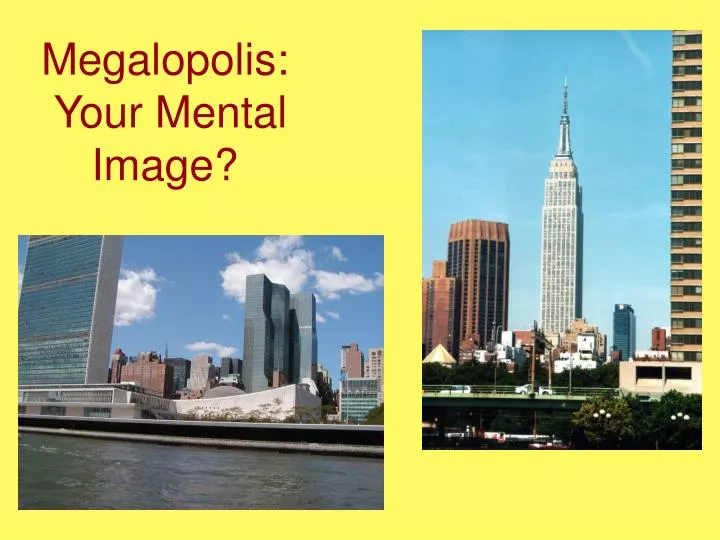
Megalopolis: Your Mental Image?. What is Megalopolis?. Historical background Initially coined by French Geographer, Jean Gottmann in 1961 The large population agglomeration which extended from Boston to Washington Traditionally BosNyWash, but now incorporates Philadelphia and Baltimore too!

E N D
What is Megalopolis? • Historical background • Initially coined by French Geographer, Jean Gottmann in 1961 • The large population agglomeration which extended from Boston to Washington • Traditionally BosNyWash, but now incorporates Philadelphia and Baltimore too! • Today: any agglomeration of coalescing super cities
Physical Geography • Three physiographic regions • Atlantic Coastal Plain • Piedmont • Appalachians • Traversed by numerous rivers • Temperate (C) and Continental (D) climates • Occasional hurricanes • SNOW!
Physical Geography • Coastal location • Numerous estuaries • Soils are variable (3 distinct categories) • Baltimore to the Philadelphia area • New York City's surrounding area • Boston vicinity • Relatively flat or gently rolling terrain • Fall line provided early water power
Fall Line Cities • Situated along boarder between Piedmont and Atlantic coastal plain • Where river rapids and falls occur • Examples…
Relative Location • To Europe, for trade and immigration • Good routes to interior • Along the Europe-Caribbean-South American trade route • Good accessibility resources • Good harbors • Routes to interior (natural & man-made) • Great stop off/service point for others conducting trade
Historical Settlement • Mainly Europeans • Many Native Americans • The Dutch • William Penn William Penn’s Map of Philadelphia, PA
Largest US cities, 1790 Establishing a Megalopolis
Population increase due to immigration Ellis Island Statue of Liberty, from Ellis Island
Megalopolis Today • Urbanness - the dominant theme • Comprised of 10 major metropolitan areas of over one million people and numerous smaller cities • 17.5% of the total U.S. population • 1.5% of the total land area • 17% of all U.S. export trade passes through its six major ports • A region of international significance
Key Ideas Related to Megalopolis • Metropolitan Coalescence • Conurbation • Central Business District (CBD) • Urban Sprawl • Gentrification Baltimore Harbor
Washington, D.C. L’Enfant’s Plan for US Capitol
Urban Landscapes Major Components • Spatial Interaction • Functional Complexity • Public Services • Accessibility • Intensity of Change
Major Components • Spatial Interaction • People, via sidewalks, parking lots, subways • Information, via communication lines, wires, terminals • Utilities, including sewage, water, electricity, and gas
Major Components • Functional Complexity • Residential • Industrial • Commercial • Recreational
Major Components • Public Services • Provide water, sewage, garbage pick-up, police protection, fire protection, public schools, road works, health care, and etc.
Major Components • Accessibility • Created and maintained to ensure access to the core from the periphery and along periphery • Accomplished via bypasses, beltloops, parkways, and limited access expressways
Major Components • Intensity of Change • The dynamic nature of the urban landscape • “Nothing seems permanent” • Economic ventures • Shifts in transportation networks • Developments and declines in residential areas
2000 1990
Readings & Discussion • Reading: Heterolocalism • Reading: Revitalization of Atlantic City • Reading: Denevan, William M. 1992. “The Pristine Myth: The Landscape of the American in 1492,” Annals of the Association of American Geographers 82: 369–385. • Disputes the common thought that Native Americans did not adversely affect the landscape before Columbus’ arrival. Why did Megalopolis emerge very early as the political-economic core of North America? How does Gentrification affect a city?
Related Book • Domosh, Mona. 1996. Invented Cities: The Creation of Landscape in Nineteenth-Century New York and Boston. New Haven: Yale University Press. • A good read. Just what the title says.
WebSources • Digital Atlas of Megalopolis http://www.umbc.edu/ges/student_projects/digital_atlas/credits.htm • Boswash: The Metropolitan Area from Boston to Washington, D.C. http://geography.about.com/cs/urbansprawl/a/megalopolis.htm • Ellis Island in New York City (searching for your family roots?) http://www.ellisisland.org/ • An Outline of American Geography: Megalopolis http://usinfo.state.gov/products/pubs/geography/geog04.htm • Climate in Megalopolis: Insights from Northeast Snowstorms http://www.infoplease.com/ce6/world/A0832515.html