Download

1 / 28
280 likes | 445 Views
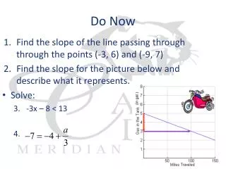
Do Now…. On a new notesheet, list all of the Physical Features you can think of that are found in the United States. (List at least 5). Political and Physical Map of Western Europe. What does everything look like?. SS6G8 The student will be able to locate selected features of Europe.

E N D
Do Now… On a new notesheet, list all of the Physical Features you can think of that are found in the United States. (List at least 5)
Political and Physical Map of Western Europe What does everything look like? SS6G8 The student will be able to locate selected features of Europe. the Danube River, Rhine River, Volga River, English Channel, Mediterranean Sea, European Plain, the Alps, Pyrenees, Ural Mountains, Iberian Peninsula, and Scandinavian Peninsula, Strait of Gibraltar.
How can I label features on political and physical maps? Locate each Country Draw blue lines to represent rivers and bodies of water. Make pointed shapes to represent mountains and mountain ranges DO NOT COLOR IN ANY OTHER LANDFORMS OTHER THAN THOSE LISTED Make sure you label each physical landform and body of water
Danube River On your notesheet complete these assignments: *Use adjectives to write a short paragraph describing what the area around the Danube River looks like. *What countries do the Danube run through?
Compare and Contrast On your notesheet use a three circle Venn Diagram and compare and contrast the 3 rivers
Compare and Contrast On your notesheet use a three circle Venn Diagram and compare and contrast the 3 mountains.
European Plain Where most of the crops are grown
Analyze Use the pictures of the European Plains to explain why most of the crops are grown in this area and not in other areas such as the mountains.
English Channel Separates the United Kingdom from Mainland Europe
Mediterranean Sea The largest inland sea in the world. It takes 100 years for the water in this sea to circulate.
Strait of Gibraltar What two continentals can be seen on this map?
Analyze What is the relationship between the Mediterranean Sea and the Strait of Gibraltar?
Assessment1. What river runs from the Black Sea west into Germany?A. Rhine River B. Danube RiverC. Colorado River D. English Channel
Assessment 2. What river runs from the English Channel east to Switzerland?A. Colorado River B. Danube RiverC. Rhine River D. English Channel
Assessment 3. What two Physical Features are found in Russia? The Ural Mountains and the Volga River The Pyrenees and The English Channel C. The Mediterranean and the European Plain D.The Alps and the Rhine River
Critical Thinking Why do you think that the areas along the coast of the countries that border a body of water are more populated than inland areas? (Answer on your notesheet.)
TOTD - 3-2-1 On your notesheet list: 3 - Mountains 2 – Peninsulas 1 – Narrow body of water