Download
1 / 6
60 likes | 62 Views
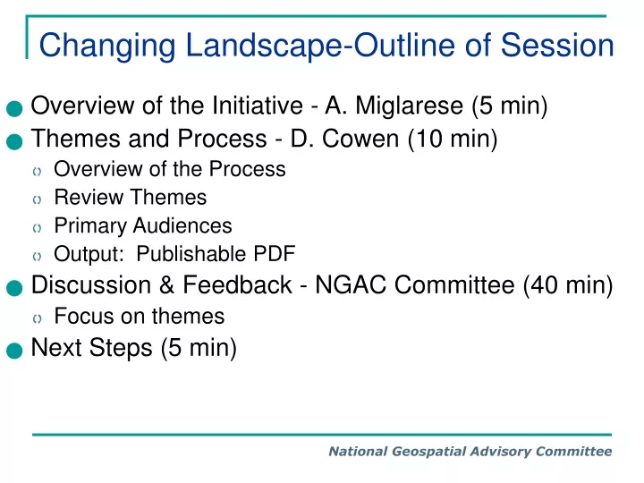
Changing Landscape-Outline of Session. Overview of the Initiative - A. Miglarese (5 min) Themes and Process - D. Cowen (10 min) Overview of the Process Review Themes Primary Audiences Output: Publishable PDF Discussion & Feedback - NGAC Committee (40 min) Focus on themes

E N D
Changing Landscape-Outline of Session • Overview of the Initiative - A. Miglarese (5 min) • Themes and Process - D. Cowen (10 min) • Overview of the Process • Review Themes • Primary Audiences • Output: Publishable PDF • Discussion & Feedback - NGAC Committee (40 min) • Focus on themes • Next Steps (5 min)
Themes - 1 • Computing Environment • Mainframe > workstation > personal computer > GPS embedded PDA/ cell phone • Software • Full function Toolbox > on demand services - Click Charges (pennies per transaction) • Technical manuals > intuitive • Data Sources • Vector maps > precise high resolution imagery • GeoEye-1 - 41 cm from space • Aircraft 4 inch vertical and oblique • Data Capture • Conversion of existing maps > on screen digitizing > field collection > automated feature extraction • In-situ > remotely sensed • Public > Commercial > Volunteered • Static > Real Time
Themes - 2 • Data Models • Layers > Objects • 2D > 3D > 4D • Data Storage • Local hard drives > “Clouds” • Free Google Mailbox 6,970 MB • User Interfaces and Access • Text (command line) >GUI (Dashboards) • Specialized graphic terminals > broad band connected personal computers • Web > Web 2.0 (lots of user provided content - collaboration) • Maps > Decision support systems • GI Data Collection and Distribution • Federal (top down) > local (bottom up) • Proprietary > Data Exchange Standards > Open > De Facto ( Shape , KML)
Themes - 3 • Users • Technician driven (chauffeurs) > Public ( High expectations) • Application specialists to managers / decision makers • Institutional Setting • Third Generation SDI (Spatial Data Infrastructure) • Product-based > Process-based development > Virtual • Products • Paper maps > location based services • Relationship to IT • Stand alone department > integrated part of enterprise • Development languages and environment • Procedural (Fortran/ANSI C) > object oriented (C++) > scripting (Visual Basic/JavaScript) > managed code (Java/C#)
Target Audiences • New Federal Leadership (political appointees) • Federal Career Senior Leaders • Geospatial Community of Practice - government, academia, private sector • Higher Education • Other: