Download
1 / 39
400 likes | 637 Views
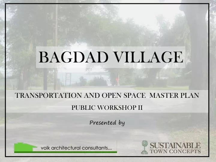
BAGDAD VILLAGE. TRANSPORTATION AND OPEN SPACE MASTER PLAN PUBLIC WORKSHOP II. Presented by. MASTER PLAN OBJECTIVES:. DEVELOP A PLAN TO CONNECT TOWN FACILITIES AND OPEN SPACES IN BAGDAD WHILE…. MAKING PROVISIONS FOR FUTURE GROWTH WITH AN

E N D
BAGDAD VILLAGE TRANSPORTATION AND OPEN SPACE MASTER PLAN PUBLIC WORKSHOP II Presented by
MASTER PLAN OBJECTIVES: • DEVELOP A PLAN TO CONNECT TOWN FACILITIES AND OPEN SPACES IN BAGDAD WHILE… MAKING PROVISIONS FOR FUTURE GROWTH WITH AN ATTRACTIVE AND SAFE CIRCULATION NETWORK FOR PEDESTRIANS, CYCLISTS AND VEHICLES. . DESIGNING HIGH QUALITY STREETSCAPING, LANDSCAPING, AND TREE PLANTINGS AND DESIGNATING PARKING THAT COMPLEMENTS THE NATURAL AND HISTORICAL SETTING. OPTIMIZING ACCESSIBILITY AND SUPPORT OF PARK AND WATERFRONT FACILITIES.
SPECIFIC OBJECTIVES: • BASED ON COMMUNITY INPUT WE INTEND TO DEVELOP A PLAN THAT WILL… • Recreation and Open Space • Define strategies for compatible preservation, development, and redevelopment of transportation and open space amenities • Identify opportunities for additional public open spaces and other uses (i.e. parking) • Recommend future improvements and funding sources for public boat ramps • Provide an implementation plan for the Mill Site Park Land Use Plan .
SPECIFIC OBJECTIVES: • Transportation • Address present/future demand for parking to accommodate future growth and use of public facilities • Develop recommendations for streetscape improvements including traffic calming, reducing transportation conflicts, and utility relocation. • Form recommendations for making the district more pedestrian and bike friendly and connecting residential and public areas • Form recommendations to advance the use of sustainable design principles and technologies in planning and landscape design • Identify projects that can be introduced to the Transportation Planning Organization Bicycle and Pedestrian Plan .
Bagdad Recreation Park--planting of native shade trees --additional lighting (especially at community center) using traditional (historic), full or semi-cutoff fixtures --bicycle rack at community center entrance --paving of parking lot, with stormwater controlscomments: no consensus on need for more parking; need for more trees and lighting were mentioned often
Oyster Pile Landing • --paved parking --stormwater controls --permanent restroom --bicycle rack --pave second boat ramp, making both concrete --pedestrian/bicycle connection to Mill Site Park comments: no consensus on more parking; not specifying a kayak/canoe launch because one is already planned for south end of Mill Site Park
Dorr’s Landing --remove concrete and add clean sand to create a soft shoreline for launching and retrieving kayaks, canoes, and other small boats launched by hand --designate streetside parallel parking for vehicles using existing footprint of ROW --stormwater treatment (exfiltration trench beneath road) --addition of one picnic table to provide a comfortable sitting area Comments: no consensus on additional parking; stormwater treatment ranked highest here; permanent restroom need ranked low
Bagdad Cemetery --planting of native trees along property line to buffer cemetery from adjacent properties --addition of perimeter fencing and front gate consistent with historic nature of cemetery Comments: consensus on no additional parking needed; improvements would ultimately need to be approved by organization managing the cemetery
Public Input Maps from Workshop One—Dec. 12 The following slides contain the maps produced by public participants in Workshop One. They are intended to define optimal corridors between important public spaces. These maps were used to identify the important pedestrian and bike routes in the following composite concept plan KEY: Blue: Elementary School to Bagdad Village Museum Red: Elementary School to Mill Site Park Green:Bagdad Village Museum to Recreation Park Brown: Mill Site Park to Bagdad Village Museum Orange: Oyster Pile Landing to Bagdad Village Museum Purple: All other connections between important public spaces .
Concept Plan Notes The concept plan designates the primary proposed pedestrian and bike corridors and preliminary concepts for transportation improvements. Phasing: All proposed utilities (water, sewer) should be installed prior to streetscaping. Overhead electric should be relocated underground when street lighting is installed and before any additional streetscapingoccurs. Priority corridors where this could occur first are Forsyth Street, any street where other utilities are already being installed (water, sewer), and streets that are priorities to receive street lighting. Zoning Potential zoning changes are noted that would allow Thompson and part of Forsyth St to contain mixed-use development (red). The limited commercial uses allowed in this district would be selected for their compatibility with residential uses and their ability to meet the needs of the neighborhood. The two areas shaded purple denote proposed water dependent /related commercial or residential uses (purple) on specified properties adjacent to public boat ramps and waterfront areas. .
Concept Plan Notes • Designated Pedestrian /Bicycle Corridors • Two new pedestrian/bicycle networks are proposed. • Bike Corridors: bike routes are proposed as an extension of the Bagdad Heritage Trail forming a loop within the town and connection to Garcon Point Rd • Walking Corridors: Sidewalks are proposed to connect important public spaces. These are divided into Phase I and Phase II priorities. • In general, bike lanes/sidewalks should be located to minimize disturbance of existing trees. Road striping is proposed for all pedestrian corridors. .
Concept Plan Notes • Signage • Signage is recommended to designate bike corridors, the BagdadBlueways network, and to provide historical info in public spaces. • Crosswalks • Crosswalks are recommended as shown on plan. One raised crosswalk with a bump-out is recommended adjacent to the School. • Utilities • Utilities should be located underground along all pedestrian corridors • Lighting: • Street lighting is proposed along all bike and pedestrian corridors. .
Profile BB: Forsyth Street • Notes: • Landscaped bump-outs are proposed at appropriate intervals on Forsyth St between Main St and Garcon Pt Rd. The specific locations for bump-outs are still to be determined. • Utilities are proposed to be located underground on Forsyth St. Street lighting is proposed the length of Forsyth St. • Existing Crape Myrtles could be added to fill in as necessary, with special landscaping located in the bump-outs. • Street trees within bump-outs should be located a minimum of 5 feet away from the travel lane. Suggested trees are of a compact pyramidal form such as Dahoon Holly .
Plan Detail: Forsyth Street and Garcon Point Rd Intersection .
Profile AA: Typical Walking Corridor(Church Street) • Notes: • This layout could be roughly typical for walking corridors with adjustments made for site specific variations. For all walking corridors- sidewalks should be constructed, utilities should be moved underground when street lighting or other improvements are installed, and street trees may be located to fill in as necessary between existing trees. • Variation will need to occur in the landscape strip width and distance of sidewalks from the street to allow for existing trees to remain, variations in right of way width, and the location of the road within the right of way.
Profile CC: Typical Bike Corridor (School Street) . • Notes: • Bike Corridors shall be designed as extensions of the Bagdad Heritage Trail with associated signage. Bike lanes may be a 4 foot minimum extension of asphalt on either side of the existing road. • Street lighting shall be located on all bike lanes during construction with overhead utilities relocated underground. Street trees may be filled in as necessary to supplement existing landscaping.
Blueways Trail --a paddling trail connecting Milton and Bagdad, Pond Creek, and eventually points beyond. Access points to the trail in Bagdad would be the Mill Site Park and Dorr’s Landing; signage at parks would identify trail and provide trail maps and information