Download
1 / 20
200 likes | 290 Views
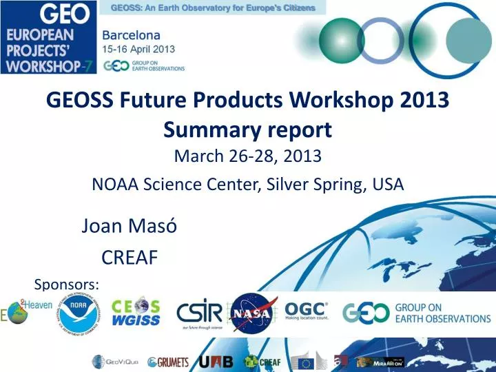
GEOSS : An Earth Observatory for Europe's Citizens. GEOSS Future Products Workshop 2013 Summary report March 26-28, 2013 NOAA Science Center, Silver Spring, USA. Joan Masó CREAF Sponsors:. Introduction: From data to information.

E N D
GEOSS: An Earth Observatory for Europe's Citizens GEOSS Future Products Workshop 2013Summary reportMarch 26-28, 2013 NOAA Science Center, Silver Spring, USA Joan Masó CREAF Sponsors:
Introduction: From data to information • GEO aim of achieving interoperability of existing and new systems that provide essential environmental observations and information • Data streaming from in-situ and remote sensing sensors (Sensor Web), models (Model Web) offers a huge potential to generate a wide portfolio of on-demand and near real time products. • In the GEO Work Plan these activities are elements of GEO Task IN-05 "GEOSS Design and Interoperability".
Session 1. Overview and Introduction - Policy and Science Vision for GEOSS Session Agenda Welcome from NOAA Zdenka Willis, NOAA representative to US GEO GEOSS Policy Vision Peter Colohan, US OSTP GEOSS Vision for Water Science Professor David Maidment, Univ. Texas - Austin Workshop Objectives George Percivall, OGC and GEO IN-05 Task
Policy and Science Vision for GEOSS • How is knowledge discovered? (D. Maidment) • Deduction from existing knowledge • Experiment in a laboratory • Observation of the natural environment • Observation is the heart of GEOSS, Crafting geoinformation, the art and science of Earth Observation (D. Maidment) • Each decision we make influences the state of the planet, it is changing, we have to understand the planet and the impacts of those influences. (P.Colohan) • Our ability to exchange data brings the imperative to bring all the data forward, for observing the planet. (P.Colohan) • Raison d'être for GEO/GEOSS is data sharing (A. Lauthenbacher) • Local to Region to Global integration, interoperability (D. Maidment) • Sensor Web Enablement allows us to pull data together (D. Maidment) • International standards, OGC process can make common languages (D. Maidment) • Build momentum around key datasets, key communities of practice, help them realize the benefits of the standards. • Different countries have different ways to define things. Semantic integration can help build the ways of conveying information and defining things in a common way.
Policy and Science Vision for GEOSS • GEOSS is a voluntary effort, not a mandate. Three principles (P.Colohan): • Science based decision making • Open access to data and information • International cooperation • A very generic approach is very difficult due to heterogeneity of data, models, decisions, etc. • Environmental policy challenges: • 1. Carbon, quantify and regionally disaggregate to figure out sources/absorption and retention. • 2. Extremes – “Water is the delivery vehicle of climate change” How are things changing? water, floods, droughts, freezing, heat waves, sea level, etc. These all affect businesses and commercial interests • 3. Food security – Seasons changing, global crop production • Full realization of GEOSS seems distant, but we need to take steps in right direction now.
Session 2. Current GEOSS Architectures - What exists and what is hindering progress Session Agenda GEOSS Common Infrastructure (GCI) Doug NebertUSGS GEO Global Agricultural Monitoring (GEO GLAM) Kathy Fontaine for Chris Justice & Inbal Becker-Reshef GEO Biodiversity Observation Network (GEO BON) Gary Geller NASA-JPL GEOSS Disaster Management Sensor Web architecture - CEOS John Evans, NASA/GST
Current GEOSS architecture and users • GEOSS Common Infrastructure • Operational GCI is in place • Usability issues and challenges • Expressed interest in sensor webs / model webs • Each building a Community of Practice within science/application area • All looking for variety of data sources/types • Common needs for data discovery, search, access services • With focus on SBAs, risk of creating new stovepipes? • SBAs have particular interest but GEOSS architecture intended to provide common capabilities • The extent of current use is unclear • Users appear to be consumers and providers of data and services
About the data • With regard to openness, who supports it? What is the business model? • Organizations (such as OGC) that include govt. and industry partners promote openness • Incentives come from top down – leaders of int’l organizations • Commercial involvement in GEOSS – as providers and users of products? • Agriculture given as potential area for data exchange • Efforts to take in socioeconomic data? • AIP tasks mentioned as mechanism to identify needs for these data • Classification of disasters by socioeconomic characteristics
Session 3. Sensor Web - Observations for forecasts, on-demand Session Agenda Theme 1: Integrating in situ, satellite and model forecasts in sensor webs Crowdsourcing, OpenStreetMap and the Nambia Flood SensorWeb Dan Mandl, NASA - GSFC Use of open standards to share ocean observing and model data in U.S. IOOS EoinHowlett, ASA Science Sensor-Web-technology based Sensor-model integration for supporting the GEOSS societal benefit areas Liping Di, GMUCSISS Incorporating models into the sensor webs SergiiSkakun, NASU Theme 2: Enabling on-demand products Scientific Workflows on the Sensor Web Derek Hohls, CSIR Integration of data and on-demand data products generation Ingo Simonis, OGC-E Data Preparedness for Disaster and Events. Ken Keiser, UAH User-centered goals driving system workflows Pat Cappelaere, NASA - GSFC
Sensor Web Session • Aims: • to explore techniques to integrate in situ and satellite observations, and model forecasts in a sensor web architecture, and • to look at ways to enable users to leverage sensor webs to develop 'on-demand' products. • Missed opportunity to talk about (J. Maso) • Sensors that auto-declare themselves in the web? • How to go from millions of individual observations to a structured information?: from observations to products.
Sensor – Model Integration and users Focus on Sensor – Model Focus on the User How do you deliver to the user the required products and services with the requisite level of customization trade-off question • How do you enable better discovery of workflows that match a given suite of user requirements • i.e. pattern match between everything from sensor types to decision-support requirements
Session 4. Model Web - Vision and current frameworks Session Agenda Theme 1: Model Web Vision The GEO Model Web vision and action overview Stefano Nativi, CNR The Model Web and the Biodiversity and Ecosystems benefit areas Gary Geller, NASA-JPL Developing and Validating Model Web Business Processes with the GEOSS User Requirements Registry Hans Peter Plag, Nevada Bureau of Mines and Geology, Univ Nevada Theme 2: Model Web Implementation The ESMF framework Fei Liu, NOAA The OpenMI and Integrated Environmental Modelling - achieving the vision Roger Moore, OpenMI Association The Business Model Broker MattiaSantoro,CNR
User-Requirement Registry (URR) • Collect, store, publish (Hans-Peter): • Requirements: what to do, who to do it • Lexicons, controlled vocabularies; essential variables • Integrated into the GEOSS Semantics Registry • Connect Earth observations to societal benefits using value chains • With the URR you can: • Identify value-adding business processes; with crowd-sourced input and validation • Analyze goals: gaps; prioritization of users, data & processes; relevance of data
Model Web Initiative • Vision: dynamic web of models, integrated with databases and websites consultative infrastructure for asking the URR “what if” questions (S. Nativi) • e.g. How will climate change affect infection rate of dengue fever in Vietnam? • Huge amounts of data available • Numerous models & modeling frameworks • Links/interfaces needed for connecting vocabularies, brokers, knowledge bases, business processes how to combine what is needed?
Diversity of Models and Tools • Simulations (OpenModeller, nanoForge, nanoHub) • Frameworks • Object Modelling System • ModCom, Invisible Modelling Environ, OpenMI, ESMF, … • Controlled vocab’s, thesauri • GEMET, INSPIRE, GCMD, GEOSS, etc • Brokering semantic assets • GEOSS Ontology WG • Knowledge bases • GEOSS User Requirements Registry (URR) • Gazetteers, including event gazetteers • The session was about tools to create future products
Vision for Integrated Modeling • Time is as important as space (R. Moore) • Natural events & “black swans” difficult to model (R. Moore) • Deep Water Horizon • Volcanic ash • Climate, energy, water, health issues • Depends on trust in framework by users and public (R. Moore) • Barriers to progress: awareness, confidence, availability, skill base, little R&D program, little uptake among target groups • Products are the results of chaining models (composed by processes) and data (also sensor)
Model Web • Include modeling/process capabilities as discoverable and usable GEOSS resources • Challenges • Manage heterogeneity of resources • Agreed definition of “model” representation • High-performance computing • Scalable, distributed • Long-term access; standardization vs virtualization • Model integration and brokering between different platforms • Recognize that GEOSS has different user types, and Model Web addresses some of them • Work out a short term roadmap for the Model Web, including effective show cases • Considering low hanging fruits • Integrating existing components
Session 5. Interoperability and Resource Discovery Session Agenda Introduction and Agenda Steve Browdy, IEEE, OMS Tech Vision on GEOSS Evolution: Towards a GEOSS for all stakeholders Roberto Cossu, ESA and GEOWOW Linked Data: Another strategy for discovery and access William Sonntag, US EPA Unique Identifiers within Systems of Systems Joan Maso, GeoViQua (CREAF) Brokering for Multi-Disciplinary Interoperability: An EarthCube perspective SiriJodha Singh Khalsa, Univ. Colorado Authentication, Single Sign-On, and User Management for GEOSS Steve Browdy, IEEE, OMS Tech Summary Steve Browdy, IEEE, OMS Tech Libre Planet Tommy Heath
Interoperability and Resource Discovery • Two directions: • GEOWOW – EU FP7 Project • Applies the Discovery and Access Broker – semantically enriched search, results ranking results • Linked Data • Government data portals moving this direction • Semantically enriching catalogs will improve discovery • Authentication, Single-Sign-on (SSO) • Will benefit providers to track accesses (aggregated) • OpenID & SAML2: Need implementations & testing • GEOSS users; where are the citizens? What are our GEOSS users, and then how can we package the product? • citizen user is hard to predict. • Helper App are important to facilitate the use of data once discovered
GEOSS Future Products Workshop 2013Thanks!! Joan.Maso@uab.cat