Download
1 / 14
140 likes | 274 Views
FIA 2007-11 Strategic Plan Greg Reams National Program Leader Forest Inventory & Analysis 1601 North Kent St. Arlington, VA 22209 703-605-4189 greams@fs.fed.us. States with Full Annual FIA in FY 2005. Guam Palau American Samoa FS Micronesia. Puerto Rico Virgin Islands. Structure of FIA.

E N D
FIA 2007-11 Strategic PlanGreg ReamsNational Program LeaderForest Inventory & Analysis1601 North Kent St.Arlington, VA 22209703-605-4189greams@fs.fed.us
States with Full Annual FIA in FY 2005 Guam Palau American Samoa FS Micronesia Puerto Rico Virgin Islands
Structure of FIA • Virtual national program using collaborative decision-making among partner programs, and FIA regional units. • Regional and national user group meetings for feedback and potential directions • Three levels of management • Executive level--policy • Management level—operations • Technical level—technical solutions
Recent Progress • In FY 2005 • Funding up $5 million over FY 2004 (before rescission) • In FY 2004 • Federal funding was $56.7 million • Partner contributions exceeded $10 million • $4.5 million in “carryover” helped jump start WV and ID and finish National Information Mgmt System (NIMS) • Operated in 44 states • 76% of U.S. (including interior Alaska) + 5 Islands • Ver. 2.0 of Field Guide released Jan 2004 • In FY 2003 • 43,000 P2 plots & 3,700 P3 plots • 1,450 consultations with users, up 41% from FY 2002 • 15,000 web downloads, up 20% from FY 2002
FIA Program Customers • National and State forest policy planners • Forest Service officials • State Foresters • Industry and consultants • Environmental organizations • International reporting organizations • Researchers • Journalists • Private citizens
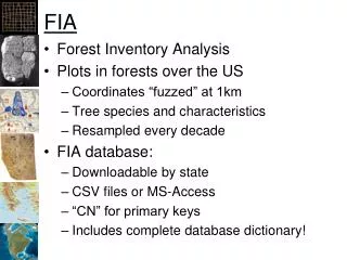
Staying the Course of 1999 Plan • Three phase program, P1-remote sensing, P2-ground plots, P3-forest health indicators • National Woodland Owner Survey • Timber Products Output • P3 is 1/16th of P2 • One P2 plot per 6000 ac • Consistent core set of field measurements across the U.S. • 10% in west, 15% in east, 20% P3 nationwide • States and FS forests can “buy down” or “fund specific measurements” • Annual data compilations • 5-year state reports, FS forest reports TBD
Staying the Course • Two priorities for FY 2005 and FY 2006: • “No State Left Behind” • “Lose No Ground” • Strategic plan assumes full implementation of annualized FIA in all 50 states; special approaches for interior Alaska and islands • Focus group meeting May 10 and 11 on approaches to national implementation without full funding.
What About FY 2006 ?? • OMB continues to be very favorably impressed with FIA program accountability • Annual Business Summaries “score” exceptionally well • Logic model giving us another boost • With President’s Budget increase of 12.788 million FIA will complete implementation in all 50 states.
Work in Progress • Better integration of advanced satellite imagery • Working on next NLCD with USGS/EROS • Faster, more accurate change detection • Working with RSAC on several projects • Cover type, burn severity, high resolution interpretation • More & better web tools for users to customize their own analyses • Add geospatial components • Add ability to create unique data layers • Small area estimation • Better linkages to pressing policy questions • Fire and fuels analyses (LANDFIRE) • Habitat, Forest Plan Implementation and Monitoring, Sustainability reporting, and certification
Feedback From Users • Key principle: Limit additional measurements; expand and deepen analyses • A host of suggested improvements: • Move into urban areas; all land with trees • Broaden coverage of health issues; invasives • Deeper analyses; wildlife habitat quality • Intensify the grid; both public and private lands • Move into range land; all-vegetation inventory • Broaden coverage of linear features; riparian
Enhancements • Techniques research-indicator development, sampling & estimation, small area/tactical assessments, geospatial tools • Synchronize P2 & P3 plot schedules • Remote sensing/spatial techniques-LIDAR applications in low change/high cost areas • Increased analytical capability • Regional and state specific issues • Wildlife habitat analyses • Deeper ownership analyses • National analyses (carbon stocks, land use & cover change) • Sustainability assessments (indicators of sustainability) • Legacy data recovery • Enhanced Tropical Forestry (vegetation sampling for exotics) • Partnerships with other federal programs • NASA, NOAA, USGS, NLCD, NRCS Natural Resource Inventory
Strategic Plan • http://www.fs.fed.us/ne/fia/news/planning/strategicplan.doc • Comments to NE-FIA • 2nd Draft May 20, 2005 for distribution prior to June FIA MT meeting. Forest Service Station Directors will review and comment. • August, 2005 draft to FSRET (Forest Service Research Executive Team)
Additions • Increase intensity of base FIA program to 15% or 20% nationwide • Land Use/Land Cover Change • Urban Forest Inventory • Rapid Assessment Teams • All Treed Land Inventory (Lands not forests, range or urban) • Inventory and Monitoring of Wildlife Habitats • Habitats of T&E species, featured species • Rangeland Inventory • Inventory & Monitoring of special forest products • Monitoring Issues Specific to Wilderness