Download
1 / 42
420 likes | 644 Views
PAMAP Program LiDAR. LiDAR Workshop - April 21, 2008. What is PAMAP and PAMAP LiDAR?. PAMAP is the digital base map of the Commonwealth of Pennsylvania. PAMAP is being created as a seamless, consistent, high-resolution set of digital, geospatial data products and associated services.

E N D
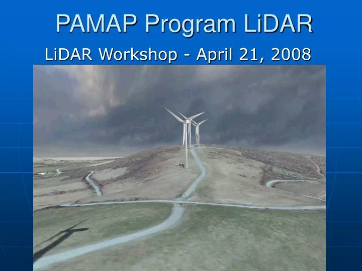
PAMAP Program LiDAR LiDAR Workshop - April 21, 2008
What is PAMAP and PAMAP LiDAR? • PAMAP is the digital base map of the Commonwealth of Pennsylvania. • PAMAP is being created as a seamless, consistent, high-resolution set of digital, geospatial data products and associated services. • The map is being compiled from new high-resolution aerial photography and elevation data, and from existing digital map resources developed by state and federal agencies, counties, regional agencies, and municipalities. • Envisioned in 2001, with operations starting in 2002
What is PAMAP? • Digital orthoimagery • LiDAR point clouds • LiDAR-derived products – DEM, contours, and breaklines • Land Use/Cover • Building/Structure data where not provided by partners • PennPilot historical aerial photographs
Collaboration • PAMAP is part of the USGS National Map • PAMAP Cooperative Agreement established with 55 of the 67 counties • PAMAP is funded primarily by the PA Department of Conservation and Natural Resources (DCNR), with contributions from other state agencies, and USGS and FEMA • The PAMAP Program is managed by agreement between DCNR and Penn State University
How Did LiDAR Come About? • The topographic mission of the Bureau of Topographic and Geologic Survey • Desire for very accurate terrain statewide • Recognition of the importance of LiDAR data for many mapping, planning, management, and monitoring efforts
How Did LiDAR Come About? • Estimated costs falling • Proposal to combine orthoimagery and LiDAR efforts • Study of synergies among imagery and LiDAR efforts • Independent review of proposals and synergies • DCNR providing funding
PAMAP LiDAR Approach • PAMAP elevation data is framework data • LiDAR is the basis for elevation framework data • Flooding is Pennsylvania’s No. 1 hazard • Need to address flooding data needs • Follow FEMA’s specifications for LiDAR data, but not all MapMod requirements • Manage Expectations
PAMAP LiDAR Program What is LiDAR?
PAMAP LiDAR Program PAMAP LiDAR Characteristics
LiDAR Specifications • Post spacing – 1.4 meters • Vertical Accuracy • 18.5 cm open areas – 0.61 foot • 37 cm forested/vegetated – 1.2 foot • Classification • LiDAR data in LAS format • Bare Earth (2) and Model Key (8) • Model key for derived products • Above Ground (1) and (12) • Other classifications also used for smaller numbers of points
LiDAR Products • Raw data retained • LAS data with classifications • Organized by PAMAP tile structure • Derived products by PAMAP tile structure • DEM – 3.2 foot (1 m) pixel • Breaklines – from PAMAP orthoimagery • 3D shapefile • Contours – 2-foot C.I. • 3D shapefile
Quality Assurance • Quantitative and qualitative review of LiDAR • Quantitative review of imagery • Independent vendor team • GeoCue/URS DPMS used for multi-participant tracking all data/tiles
Quality Assurance • Imagery and LiDAR have passed quantitative checks • Qualitative review of 2006 LiDAR underway
How Will Users Get The Data? • All PAMAP data distributed in the public domain • Widespread distribution of final data • Federal – USGS and FEMA distribution • State • Counties • PASDA • State Data Center
Distribution State/County • A geospatial enterprise server architecture is established for state agencies • All levels of government able to use database and services • State agencies acquire copies of the data • All Cooperative Agreement counties receive a portable hard drive with data
Distribution PASDA • PA Spatial Data Access clearinghouse • PAMAP data available without cost or use restriction • Imagery • DEM • Contours • FTP and web services available to anyone • www.pasda.psu.edu
Distribution of LiDAR Point Clouds (LAS Data) • Available from PA State Data Center • Offline request only • Requested data on portable hard drive or DVD • Contact Data Center • Email: PaSDC@psu.edu • Voice: (717) 948-6336 • FAX: (717) 948-6754 • Website: http://pasdc.hbg.psu.edu
Land development Wind farm siting Floodplain mapping Landslide review Flood control Mining Education Geologic mapping Rescue Forest classification Orienteering Conservation Highway design Property management Resource exploration Hydrology What Are Users Doing With The Data?
Landslide Review and Modeling • PennDOT use of LiDAR for evaluation of landslides • Jay, Thanks, the LiDAR information was exceptionally useful. It was much more detailed than we imagined which was great! We actually are using it on 2 emergency slide projects, one on SR 130 in Penn Hills where we have a road closed due to a slide about 200 feet wide by 800 feet long, the other is being used for rockfall remediation/removal on SR 28 in the Harmarville area where we have problems and recently had a fall where motorists were involved. The information is extremely useful especially when we don't have the luxury of getting survey as quickly as we need it. Again, Thanks. • Joseph Schultz, District Geotechnical Engineer, PennDOT District 11 • Geologic Survey use of LiDAR for evaluation of landslides
Vegetation Analysis • LandBase SystemsConsistent Vegetation Relief & 3D VegVolume viewed in Google Earth
Mining • PA DEP evaluating subsidence from longwall mining in western PA • PA DEP Bureau of Abandoned Mine Reclamation evaluating LiDAR for use to replace project-specific flights and photogrammetric work • I am IMPRESSED! I have been harping on coal mining consultants to get better surface contouring for some time now (they still just digitize the USGS 7.5 minute topo contours into ACAD). I argue that the accuracy standards and contour intervals are not good enough for the large-scale maps that they submit (usually 1:4800 or 1:2400). Now we can really get down to business. We can accurately map coal contours, confidently design erosion and sediment controls, do volumetric calculations, etc, etc. I cannot thank you enough. • Scott Barnes, P.G., Moshannon District Mining Office
Corps of Engineers • Clymer, PA - Flood Damage Reduction Project to design and construct flood control measures to protect Clymer Borough from flood related damages up to the 100-year level flood from Two Lick Creek and its tributary Dixon Run. • Conemaugh Reservoir - Supplement PAMAP data with bathymetric surveys to build a complete terrain model for the reservoir. • Monongahela and Youghiogheny Rivers - Supplement PAMAP data with existing river sounding data to evaluate pool changes. These evaluations include the effects of pool changes on properties along the rivers. • East Branch Dam Break - Supplement PAMAP data with existing river sounding data as well as new bathymetric survey data to build a complete terrain model of the reservoir basin as well as a complete terrain model from East Branch Dam (East Branch Clarion River) to the confluence with Allegheny River continuing on the Allegheny River to Pittsburgh.
Information PAMAP Program www.dcnr.state.pa.us/topogeo/pamap www.pamap.info Chris Markel cmarkel@geographit.com 814-360-8406