Download

1 / 7
70 likes | 185 Views
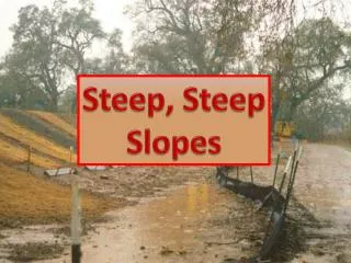
Steep Slope Avoidance for Seattle Bicyclists in Wintry Weather. GIS Cyclists United Presented By: Tori Hesedahl & Geoffrey Morgan . Objectives. Discern which bike paths in the Seattle area are hazardous to bikers during periods of severe weather such as snow and ice

E N D
Steep Slope Avoidance for Seattle Bicyclists in Wintry Weather GIS Cyclists United Presented By: ToriHesedahl & Geoffrey Morgan
Objectives • Discern which bike paths in the Seattle area are hazardous to bikers during periods of severe weather such as snow and ice • By identifying areas of high slope and making maps available, bikers will be able to avoid hazardous areas and stay on safer routes
Data Sources • King County GIS • Bike Lane Data • Road Data • Puget Sound LidarConsortium • 6ft Elevation LIDAR Data
Analysis • Created a mosaic of the LIDAR data and then converted it to a slope raster using the spatial analyst function. • Used the raster calculator to create new raster files of slope of various percentages • Converted each newly classified raster into a polygon • Each polygon was then intersected with the bike path • Each intersection was then given a color to rate the slope severity
Discussion • After completion a few inaccuracies were observed in known bike slopes (the Burke) • This was due to cross-slope data interfering with the slope of the trail and inaccuracies in trail data placing it on the hill not on the trail • Since roads are wider this error was not perceived on shared lane paths
Sources • http://pugetsoundlidar.ess.washington.edu/lidardata/ • https://wagda.lib.washington.edu/data/geography/wa_counties/king/index.html#topographic • photo courtesy of: http://www.dutchbikechicago.com/_blog/Dutch_Bike_Co_Weblog/tag/bicycles