Download
1 / 82
820 likes | 1.16k Views
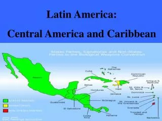
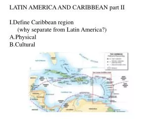
Latin America and the Caribbean. Countries of Mexico and Central America. Mexico, Belize, Guatemala, El Salvador, Honduras, Nicaragua, Costa Rica, Panama. Countries of South America.

E N D
Countries of Mexico and Central America • Mexico, Belize, Guatemala, El Salvador, Honduras, Nicaragua, Costa Rica, Panama
Countries of South America • Colombia, Venezuela, Guyana, Suriname, French Guiana, Ecuador, Peru, Bolivia, Brazil, Paraguay, Argentina, Chile, Uruguay
Countries of the Caribbean • Cuba, Haiti, Dominican Republic, Jamaica, Puerto Rico (US)
Physical Features • Major Mountain ranges • Andes Mountains • Sierra Madre Mountains--Oriental and Occidental • Rainforests • Coastal Desert--Atacama Desert • Amazon River Basin
Tropical Grasslands--Pampas, Llanos • Archipelagoes groups of related islands • Reversed seasons south of the Equator • Volcanoes and Earthquakes
Vertical Zonation of Climates in Mexico • Tierra Templada-temperate • Tierra Fria-cold • Tierra Caliente-hot
Economic Characteristics • diverse economies • subsistence farming • plantation agriculture • slash and burn agriculture • cash crops and food crops • haciendas • cattle ranches and gauchos
deforestation • destruction of the rainforests • oil resources--Ecuador, Venezuela, Mexico • Heavy smog and pollution--Mexico City
disparity of income distribution • NAFTA member • diverse mineral resources • copper in Chile • iron ore in Venezuela and Brazil
Cultural Characteristics • Indian civilizations--Aztec, Inca • African traditions--slaves • influences of European colonization--Spanish • predominance of the Roman Catholic religion • rigid social structure—no movement
Mestizos-European and Native • location of settlements--coastal in South America • Megacities with large squatter settlements • rapid population growth • out-migration
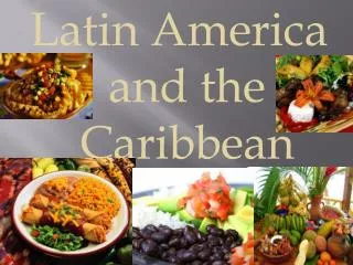
Cultural heritage • music--African influences, calypso, steel drum bands, reggae • traditional dances • Spanish and Portuguese languages
Cultural landscape • pyramids and cathedrals • haciendas and ejidos (communal land) • ruins at Machu Picchu • ruins at Tikal
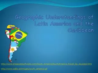
LatinAmerica From Mexico to Chile and Argentina
Andes 2nd highest range in the world. Run from Chile to Panama Sierra Madres In Mexico 3 different areas ORIENTAL OCCIDENTAL DEL SUR Mountain Ranges
Macchu Picchu is an ancient city that the Inca claimed was the center of the earth.
ancient Mayan city • ceremonial and civic center • Tikal is the "New York City" of the Maya, its skyscraper-like pyramids soaring up out of the jungle canopy.
Amazon River Basin • Over 1000 tributaries feed the Amazon River. • Drains an area almost the size of the USA. • Amazon 2nd largest river in the world. • Drains 60 times more water then the Nile.
Pampas In Argentina Used for grazing and farming Llanos In Venezuela Used for grazing and farming Grasslands