Download
1 / 22
220 likes | 365 Views
VTrack : Accurate, Energy-aware Road Traffic Delay Estimation. Arvind Thiagarajan , Lenin Ravindranath , Katrina LaCurts , Sivan Toledo,Jakob Eriksson, Samuel Madden, Hari Balakrishnan . Seif Eldrsi. Outline . Introduction Overview and Challenges Implementation

E N D
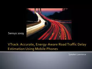
VTrack: Accurate, Energy-aware Road Traffic Delay Estimation ArvindThiagarajan, Lenin Ravindranath, Katrina LaCurts, Sivan Toledo,Jakob Eriksson, Samuel Madden, HariBalakrishnan. SeifEldrsi
Outline • Introduction • Overview and Challenges • Implementation • Requirements and Challenges • VTrack Algorithms • Travel Time Estimation • Evaluation • Validation • Hotspots detection • Related Work • Conclusion
Introduction • According to much-cited data from the US Bureau of Transportation Statistics, 4.2 billion hours in 2007 were spent by drivers stuck in traffic on the nation’s highways alone. • VTrackis a system for travel time estimation using smart phones sensors ( GPS, WiFi). • Some challenges are faced when VTrack is implemented • Energy consumption. • Sensor Unrelibility. • VTrack uses a hidden Markov model (HMM) which is based map matching scheme and travel time estimaition method. • VTrack can tolerate significant noise and outages.
Overview and Challenges • Smartphoneshas sensors including GPS,WiFiwhich can be sampled to obtain time-stamped position estimates and deliver it to a server, but can face some challenges: • Energy Consumption. • Inaccurate position samples. • VTrack is a real time monitoring system that overcomes those challenges by: • using sensor like WiFi can consume much less energy than GPS. • performing HMM map matching which is robust to noise producing trajectories with median error less than 10% when sampling only with WiFi and pre-process the data before using the algorithm. • Is costly when the phone is not equipped with WiFi sensor.
Implementation (I) Figure2: VTrack Server Figure1: VTrackArchitecture
Implementation (II) • Users with mobile as in Figure 1 run an application that reports position data to the server. • The server runs a travel time estimation algorithm that uses noisy position samples to identify the road segments and estimate travel time. • In the server's side: in case the GPS is not present ( not present or too power hungry, WiFi here is going to take a place for position estimation using localization algorithm using “wardriving” database of GPS coordinates indicating where Wifi APs observed. • Positions from sensors are fed in real-time to estimation algorithms, consists of ( map matcher, travel time estimator).
Implementation (III) • VTrack app is a real time application which is needed to support two key applications using real-time travel times • Detecting and visualizing hotspots: Hotspot is defined as a road segment on which the observed travel time exceeds the time that would be predicted by speed limit ( threshold). • Real-time route planning: The only concern of users is the overall travel time from first taking off to the destination rather than the time they spend on one road segment, the goal is to provide users with routes that minimize the total travel time but for this app ( prediction and estimation are key works).
Requirements and Challenges • Requirements: • Accuracy: the estimation needed to be close enough to reality for route planning and hotsoptdetection ( errors in the rang of 10 to 15 % are acceptable) • Efficient enough to run in real time as data arrives. • Energy efficient: Using energy by the algorithm has to be as little as it possible with meeting to the accuracy goal. • Challenges to meet those constraints: • Map matching with outages and errors • Time estimation even with accurate trajectory is difficult: When a source location data is very noisy, even if the map- matching is right it is difficult to attribute a car travel time on a road segment. • Localization accuracy is at odds with energy consumption: GPS is accurate with 5m in many settings but power hungry more than WiFi sampling up to 20x mor. WiFi is less accurate depends on localization with in a radius of 40m of true location.
VTrack algorithm • VTrack uses a viterbi decoding over a Hidden Markov Model (HMM) to estimate the route driven. Preprocess the position samples to remove outliers and post-process the HMM output to remove low quality matchers. • HMM and Viterbi Decoding: - A Marcov process with a set of hidden states and observables. Every state emits an observable with a particular conditional probability distribution call emission probability distribution. - Transitions among the hidden states are governed by a different set of probabilities called transition probability. - The hidden states are road segments and the observables are position samples.
VTrack algorithm (II) 1: 2: Figure 3: Hidden Markov Model Example. 3: 4: Figure 4: Map Matching
VTrack algorithm (III) • Figure 3 in the previous slide shows the map matching approach. A sample p is an outlier if it violates a speed constraint which set to be = 200 mph as a threshold. A pre- process is done to remove the outliers before the HMM, Figure 4.1. • Inserting interpolated points in the region where the location data experiences an outages. This interpolated samples are generated by the algorithm at 1 second intervals along Figure 4.2. • A line segment connects the last observed point before the outage and the first following the outage Figure 4.3. • Viterbi algorithm is used to predict the most likely sequence of road segments to the observed interpolated points. The hidden states in the Markov model that was used are directed road segments and observations are position samples. Computing the most likely sequence of road segment Figure 4.3. • Bad zone removal is done to remove low confidence Viterbi matches, Figure 4.4.
VTrack algorithm (IV) • Transition probabilities reflect three notation: • For a given road segment, there is a probability that at the next point, the car will still be on the road segment. The probability p from a segment i at sample t-1 to a segment j at sample t as follows • A car can travel from the end of one road segment to the start of the next if it uses the same transaction. • A car can not travel unreasonably fast on any road segment. The probability p from a segment i at sample t-1 to a segment j at sample t as follows: • if i=j, p=€ ( constant set to be <= 1/(dmax+1) where dmax is the maximum number of segments that start at the end of the same segment. • if j does not start where i ends, p=0. • If j does not start where i ends, p=€ or 0 ( this is reflecting the third notation). • Emission probability. • Viterbi decoding. • Bad zone detection.
Travel Time Estimation • Travel time known as T(S) where S is a segment consists of three parts as follow: T(S)=Tleft(S)+Tmatched(S)+Tright(S) • Tleft(S): is the time between the unobserved entry point for S and the first observed point. • Tmatched(S): is the time between the first observed entry and the last point marched to S. • Tright(S): is the time between the last point matched to S and the unobserved exit point from S. • Estimation Errors • Outages during the transition times: when a car is moving from one road segment to anothers. • Noisy position samples.
Evaluation • VTrack has been evaluated on a large data set of GPS and WiFi observing by: • Data and Method: Ground truth is obtained for evaluating the resulting of the estimation of travel time. Recording videos is one way but it is very costly. • GPS Samples: is another way but it is subject to errors and outages. • Using another approach based on aggressive data cleaning to produce ground truth by steps: • For each GPS point g in a drive, consider the set of segments Sg within a 15m radius of g. • Searching the space of these segments to match the sequence of points g to a continuous sequence of segments Xg, such that X€Sg then each GPS point is matched to one of its neighbors. • Looking to the outages for more than certain duration 10s and split the drive into multiple drives. • Finally projecting each g to the closest point on Xg to obtain a ground truth point no gap exceeds the 10s, each GPS point is matched to a segment at most 15 meters from it and the resulting is unbroken drive.
Evaluation (II) • Validating ground truth for delays on a very small data sample ( about one hour driving) in Boston. • Using android phone equipped with GPS to continuously record location. • A human operator pressed a button whenever the vehicle crossed an intersection. • Comparing the travel times between successive turns from the app to the ones obtained from the GPS. • The average error in travel times from a cleaned version was 4.74% for half an hour in Boston with 30 segments, and 8.1% for another half an hour in Cambridge with 50 segments. • Using GPS samples associated with WiFi to evaluate and validate the accuracy of time estimation. • Route planning: Finding the best routes between the source and destination minimizing the expected drive time. For each sensor setting the evaluation takes a set of clean drives Dg and noisy Dnoisy and run the VTrack algorithm on them specially the Dnoisy to produce the travel time estimates for each segment.
Evaluation (III) Figure 5:
Evaluation (IV) Figure 6:
Hotspots detection Figure 7: Figure 8:
Energy Vs Accuracy • On iphone battery the energy can be summarized in the following table: • Optimal strategy for different energy cost is showed in the next figure Figure 9:
Related Work • The Mobile Millennium project at UC Berkeley has built software to report traffic delays on mobile phones, as well as for detecting traffic using mobile phones. • The NeriCell project focuses on monitoring road conditions and traffic using smartphones. Their goal is to combine data from the GSM localization, GPS and accelerometers to get a picture of road surface quality as well as traffic conditions. • Gaonkar et al presents an idea of a “ micro-blog” where users can annotate locations and pick up other users annotations as they travel.
Conclusion • VTrack is a system for using mobile phones to accurately estimate road travel times using a seguence of inaccurate postion samples. • Evaluate these samples on route planning and hotspots detection. • VTrack uses HMM based map matching scheme. • Come over the challenges such as ( Energy consumption using WiFi rather than GPS, facing inaccurate position samples).