Download
1 / 25
250 likes | 327 Views
SOUTHEASTERN ANATOLIAN PROJECT AND ITS IMPLEMANTATION ON PUBLIC INVESTMENTS. CANSU KARŞILAYAN ADNAN MENDERES UNIVERSITY 2010 BIALYSTOK. KEY QUESTIONS. WHY DO WE NEED THIS PROJECT WHY IS THIS REGION CHOOSEN.

E N D
SOUTHEASTERN ANATOLIAN PROJECT AND ITS IMPLEMANTATION ON PUBLIC INVESTMENTS CANSU KARŞILAYAN ADNAN MENDERES UNIVERSITY 2010 BIALYSTOK
KEY QUESTIONS • WHY DO WE NEED THIS PROJECT • WHY IS THIS REGION CHOOSEN
The climate of Turkey is called semi-arid with some extremities in temperature . In the higher interior Anatolian Plateau, winters are cold with late springs, while the surrounding coastal fringes enjoy the very mild-featured Mediterranean Climate. mediterranean, sub-tropic and terrestrial
TURKEY IS NOT A WATER RICH COUNTRY Countries classified as a rich country in water resources if they have 8-10 thousand m3 water per capita per year. The available water per capita per year in Turkey is about 1/5 of the water-rich countries.
THE PROJECT AREA ADIYAMAN – GAZİANTEP – DİYARBAKIR – KİLİS – MARDİN – ŞANLIURFA – BATMAN – SİİRT - ŞIRNAK
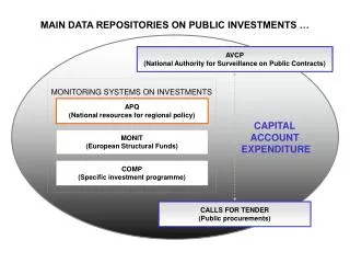
WHAT IS GAP • GAP is a multi-sectoral integrated regional development project based on sustainable development. • Water resource utilize on Fırat (Euphrates) and Dicle (Tigris)
THE GAP MASTER PLAN PINPOINTS FOUR BASIC STRATEGIES Development and management of water and land resources for both irrigation purposes and for urban-industrial uses, Improvement of land use by introducing better farm management systems, farming practices and crop designs, Encouragement of manufacturing industries by giving special emphasis to local and agriculture related resources and inputs, Improvements in social services and urban infrastructures in order to better respond to the needs of the people and attract qualified personnel to the region.
AS A RESULT OF THE COMPLETION OF THE ACTIVITIES AND PROJECTS WITHIN THE GAP ACTION PLAN; The completion of the construction of 1,649 km. long main irrigation channels The opening up of 1,060,000 hectares of land to irrigated agriculture, The completion of 2,209 km. of national and county roads and many highway bridges reaching 2,8 km. in length, Reaching the targets of 50%, 100% and 90% of schooling, respectively in preschool, primary and high school education Creation of 3,580 additional bed capacities in health sector. Giving vocational training to 35 000 people, through an extended vocational qualification acquaintance training program. Reaching up to 6,200 people with training and consultancy programs in order to help them establish their own businesses, are targeted.
HISTORY OF THA GAP ( 1 ) • Electricity Survey Administration - 1936 • Keban Project – 1938 • Drillings on Euphrates(Fırat) and Tigris (Dicle) 1950-1960 • State Hydraulic Works – 1954 • Fırat and Dicle Planning Authority – 1961 • Reconnaissance Report For Fırat Basin – 1964
HISTORY OF THE GAP ( 2 ) • Reconnaissance Report For The Lower Fırat Basin – 1966 • Irrigation Shemes Of The Lower Fırat Project – 1968 • SOUTHEASTERN ANATOLIAN PROJECT - 1977
ŞANLIURFA • Due to the success of the National Independance War Şanlı (Glorious) title was given to city. • Mardin (east side), Gaziantep (west side), Adıyaman (north side), Diyarbakır (northeastern side) and Syria(south side ) border the city.
ECONOMIC DEVELOPMENT • Based on agriculture, stockbreeding • 20 private and public bank • 24 exchance office • 3 organized industrial zone
POPULATION • 795.000 people in 1985 – 1.443.442 people in 2000 • Two kind of internal migration • A) comes from neighboring provinces and rural areas • B) local registers who migrated to other city before 1990. They come back
HEALTH AND EDUCATION • Additional to public hospital one private hospital • 500 bad capacity university hospital • Mobil education (provided by translation) • New opening university
INFRASTRUCTURE • Infrastructure cannot provide drinking water, sewage service and traffic control due to rising population and citizen needs. • Centre of town has one main street but it is not enough for economy, bureaucracy and trade activities. • SOLUTION • Municipalities should prepare action plans for build sewage cannels. • To built a centre of bussines for trade activities • Municipalities should agree with some private logistic companies.
SOCIO-CULTURAL LIFE • PROBLEMS • Social development progress is slower than the economic sphere. • Women have begun to take place in public life but it is so less • Sending girls to school is a problem • Bloodfeunds • Terrorism is much less than neighboring cities but it’s an important source of social discomfort • SOLUTIONS • The reduction of terrorism. • Positive discrimination for women • Preparation schools for primary eduction and enhancing the campaigns for sending school • More punishment for bloodfeunds
DİYARBAKIR Diyarbakır has a great history. The cities ramparts made by Johan 9000 years ago. Diyarbakır was been the capital city of Armenian Kingdom and Kingdom of Akkoyunlular
ECONOMIC DEVELOPMENT • Based on agriculture and stockbreeding. • 25 Private and Public Bank • 20 exchange offfice • 2 Organized Industry Zone • 2 Finansial institution
PROBLEMS AND SOLUTION • Feudal cultural structure • Terrorism • Insufficient information about the market • GAP could be implemented as 5% of it • Feudal cultural structure had been planned by government. • Public and private sector should make research with together. • GAP should be done exactly.
POPULATION Diyarbakır was gettingmigration from surrounding cities and villages since 1990. Because of security concerns, evacation of villagers, instability in the region. In Diyarbakır there is both internal and external migration. External migration - %70 Internal migration - %30
PROBLEMS AND SOLUTIONS • Lack of infrastructure • Lack of urban transportation • Difficulties of inadequate busses • Increased un employment • The reduction of terrorism • Enhancing security for emigrants returned to their villages • To give support to agriculture and low loans • Provide support for the repair of houses • Ensure minimum living conditions to villagers (example: telephone, drinking water, electricity)
EDUCATION • PROBLEMS • If we compare the closed school amounts with 90’s it is more less but still some schools are closed • Education provide with transportation • Lack of personnal • SOLUTIONS • The builds of school should been restored. • Municipalities should built efficient class to every districts • Needs of personals should been provided by government.
INFRASTRUCTURE • PROBLEMS: (As a result of incresed population) • housing, sewage, drinking water • increased traffic problems • SOLUTIONS • Urbanization-plan and house projects • The municipalities should find some areas for building • Minimum living standards for emigrants to change their mind as the only way isn’t migration.
SOCIO-CULTURAL LIFE • In this city 321 culture-art-sport projects and 157 employment are implemented. • There is 3 big shopping center. • 5 local television channels and 8 radio stations are existing • Dicle University contributes the cultural life. • Only problem is pressure of terrorism.
PROPOSALS AND FUTURE EXPECTATIONS • To find alternative jobs suitable with the social and geographic structure of the region for example beekeeping and weaving. • To make agriculture revolution and give credits with low loans • To enhance all industrial investments • The government should be tolerant to citizens and institutions • Come back projects to villages • To support social and cultural investments not only economic ones. • The region tried to get rid of such a confused situations so some projects should be made like earthquake projects.