Download
1 / 3
150 likes | 450 Views
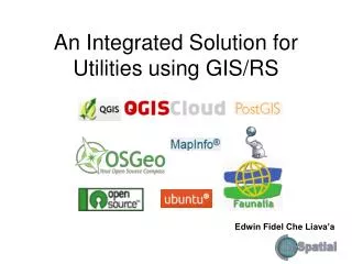
GIS for Utilities. Discussion. Agenda. The Role of FOSS in GIS for Utilities PostGIS/PostgreSQL QGIS-Desktop QGIS-Server QGIS-Cloud QGIS-Web-Client QGIS-GRASS+R The Role of GIS/RS unit in the heart Utilities Billing Assets Register Maintenance Scheduler Network Modeling/Simulation

E N D
GIS for Utilities Discussion
Agenda • The Role of FOSS in GIS for Utilities • PostGIS/PostgreSQL • QGIS-Desktop • QGIS-Server • QGIS-Cloud • QGIS-Web-Client • QGIS-GRASS+R • The Role of GIS/RS unit in the heart Utilities • Billing • Assets Register • Maintenance Scheduler • Network Modeling/Simulation • Sharing • Data • Knowledge • Source Code • Information
Abstract: In the Pacific region, Geographical Information System (GIS) and Remote Sensing (RS) are increasingly being recognized as essential tool-sets for planning and development that can allow Utilities to better manage their assets in order to make well-informed planning and strategic action decisions. For more than 15 years of experience in the Utilities sector using GIS/RS tools for assets management and planning, I feel the full capacity of GIS/RS is not fully utilised and sometimes not fully understood by executive level on how powerful these tool-sets are for the successful operation and sustainability of the utility. Most utilities have several specialised information systems to empower the services they provide for their customers, suppliers and stakeholders. These include Finance Systems, Cashier, Billing Systems, Assets Register, Schedule Maintenance, Supply and Demand Forecasting and Network Modelling/Simulation, etc. In the mists of all these systems are the GIS/RS tools to support all these segregated systems. However, day to day operations and procedures seems to neglect the GIS/RS component and in most cases the “cart is pulled before the horse” and the GIS unit is chasing after other systems for updates instead of dictating the data/information updates and procedures. This paper will put GIS/RS at the heart of utilities operation and will dictate data flow and operating procedures thus integrating all other systems as one cohesion centralised GIS/RS system.