Download
1 / 14
140 likes | 240 Views
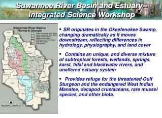
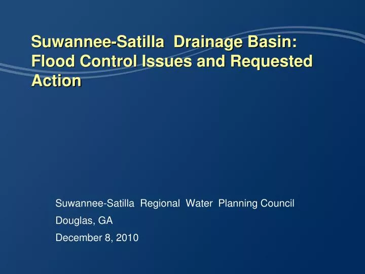
Suwannee-Satilla Drainage Basin: Flood Control Issues and Requested Action. Suwannee-Satilla Regional Water Planning Council Douglas, GA December 8, 2010. In April 2009 a total of 46 Georgia Counties declared Disaster Emergency. Suwannee-Satilla Region.

E N D
Suwannee-Satilla Drainage Basin: Flood Control Issues and Requested Action Suwannee-Satilla Regional Water Planning Council Douglas, GA December 8, 2010
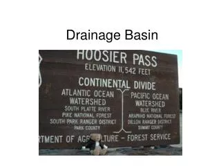
In April 2009 a total of 46 Georgia Counties declared Disaster Emergency Suwannee-Satilla Region
Recorded Data – USGS Streamgage - Quitman, GA A total of 8.0 inches of rainfall occurred in 3 days. It took 5 days for the River stage to rise 30 feet, indicating that the source is located upstream
Lowndes County and the City of Valdosta were deeply impacted by the flood • The Withlacoochee and Little River basins encompass about 1,450 square miles • Valdosta’s drainage area to the river is only 1% • Very limited benefits will be achieved without regional coordination with other communities • Coordination with the FEMA, USACOE, and EPD is necessary to involve upstream communities
Lowndes County/Valdosta recorded more than 150 homes and 20 businesses severely flooded Winding Way Meadowbrook Drive Meadowbrook Drive Winding Way
The current FEMA flood maps are based on an outdated analysis: Flood levels exceeded the 100 year FEMA estimates. FEMA 100-Year Flood Plain CDM 100-Year Flood Plain
The Withlacoochee WWTP was severely flooded Temporary Earth Berm Tertiary Filter No. 1 Chlorine Building Influent Pump Station
The Withlacoochee WWTP was severely flooded The tertiary filter #2 submerged to the traveling bridge
This occurrence was extreme, but it has become more frequent in recent years The Withlacoochee River has reduced its ability to convey flows due to significant sedimentation and obstructions by dead trees. Tree/Debris Removal at SR. 84
Potential Factors contributing to recent floods • Upstream communities in our area have implemented different runoff control measures, without regional coordination. • Some communities lack proper regulations as well as expertise and resources to address their needs. • Some of the existing dams and levees can release significant volumes of water and require coordination and advance notice to downstream communities. • A city by city or county by county approach is inefficient, more costly and not as effective as a regional approach.
Immediate Response Needed in the Suwannee-Satilla watershed • A series of storage areas should be identified to control stormwater flows, while providing a much needed water supply reservoir network. • Recharge areas combined with stream buffers should be considered to reduce the stream flow and recharge the aquifers. • Stream restoration should be considered in selected areas that are degrading and releasing significant sediment and debris loads. • State and Federal funding is essential to the development of these solutions that are beyond the financial and institutional capacity of any jurisdiction in the watershed.
Regional Regulatory/Coordination Needs • Urban areas need to start controlling runoff in regional facilities to retrofit areas that were developed in the past before regulations were established and accommodate current and future needs. • A tool-kit of best practices and options could be prepared to help communities select the right choices for their individual issues and needs. • A common ordinance template could be prepared to create consistency between different communities. • Ordinances should consider stormwater control within private property for both sub-division and commercial development. • Roadway projects can increase the peak runoff and velocities without the appropriate stormwater best management practice, and should be included as part of the regional solution.
Recommended Actions for Water Council • Form a sub-committee to study the regional stormwater issue. • Develop education materials and model policies and ordinances for communities to consider that take into account unique needs. • Study the possibility of regional reservoirs that address flood control as well as provide opportunities for additional water supply. • Propose solutions and request funding in the states 5 year plan to include GEFA eligibility.
Questions? Suwannee-Satilla Regional Water Planning Council Douglas, GA December 8, 2010