Download
1 / 17
180 likes | 376 Views
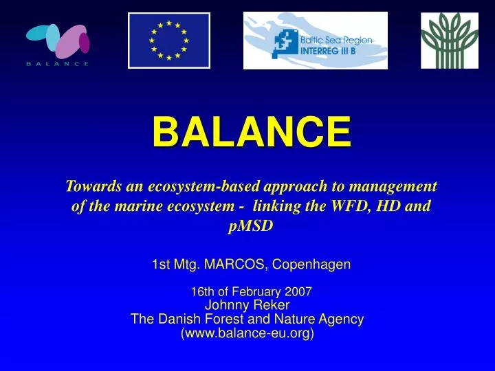
BALANCE Towards an ecosystem-based approach to management of the marine ecosystem - linking the WFD, HD and pMSD 1st Mtg. MARCOS, Copenhagen 16th of February 2007. Johnny Reker The Danish Forest and Nature Agency (www.balance-eu.org). OUTLINE. The BALANCE project

E N D
BALANCE Towards an ecosystem-based approach to management of the marine ecosystem - linking the WFD, HD and pMSD 1st Mtg. MARCOS, Copenhagen 16th of February 2007 Johnny Reker The Danish Forest and Nature Agency (www.balance-eu.org)
OUTLINE • The BALANCE project • Marine landscapes in the Baltic Sea • The MARCOS challenge Submarine structures made by leaking gases in northern Kattegat. Photo: Dan Kaasby
SCOPE 19 partners + 7 consultants 10 countries incl. Norway & U.S.A but excl. Russia Budget Є4,7 mio. Runs 2½ year from 1/7 2005 Covers the entire Baltic Sea Funded by the BSR INTERREG IIIB Programme (DG Regio) BSR INTERREG IIIB region. The “BALANCE” project area includes The Baltic Sea, Kattegat & Skagerrak
TRANSNATIONAL & CROSS-SECTORAL PARTNERSHIP The Danish Forest and Nature Agency (Lead) The Geological Survey of Denmark and Greenland The National Environmental Research Institute The Danish Institute for Fisheries Research WWF Denmark WWF Germany Institute of Aquatic Ecology, University of Latvia Estonian Marine Institute, University of Tartu Coastal Research and Planning Institute Metsähallitus Natural Heritage Service The Finnish Environment Institute The Geological Survey of Finland WWF Finland The Swedish Environmental Protection Agency The National Board of Fisheries The Geological Survey of Sweden County Administrative Board of Stockholm Department of Marine Ecology, Gothenburg University WWF Sweden
AIM Aim: Development of an informed management template for the Baltic Sea focused on marine spatial planning through cross-sectoral & transnational co-operation. Activities: Identify & collate available BS marine data (physical, biological, socio-economic), meta-database Identify & map marine landscapes & habitats in the Baltic Sea Assessment of the Baltic MPA network & development of the “blue corridors” concept Development of Baltic marine zoning plans in 2 pilot areas Stakeholder communication strategy & dissemination
Characterisation requirements- similarities between directives • Water Framework Directive (art. 5.1, Annex II): “- an analysis of its [river basin district] characteristics” • Habitats Directive (art. 3.2, Annex I): “- shall contribute to the creation of Natura 2000 in proportion to the representation within its territory of the natural habitat types and the habitats of species…” • Proposed Marine Strategy Directive (art. 7.a, Annex II): “- an analysis of the essential characteristics and current environmental status of those waters… and covering the habitat types, the biological components, the physio-chemical characteristics and the hydromorphology” • All three directives (WFD art. 5.1, Annex II), pMSD art. 3.1, HD art. 1.c) requires a transnational approach covering entire ecoregions e.g. the Baltic Sea.
MARINE LANDSCAPES- characterising the marine environment • It is a broad scale characterisation of the marine environment based on geophysical and hydrographical features. • It is an cost-effective and suitable for describing offshore marine areas where biological data often are sparse. • It was first developed by Roff and Taylor (2000) for predicting species assemblages based on geophysical and oceanographic data for Canadian territorial waters. • The purpose was to enhance conservation of marine biodiversity through the establishment of a national framework of MPAs and can be applied for describing both the benthic and pelagic environment. • The method has been applied in the North-western Atlantic through MESH, the UK through the Irish Sea Pilot Project and UKSeaMap.
MARINE LANDSCAPES Marine landscapes are defined as: • Seabed features which occur away from the coast, i.e. the seabed of open sea areas. In this group, the marine landscapes comprise the seabed and water at the substrate/water interface; • Coastal (physiographic) marine features such as fiords and estuaries where the seabed and water body are closely interlinked. In this group, both the seabed and the overlying water are included within the marine landscape; • Water column marine landscapes of open sea areas, such as mixed and stratified water bodies and frontal systems. In this group, the marine landscapes comprise the water column above the substrate/water interface.
THE BALANCE APPROACH • Collate and analyse available geophysical and hydro-graphical information for the entire Baltic Sea & Kattegat • Define and agree on an unified data format • Decide a common platform for data handling, processing and projection of marine landscape map, e.g. ArcGis, WGS84, UTM • Define standards for classifying Baltic marine landscapes • A validation scheme to confirm the whether the predicted landscapes are describing the real life situation • Evaluate the existing Baltic network of MPAs, identifying Baltic marine diversity hotspots & strategic tool for planning field work etc.
Sediment • 5 classes • First compiled sediment map of the Baltic Sea Salinity • Modelled in 7 km grid in 20 layers • 6 classes based on biogeographic distribution patterns of macroalgae and ecological requirements of commercial fish • Salinity at the seafloor used Seafloor within the photic zone • Modelled • Based on Secchi measurements from March to November over 10+ years Halocline • Based on modelled data
Current velocity • Wave exposure • Bed Shear Stress • Temperature Secondary data layers: • Ice cover • Oxygen depletion (incomplete) • Data layers are merged for the entire region ~ ecosystem approach
Major basins Biogeographic boundaries Picks up known banks and reef areas Benthic marine landscapes of the Baltic Sea
Pelagic landscapes – a Baltic example Areas with suitable conditions (>11 PSU and >2ml O2/l) for survival of Cod egg. Field stations (salinity, temperature & oxygen)
Cod Reproductive Volume- a Baltic pelagic landscape • Is characterised by >11 PSU and >2ml O2/l • Occurs as a 10-15 m layer at 55 to 70 m of depth where Cod eggs can both float and survive • Show distinctive temporal variation • Available volume influence the size of Cod cohorts • Several species are linked to this pelagic landscape Areas with suitable conditions for successful Cod spawning.
Illustrating the applicability of marine landscape mapping • Linking the physical characterisation to socio-economic utilisation of the marine environment • It can be linked to models predicting climatic change showing the consequences to marine environment • Easy to identify status…
FUTURE CHALLENGES?- bridging the gap between science and policies • Validation • Continue development • Shaping the marine landscapes to the needs and requirements of relevant directives • Status assessment – can getting the characterisation right pave the road for one approach to assessing “ecological status”, “favourable status”, “environmental status” • Future implementation – one monitoring programme covers all, one management plan etc. • MARCOS? – Our challenge will be to come up with recommendations & guidance that will help shaping and implementing a true ecosystem-based approach to management linking the three directives