Download
1 / 45
1.17k likes | 3.65k Views
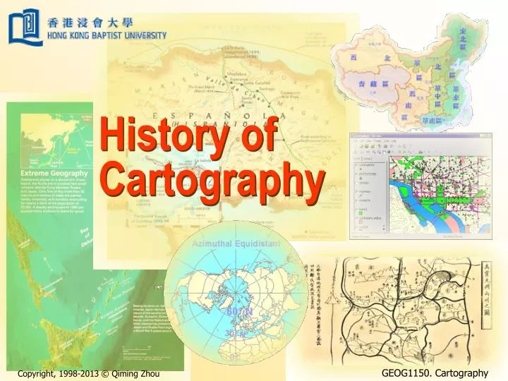
History of Cartography. History of Cartography. Sequence of development Cartography in China Cartography in Europe Impact of changing ideas Impact of changing technology Information age mapping. Sequence of development. Evolution - the ladder concept.

E N D
History of Cartography • Sequence of development • Cartography in China • Cartography in Europe • Impact of changing ideas • Impact of changing technology • Information age mapping History of Cartography
Sequence of development • Evolution - the ladder concept. • “Missing links” - gaps in development. • Revolution - the tree concept. • Each revolution leads to a new map type. • Map types develop in evolutionary fashion, until the next revolutionary change occurs. History of Cartography
Cartographic development OriginA Present Ladder Concept OriginB Present Tree Concept History of Cartography
0 A.D. 30,000 B.C. 200 A.D. 500 A.D. 1200 A.D. 1700 A.D. 1800 A.D. 1900 A.D. 2000 A.D. Cartographic revolution and evolution The diverse map types we know today emerged through a long process of cartographic revolution and evolution. (From Robinson, et al., 1995) History of Cartography
Early development • Nobody knows when the first map was made. • Principles of cartography were understood as early as 2500 BC. When Babylonians drew maps on clay tablets. History of Cartography
Early mesopotamian map of the world The earliest extant world map is a Babylonian clay tablet from the sixth century B.C., on which Earth is shown as a flat circular disc surrounded by ocean and several mythical islands. (From Wilford, 2000) History of Cartography
A map from ancient egypt An map made in Ancient Egypt with an estimated date to 3200 B.C. showing the trace of gold workings in Egypt. The map, now in Turin, depicts gold workings around the time of King Seti I (1350-1205 B.C.). (From GEOEurope, January 2000) History of Cartography
China Xia【夏】, Shang【商】, Zhou【周】 (- 476 BC) Warring State Period 【春秋戰國】 (475-221 BC) Qin【秦】 (221-206 BC) Han【漢】 (206 BC – 220 AD) Three Kingdoms【三國】 (220-280) Jin【晉】 (265-420) South and North【南北朝】 (420-581) Sui【隋】 (581-618) Tang【唐】 (618-907) Five Dynasties【五代十國】 (907-960) Song【宋】 (960-1279) Yuan【元】 (1279-1368) Ming【明】 (1368-1644) Qing【清】 (1644-1911) Europe Ancient Greece (- 404 BC) Roman Republic (508-27 BC) Western Roman Empire (27 BC – 476 AD) Medieval (5-15th century) Renaissance (14-17th century) Age of Discovery (15-17th century) Colonial Empires (started in the 15th century) Industrial Revolution (18-19th century) French Revolution (1789-1799) The historical periods in China and Europe History of Cartography
Cartography in China • Astronomical knowledge existed in Shang 【商】Dynasty, 11th century B.C. • “Fragment on Maps” 480-100 B.C. • Three maps made in Han 【漢】Dynasty (2nd century B.C.) were discovered. • In a tomb (長沙馬王堆漢墓). • made in silk. • one topographic map focused on military matters: streams, roads, mountain ranges, names, scale and orthogonal view point. For more details please check web page http://geog.hkbu.edu.hk/geog1150/Chinese History of Cartography
A map on a pinewood board Seven maps, painted on four pinewood boards were unearthed in March 1986 from a tomb dated from 299 BC (Warring States Period, 475-221 BC). (Retrieved from Treasures of Maps – A Collection of Maps in Ancient China, Harbin Cartographic Publishing House, 1998) History of Cartography
A topographic map of the southern part of Changsha State Ancient Chinese topographical map, Western Han Dynasty, (Wendi, 179-157 BC): A silk map in the ancient tombs. "Their great significance lies in the fact that they are in part surprisingly accurate and detailed and show that the art of cartography was well advanced at this time". — Bulling, 1978 (cited in Wilford, 2000) History of Cartography
The four greatest inventions of ancient China • The first compass was invented in China. • 司南(戰國, 453-221 B.C.). • was not widely used until North Song Dynasty (北宋, 960-1126 A.D.) when the artificial magnetisation was invented. • introduced to Europe in 12th century. • Paper-making was invented in 105 A.D., East Han Dynasty (東漢, 25-220 A.D.). • Gunpowder was invented in the Three Kingdoms period (三國, 220-265 A.D.). • The first printing of map 1155 A.D. (South Song Dynasty:南宋, 1127-1279, 300 years before Europe). History of Cartography
The ancient compass Up: The earliest magnetic compass Si-nan (司南) made in West Han Dynasty (西漢, 206 B.C. – 8 A.D.). Right: the clay figure made in South Song Dynasty (南宋, 1127-1279 A.D.) showing the rather modern look compass held in the man's hand. (The National Museum of Chinese History) History of Cartography
Ancient mechanic devices The compass coach invented in the "Three-Nation" eras (三國, 220-280 A.D.). The mileage coach invented in the East Han Dynasty. (models made according to historical records, The National Museum of Chinese History) History of Cartography
The earliest paper map The earliest paper map made in the West Han Dynasty, almost at the same time when the paper itself was invented by Chinese. The paper map was discovered in an ancient tomb in Gansu Province (甘肅天水放馬灘5號漢墓), western China. (The Provincial Museum of Gansu) History of Cartography
The earliest printed map The earliest printed map made in the South Song Dynasty showing east part of China in the modern history. (Beijing Library) History of Cartography
Cartography in Europe • Aristotle (384-322 B.C.): Earth is a sphere. • Ptolemy (90-160 A.D.): Geographia. • Development in medieval period (the “dark age”) was limited, except the sudden appearance in 13th century of “portolan charts”. History of Cartography
Ancient Greece Map of Hecataeus (about 500 B.C.): by an empirical approach, relying on exploration and travel instead of pure geometry alone. (From Dorling and Fairbairn, 1997) History of Cartography
The Roman empire The world-view of the Roman Empire (400 A.D.): A circular earth disc, set in a surrounding ocean, became the dominant interpretation of the Middle Ages cartographer. (From Dorling and Fairbairn, 1997) History of Cartography
E E River River Ocean A S I A Ocean A S I A Don Nile N S N S Don Nile Ocean River ANTIPODES EUROPE AFRICA EUROPE Mediterranean FRIDID ZONE AFRICA Mediterranean TEMPERATEZONE TORRID W W Ocean River ZONE TEMPERATEZONE FRIDID ZONE Typology of mappae mundi Quadripartite Tripartite Transitional Zonal History of Cartography (From Harley and Woodward, 1987, cited in Dorling and Fairbairn, 1997)
The Ebstorf map The Ebstorf map showing Christ's head, hands and feet at the extents of the world (1235 A.D.). (From Dorling and Fairbairn, 1997) History of Cartography
The renaissance in western cartography • The renaissance in western cartography (later half of 1500s) • beginning of printing (1450) • Great Discovery (e.g. Columbus) led to more accurate maps • topographic survey (France) at 1:86,400 completed in 1800 • The introduction of metric system (Napoleon) • 1 metre = 1/10,000,000 part of the arc distance from the equator to the pole History of Cartography
The growth of modern cartography • The rise of thematic maps • Until 18th century, most maps are general maps and charts • From late 17th century, thematic maps began to appear • The growth of modern cartography since 19th century with the inventions of photography and computers History of Cartography
Impact of changing ideas • Concept of representation • Early maps: more figurative than literal • Geometry • Shape and size of the earth • Locational reference system • Reconciling conflicting information • Church maps History of Cartography
The philosophy of cartography • View: land or sea? • Discipline: arts or science? • Purpose: A picture or a tool? • Method: perception or survey? History of Cartography
Design philosophy and culture • The common nature of the eastern and western cartography • Self-centred • The primary purpose was for travel and exploration • The cultural difference • Ancient China: land-based civilization (the “yellow” culture) • Ancient Europe: sea-based civilization (the “blue” culture) • The disciplinary difference • Ancient China: arts perception • Ancient Europe: science survey History of Cartography
A Chinese self-centred map The world map presented in Shan-hai-jing【山海經】, an ancient Chinese legendary which was authored in the Warring State period (475-221 BC) and was revised in later centuries. The centre of the map is the “Central Plains”, comprising the middle and lower reaches of the Yellow River. History of Cartography
E River Ocean A S I A N Don Nile S EUROPE AFRICA Mediterranean W An European self-centred map Redrawing of a Christianized T-O map diagram for the geographical description of the world in the pagan writer Salust’sJugurtha, 10th century. (Map retrieved from Barber, P. (ed.), The Map Book, Walker & Company, New York) History of Cartography
China: the land-based civilization • Chinese civilization started in the Yellow River Valley back to 4000 BC. • The in-land origin makes the Chinese culture a land-based culture (or a “yellow” culture). • This is well reflected in the development of Chinese cartography: • Details in river and land features; • Inaccurate description on coastal lines; • Very much guessing work for the lands across the sea; • Map grid instead of spherical coordinates. History of Cartography
The Hua-Yi Map【華夷圖】 “Hua-Yi” means “China” and “overseas”. The map was made in 1136 (Southern Song Dynasty), on a stone monument. It presents incredibly accurate information on the major rivers of the eastern part of China, with over 400 place names. The coastline, however, was poorly presented and very little information was shown for the lands across the sea. (The Beilin Museum of Shaanxi Province, China) History of Cartography
The Yu-JiMap【禹跡圖】 “Yu-Ji” means “The track of Yu”. Yu was an legendary pre-history Chinese empire who was regarded as the god for river management. The map was made in 1136 (Southern Song Dynasty), on a stone monument. The map featured the earliest map with grid coordinates and presented detailed water systems in eastern China. (The Beilin Museum of Shaanxi Province, China) History of Cartography
Europe: the sea-based civilization • European civilization started at the coast of Mediterranean featured ancient Greece and Roman Republic and Roman Empire. • The limited land availability makes the ancient Greek and Roman go to the sea to search new settlement, thus to develop a sea-based culture (or a “blue” culture). • Therefore in European cartography: • Details in coastlines and islands; • Inaccurate description on in-land features; • The need for navigating through the sea made use of spherical coordinates. History of Cartography
A map based on Ptolemy's descriptions The map constructed in the 15th century from Ptolemy's written directions and descriptions, and reflects geographical knowledge of the known world in the 2nd century AD. (Retrieved from Clark, J.O.E. (ed.), 2005, 100 Maps: The Science, Art and Politics of Cartography Throughout History, Sterling, New York) History of Cartography
Halley’s navigation chart Halley’s 1700 chart of the western Atlantic and the Americas, showing lines of magnetic variation. The journey Halley undertook to make these measurements was arguably the first purely scientific sea voyage. (Retrieved from Barber, P. (ed.), The Map Book, Walker & Company, New York) History of Cartography
Perception and survey • Chinese map-making was long regarded as artwork. • The map-style was mainly for the perception rather than the measurements. • The modern surveying and mapping methods were not introduced into China until the Ming Dynasty by an Italian Ricci Matthieu (1552-1610). • The survey-based mapping in Europe • Re-introduced during the renaissance • Measurements History of Cartography
Map of the Beijing-Hangzhou Grand Canal The map was made in Qing【清】Dynasty (Qianlong【乾隆】, 1736-1795) and is both a cartographic and a meticulous, detailed work of art. It accurately depicts geographical features and scenery along the Grand Canal from Beijing to Hangzhou, and vividly portrays mountains, rivers, cities, bridges, boats on the canal, and people on its banks. (Retrieved from Treasures of Maps – A Collection of Maps in Ancient China, Harbin Cartographic Publishing House, 1998) History of Cartography
Early survey in France The perceived shape of France before and after the 1693 survey by Picard and La Hire (revised coastline in bold). (from Dorling and Fairbairn, 1997) History of Cartography
Historical lessons learnt • At the early stage the Chinese and European civilization shared the same vision of the World. • The Chinese civilization is land-based so that their map-making was more focused on land with local details and paid little attention on sea navigation. • In ancient China, traditionally the scientific work was discouraged, so that they map-making was inevitably oriented towards art works. • As the consequence, ancient Chinese did not continue their early efforts to develop mathematic theories and surveying methods. History of Cartography
Impact of changing technology • Manual: mappae mundi and portolan charts - hand drawing • Magnetic: compass and magnetic media • Mechanical: machine process and printing • Optical: telescopic sighting instruments and projection, optical media • Photo-chemical: photogrammetry • Electronic: computer process History of Cartography
Impact of changing technology Electronic Photo-chemical Optical Mechanical Magnetic Manual 1100 1200 1300 1400 1500 1600 1700 1800 1900 2000 History of Cartography
Manual technology A formschneider (one who carves woodcuts) at work in front of a window. In those days there was no satisfactory substitute for daylight. "Manual mapping procedures were dominant during the longest period in the recorded history of cartography". — Robinson, et al., 1995 History of Cartography
Mechanical technology Printing from a copperplate engraving with the rolling press was a hard work. "Machine power augmented and magnified human muscle power. The result was a major increase in the speed and efficiency of the mapping process, with a commensurate reduction in mapping cost". — Robinson, et al., 1995 History of Cartography
Information age mapping • Information age. • Information. • Information systems. • Geographical information systems (GIS). • Maps play a key role in GIS. • GIS are crucial in modern mapping. History of Cartography
Mapping with GIS StatisticalTools Datacollection EditingStructuringUpdating DataBase Map DataManipulation GraphicalTools History of Cartography