Download
1 / 31
310 likes | 441 Views
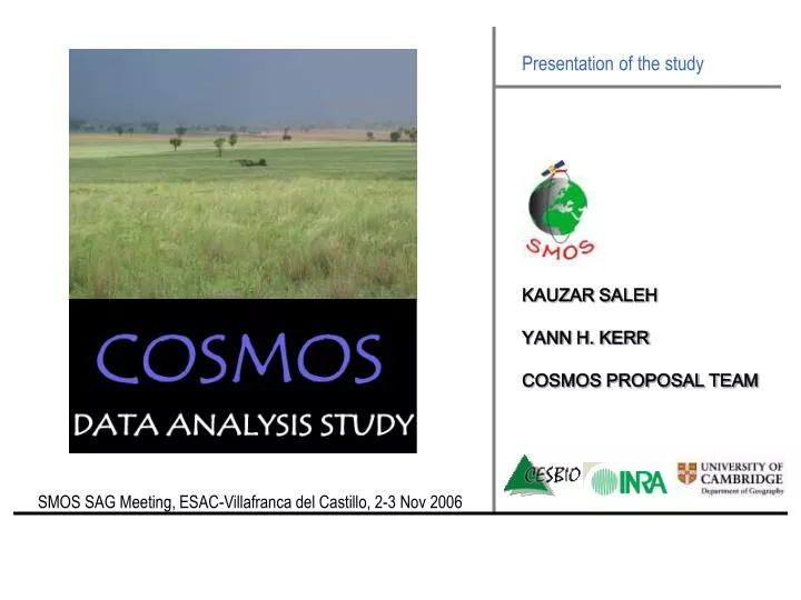
Presentation of the study. KAUZAR SALEH YANN H. KERR COSMOS PROPOSAL TEAM. SMOS SAG Meeting, ESAC-Villafranca del Castillo, 2-3 Nov 2006. Outline. 1-CAMPAIGN DESCRIPTION 2-ACQUIRED DATA 3-QUICK-LOOKS 4-COSMOS DATA ANALYSIS SPP AND SCHEDULE.

E N D
Presentation of the study KAUZAR SALEH YANN H. KERR COSMOS PROPOSAL TEAM SMOS SAG Meeting, ESAC-Villafranca del Castillo, 2-3 Nov 2006
Outline 1-CAMPAIGN DESCRIPTION 2-ACQUIRED DATA 3-QUICK-LOOKS 4-COSMOS DATA ANALYSIS SPP AND SCHEDULE SMOS SAG Meeting, ESAC-Villafranca del Castillo, 2-3 Nov 2006 1
2 1-COSMOS CAMPAIGN: Site NAFE-05 (31/10-25/11) Focus on high resolution retrievals, scaling and assimilation Cosmos & NAFE 2005 : Goulbourn COSMOS (13/10-09/12) Focus on SMOS L2 implementation, SMOS open issues, SMOS L2 validation NAFE-06 (/10-/11) Focus on SMOS scale retrievals, downscaling and assimilation NAFE 2006: Murrumbidgee
MODELLING IMPROVEMENTS • [interception?, grass model?, soil model? … ] • SUN GLINT OVER LAND? • ANCILLARY DATA USEFUL? HOW DO WE USE IT? • SM LEVEL 2 CONCEPT VALIDATION • ERROR ANALYSIS 3 1-COSMOS CAMPAIGN: Objectives 2 SMOS L2 ALGORITHM VALIDATION 1 SMOS L2 ALGORITHM IMPLEMENTATION COSMOS/NAFE MOST COMPLETE AIRBORNE DATA SET OVER PRAIRIES- ‘OUTDOORS LAB’
250 m DEM Elevation above sea level (m) clay-loam clay loam sandy loam sand 4 1-COSMOS CAMPAIGN: Goulbourn catchment 8 FARMS Whole catchment area ~75km x 100km
5 1-COSMOS CAMPAIGN: Goulbourn catchment 8 FARMS Whole catchment area ~75km x 100km
6 1-COSMOS CAMPAIGN: EMIRAD and PLMR ECO-DIMONA SERA PLMR (TUD) L-BAND across/along-track POLARIMETRIC + 6 incidence angles (+/-7, +/-21.5, +/-38.5) EMIRAD (TUD)L-BANDalong-track POLARIMETRIC + Potter horns 37.6 deg & 30.6 deg HPBW (0 DEG AND 40 DEG TILT)
1-COSMOS CAMPAING: EMIRAD and PLMR ⇨ Opportunity for intercomparison between two L-band sensors 7
8 1-COSMOS CAMPAING: SOIL MOISTURE SAMPLING 15/11 Pembroke sampling 14/11 INTERMEDIATE RES: 125 m, 250 m HIGH RES: 12.5 m, 62.5 m ‘SUPER HIGH’ RES: 6.25 m REGIONAL RESOLUTION: 1 km (AMSR validation)
LETTERS ARE FARM NAMES VEGETATION DATA NOT INCLUDED 2- ACQUIRED DATA (COSMOS PERIOD) 9
13/11 14/11 15/11 17/11 regular dew regular/sun glint regular rainfall 20/11 21/11 22/11 23/11 regular high altitude dew regular/high altitude rainfall 03/12 09/12 27/11 29/11 regular high altitude regular regular 3-Quick-looks: TB EMIRAD H POL (corrected for attitude and topography) .Type of flight [K] 10
3-Quick-looks: TB EMIRAD H POL (corrected for attitude and topography) EXAMPLE OF A REGULAR FLIGHT Grazing, wheat grazing Oats, barley 11
3-Quick-looks: TB EMIRAD (corrected for attitude and topography) EXAMPLE OF HIGH ALTITUDE FLIGHT Footprint size at nadir ~ 1200m x 1200 m nadir view 21/11 Soil moisture conditions: absence of rain for ~10 days Dynamic range: H pol- (20 K) -- V pol- (10 K) TB_V<TB_H at all nadir flights --- problem with nadir antenna H channel ? 12
3-Quick-looks: TB EMIRAD (corrected for attitude and topography) COMPARISON PLMR-EMIRAD (1): REGULAR FLIGHT EMIRAD PROBLEM WITH NADIR H CHANNEL? SMALL POL. RATIO PLMR EMIRAD TRACK IN BLUE 13
3-Quick-looks: TB EMIRAD (corrected for attitude) CALIBRATION ISSUES: flights over Glenbawn lake (e.g. 15/11) 14
3-Quick-looks: TB EMIRAD SUN GLINT EFFECTS 40 deg sun elevation observations ‘Diving’ flights 15
3-Quick-looks: RFI? (plots here t=0.1 s! …) Unknown Not associated to RFI Take-off & at the airport Take-off at airport Take-off at airport 16
17 4-Cosmos data analysis SPP SPP: Focus on exploitation of the COSMOS data set in view of: SMOS L2 ALGORITHM IMPLEMENTATION SMOS L2 ALGORITHM VALIDATION Cosmos Data Analysis proposal- Led by CESBIO/UPS Validity period: Nov. 2006-Nov. 2008 Year 1: Exploitation of the COSMOS data set Year 2: Complementation of the study (NAFE05-NAFE06) and further validation studies
19 5-Conclusions COSMOS/NAFE site: Great ’Outdoors lab’ for SMOS Level 2 Implementation/Validation Complementary EMIRAD/PLMR flights: 6-week campaign, room for addressing a large number of issues (cross-comparison sensors, modelling of TB, sun glint, scale of soil moisture for validation, impact of ancillary data on retrievals …) Priority tasks: -- Check calibration of EMIRAD data to clarify nadir observations and problems derived from high temperature within the aircraft -- Obtain calibration flights from PLMR flights over Glenbawn lake -- Analyse faster sampling data for RFI detection -- Calibration of TIR measurements
Extra (Work-packages)