Download
1 / 31
310 likes | 468 Views
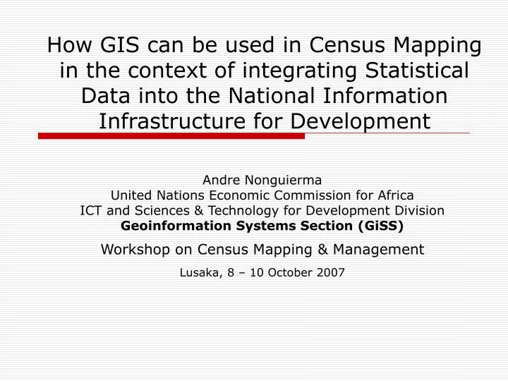
How GIS can be used in Census Mapping in the context of integrating Statistical Data into the National Information Infrastructure for Development. Andre Nonguierma United Nations Economic Commission for Africa ICT and Sciences & Technology for Development Division

E N D
How GIS can be used in Census Mapping in the context of integrating Statistical Data into the National Information Infrastructure for Development Andre Nonguierma United Nations Economic Commission for Africa ICT and Sciences & Technology for Development Division Geoinformation Systems Section (GiSS) Workshop on Census Mapping & Management Lusaka, 8 – 10 October 2007
Outlines • Spatially-enabled Statistics • Issues in Africa • Geospatial Technologies insight • Data we can get and Where • Tools we can we use • Capacity Building • Coordination : SDI • Challenges • Way Forward http://geoinfo.uneca.org
Why spatially-enabled statistics? • Arguing that 80% of all human decisions involve a “where?” question : • Location affects nearly everything we do in life: we choose where to build homes, where to eat, where the nearest hospital is in case of emergency, etc… • Whatever we do, whatever happens, happens somewhere …. http://geoinfo.uneca.org
Why Spatially-enabled statistics? • Because we … • Need to visualize complex social, economic and environmental indicators in their spatial relationships • Need to provide various “what if” planning scenarios results in quantitative measures that allow developers, planners, and community groups to feel greater comfort with the ultimate design decision. http://geoinfo.uneca.org
Why Spatially-enabled statistics? • Because if Information are the sum of our interpretation of data … • We cannot provide relevant information for decision-making without : • Fundamental datasets • (as well as the) Interrelationships between these datasets, • (the) Management of them, • (and the means of) Accessing and Distributing those data http://geoinfo.uneca.org
Typical “Where” Questions in Africa… • In Africa, the major source for statistical data is the National Statistics Offices, which conduct regular censuses, economic and household surveys. • Others data are collected and maintained by specialized technical agencies, such as geological services, environmental protection authorities, national mapping agencies, etc. http://geoinfo.uneca.org
Typical “Where” Questions in Africa.. • Nexus issues in sustainable development and achieving millennium development goals require that all data sets be integrated. • The nature of the issues further requires that they be presented in their spatial context http://geoinfo.uneca.org
d1 d2 d3 d4 d5 d6 d7 ../.. d13 2000 d14 d15 d16 d17 d18 Typical SpatialData Requirement • Where are... Lands : Agriculture and food security • Land cover, soil types, topography, hydrography, rainfall, demographics, infrastructure, Suitability maps, yield statistics, etc Health • Hospitals locations, settlements and demographics, disease vectors, environmental factors distribution, infrastructure, etc. Education • Schools locations, demographics, infrastructure & utilities, etc. Housing • Demographics, infrastructure & utilities, topography, building materials, etc. Water Supply • Hydrography, aquifers & groundwater, topography, etc. Mining & Minerals • Land cover, soil chemistry, topography, rock formations and physical properties, etc. Infrastructure Development • Demographics and settlements, socio-economic establishments, topography, hydrography, soil types, etc Large volume of data -12.106 pixels *18 dekads -12.106 set. How to Synthesize ? How to Analyse ? http://geoinfo.uneca.org
Typical technical requirement: Produce Once, Use Many Times • Geoinformation content requires special field and lab operations to define the location against which data are collected • Operations: Surveying and mapping, photogrammetry, remote sensing, geodesy, etc • Location entities: reference frames, point coordinates, land parcels and administrative units • Different applications need to cross reference data with one another • They refer to the same database entities • No single agency can satisfy its geographic data needs on its own • Data collected for one purpose or project can be used for other purposes and projects http://geoinfo.uneca.org
Typical skill requirement • Where can we get experienced people… http://geoinfo.uneca.org
Typical answers to “Where” questions… • What we have... • High Duplication Potential • Low resources sharing • Lack of coordination 80% common content in spatial data used by three ministries in this avian flu scenario http://geoinfo.uneca.org
Challenges • Imagine if various specialists could concentrate on … • Socio-economic planning • Ground water management • Health and sanitation issues • Land management • Whatever else you do Without worrying about “Where” they are • Imagine further that all the data you have are used to their maximum potential • Contribute to overall economic development • Increase your visibility and prestige http://geoinfo.uneca.org
Justifying Geo-Spatial Data Infrastructures • It is possible … • If potential sources of information are known to everybody – clearinghouse and metadata management • And easily accessible • And even more so if integrated into the structure of society • Like an infrastructure • Therefore, you have to participate in building the infrastructure http://geoinfo.uneca.org
What? Spatial Data Infrastructure • The basis for spatial data discovery, evaluation, and application for users and providers within all levels of government, the commercial sector, the non-profit sector, academia and by citizens in general. • Put in place policies, resources and structures to make available Geospatial information technologies easily accessible to decision makers and the community … • When they need it • Where they need it • In a form they can use it (almost) immediately • Help them make sense of it http://geoinfo.uneca.org
Building Fundamental Datasets http://geoinfo.uneca.org
Building Fundamental Datasets http://geoinfo.uneca.org
Building Fundamental Datasets http://geoinfo.uneca.org
Building Just in Time (JIT) Maps • In the digital environment, maps are produced as and when needed • just in time for the decision to be made • With most current data from databases that are continuously updated http://geoinfo.uneca.org
Building Capacity • Human Resources… • Wide range of skill covered • But… Extreme mobility of Geospatial technology professionals http://geoinfo.uneca.org
Building Capacity • Training and Workshops … • Critical mass of awareness of GIS. • More people understand not only the power, but also the value of integrating GIS data into the workflows of their organizations. http://geoinfo.uneca.org
Building Coordination • Subsidiarity … • Mutually accepted standards … • Common base themes of data • Interoperability and Standards • Using e-technology to help find and share data • Data Access Policy http://geoinfo.uneca.org
Getting there without getting lost Your Role in developing SDI What can you do?
Data access and Sharing • To use data produced by another person/agency, potential users need to know: • That the data resource exists • How the data was produced • When it was produced or last updated • Why it was produced • How to access the data • Any constraints, restrictions or special conditions for access and/or use • Only possible if every data producers describes every data product in a standard, field-based format • This standard description is called metadata data about data • Potential users consult metadata to determine suitability of data for intended use, and access procedure http://geoinfo.uneca.org
Metadata tools http://geoinfo.uneca.org
2. Development 1. Adoption / Adaptation Define Describe Process Spatial Data 3. Implementation 4. Deployment Interoperability and Standard “ Standardization was a process for recognizing and codifying the status quo of technology. Standardization is now beginning to define the requirements and implementation of new technology.”(Olaf Østensen, Chairman of ISO/TC 211) Spatial Data Standards • Information • Technology • Standards • Software Interfaces Industry : E.g. OGC • Spatial Data Standard Data producers & users : E.g. ISO • All levels of Government • Industry • Professional organizations • UN agencies http://geoinfo.uneca.org
GIS Standards Infrastructure http://geoinfo.uneca.org
Paradigm Shift • We need to move…. • From… Statistic as standalone data collection • To… Knowledge generation, sharing and utilisation • Organize data so that information (spatially- enabled) can be produced as and when needed • Just in time data on demand • Empower users to do as much as possible by themselves http://geoinfo.uneca.org
Geo-demographics Physical Relief Topographic Images Political Typical Way Forward : GeoVisualisations • Web-based mapping tools…. • MDG Mapper • http://geoinfo.uneca.org/mdg/ http://geoinfo.uneca.org
Typical Way Forward : Positioning technologies • AFREF Project …. • Common geodetic framework for Africa • A unified geodetic reference frame for Africa to be the fundamental basis for the national and regional three-dimensional reference networks fully consistent and homogeneous with International Reference Frame • A network of Continuous Operation GNSS Reference Stations (CORS) spread all over Africa • You have to build your data based on this National geodetic networks… • http://geoinfo.uneca.org/afref/ http://geoinfo.uneca.org
Typical Vision … • Your vision must be Knowledge generation, sharing and dissemination • Ensure that statistic spatially-enabled data permeates every aspect of society and that they are available to people who need them, when they need them, and in a form that they can use to make decisions with minimal pre-processing • Ensure that generated information is put to the maximum possible uses by publicising their existence and making them easily available to the widest possible audience http://geoinfo.uneca.org
Contacting Us • ICT, Science & Technology for Development Division • Aida Opoku-Mensah, Officer in charge • aopoku-mensah@uneca.org • Geoinformation Systems Section (GiSS) • Dozie Ezigbalike, Chief of section • ezigbalike.uneca@un.org • Andre Nonguierma, GIS Officer • ANonguierma@uneca.org • Paul Belanger, GIS Officer • PBelanger@uneca.org • http://geoinfo.uneca.org/sdiafrica/ http://geoinfo.uneca.org