Download
1 / 1
10 likes | 132 Views
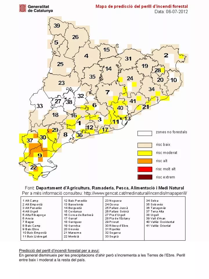
zones no forestals. risc baix. risc moderat. risc alt. risc molt alt. risc extrem. Mapa de predicció del perill d’incendi forestal Data: 06-07-2012. 39. 26. 5. 15. 2. 4. 31. 25. 19. 14. 28. 35. 24. 20. 10. 23. 34. 7. 32. 41. 27. 38. 6. 33. 21. 40. 18. 16.

E N D
zones no forestals risc baix risc moderat risc alt risc molt alt risc extrem Mapa de predicció del perill d’incendi forestal Data: 06-07-2012 39 26 5 15 2 4 31 25 19 14 28 35 24 20 10 23 34 7 32 41 27 38 6 33 21 40 18 16 13 3 11 1 12 17 29 8 36 30 37 9 22 Font: Departament d’Agricultura, Ramaderia, Pesca, Alimentació i Medi Natural Per a més informació consulteu: http://www.gencat.cat/medinatural/incendis/mapaperill/ Predicció del perill d’incendi forestal per a avui: En general disminueix per les precipitacions d’ahir però s’incrementa a les Terres de l’Ebre. Perill entre baix i moderat a la resta del país.