Download
1 / 13
130 likes | 254 Views
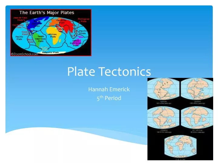
Plate Tectonics. Hannah Emerick 5 th Period. 1. Wegener’s Theory of Continental Drift and the Supercontinent Theory (Continued). a. Continental Drift

E N D
Plate Tectonics Hannah Emerick 5th Period
1. Wegener’s Theory of Continental Drift and the Supercontinent Theory (Continued) • a. Continental Drift • In 1912 Alfred Wegener noticed that the continents were once compressed into a single protocontinent which he called Pangaea, and over time they have drifted apart into their current distribution. He believed that Pangaea was intact until about 300 million years ago, when it began to break up and drift apart. However, Wegener's hypothesis lacked a geological mechanism to explain how the continents could drift across the earth's surface as he proposed. • Evidence includes his newspaper theory, meaning when you rip a newspaper and put it back together, the pieces fit. • His theory was shot down by geologic evidence because he said the continents went through rock on the ocean floor.
b. Supercontinent Theory • Supercontinent cycle- the process of change during which supercontinents develop and later break apart, forming pieces that may merge once again in geologic time to make yet another supercontinent. • Pangea was a supercontinent that existed during the late Paleozoic and early Mesozoic eras, forming about 300 million years ago and began to rift around 200 million years ago, before the component continents were separated into their current configurations. And the single global ocean which surrounded Pangaea is accordingly named Panthalassa. • Accretion- A process where a terrain becomes part of a continent. • Rifting- form fissures, cracks, or breaks, esp. through large-scale faulting; move apart. • Plate tectonics make the continents move, if they move farther from the equator, they tend to have a colder climate as compared to being near the equator with a warmer climate.
2. Theory of Tectonic Plates • Theory of Plate Tectonics • Lithosphere- the solid, outer layer of earth that consists of the crust and the rigid upper part of the mantle. • Asthenosphere–the solid, plastic layer of the mantle beneath the lithosphere; made of mantle rock that flows very slowly, which allows tectonic plates to move on top of it. • Plates move in a pattern called a convection cell that forms when warm material rises, cools, and eventually sink down. As the cooled material sinks down, it is warmed and rises again. • 1. Divergent boundaries – the boundary between tectonic plates that are moving away from each other. • 2. Convergent boundaries – the boundary between tectonic plates that are colliding • 3. Transform boundaries – the boundary between tectonic plates that are sliding past each other horizontally. • Isostasy- The equilibrium that exists between parts of the earth's crust, which behaves as if it consists of blocks floating on the underlying mantle, rising if material (such as an ice cap) is removed and sinking if material is deposited. • Isostaticadjustments- the rise of land masses that were depressed by the huge weight of ice sheets during the last glacial period, through a process known as isostasy. It affects northern Europe (especially Scotland, Fennoscandia and northern Denmark), Siberia, Canada, the Great Lakes of Canada and the United States, the coastal region of the US state of Maine, parts of Patagonia, and Antarctica. • Stress- the amount of force per unit area that acts on a rock.
3. Divergent Boundary • Sea floor spreading • The process by which new oceanic lithosphere (sea floor) forms as magma rises to earth’s surface and solidifies a a mid-ocean ridge. So the land that is forms is the ocean floor and becomes solid at the mid ocean ridge (undersea mountain ranges). The mid-ocean ridge has a valley at its center. • Mid-ocean Ridges - an underwater mountain system that consists of various mountain ranges (the Mid-Atlantic Ridge and the East Pacific Rise are examples of Mid-ocean Ridges). • b. Paleomagnetism • The study of the alignment of magnetic minerals in rock, specifically as it relates to the reversal of earth’s magnetic poles. • Magnetic reversals- A geomagnetic reversal is a change in the orientation of Earth's magnetic field such that the positions of magnetic north and magnetic south become interchanged • Magnetic symmetry – magnetic mirror like image patterns found in the earth (usually on the sea floor) • c. Normal fault • A fault in which the hanging wall moves downward relative to the footwall. Forming cliff like formations like small mountains. • The San Andreas fault in California.
4. Convergent Boundary • a. Subduction Zones • Continental and oceanic crust • Volcanic mountains are formed because each time they collide with each other they are building up. • Oceanic and oceanic crust • Volcanic mountains and trenches are formed because the mountains are built up and long chains of mountains wind up making trenches. • b. Collision Zones • Continental and continental crust • Compression is a type of stress that squeezes and shortens a body. Uplift is when a mountain becomes smaller and lighter, the area may rise by isostatic adjustment. • Himalayan Mountains, the Colorado Plateau, and the Navajo Mountain are examples that are found in collision zones.
Volcanoes • Magma- liquid rock produced under Earth’s surface. • Three conditions under which magma forms: • If the temperature of rock rises above the melting point of the minerals the rock is composed of, the rock will melt. • If enough pressure is removed from the rock, the melting point will decrease and the rock will melt. • The addition of fluids, such as water, may decrease the melting point of some minerals in the rock and cause the rock to melt. • Lava- magma that flows onto Earth’s surface; the rock that forms when lava cools and solidifies. • Volcano- a vent or fissure in Earth’s surface through which magma and gases are expelled. • Common locations would be at tectonic plat boundaries. • The major zone of active volcanoes encircling the Pacific Ocean is called the Ring of Fire. • Pyroclastic material- fragments of rock that form during a volcanic eruption. • Viscosity- the state of being thick, sticky, and semifluid in consistency, due to internal friction. • Magma contents form produce explosive eruptions by pyroclastic materials forming when magma breaks into parts during an eruption because of rapidly expanding gases in the magma.
Types of volcanoes: • Shield • Cinder Cones • Composite Volcanoes • Shield- volcanic cones that are broad at the base and have gently sloping sides. An example would be the Hawaiian Islands. • Cinder cones- a type of volcano that has very steep slopes. An example would be Lava Butte, Oregon. • Composite volcanoes- made of alternating layers of hardened lava flows and pyroclastic material. An example would be Mount Rainier, Washington. • Caldera- a large, circular depression that forms when the magma chamber below a volcano partially empties and causes the ground above to sink. An example would be Yellowstone National Park, Wyoming. Hawaiian Islands Lava Butte, OR Mount Rainier, WA Yellowstone, WY
5. Transform Boundary • Reverse faults- a geological fault in which the upper side appears to have been pushed upward by compression. • Strike- slip faults-a geological fault in which one of the adjacent surfaces appears to have moved horizontally. • Tension- a stress that stretches and pulls a body apart. • Sheer stress- distorts a body by pushing parts of the body in opposite directions. • The Death Valley in California is a good example of a fault block mountain and a graben.
5. Transform Boundary (Continued) • Earthquakes • Elastic rebound- an explanation for how energy is spread during earthquakes. As plates on opposite sides of a fault are subjected to force and shift, they accumulate energy and slowly deform until their internal strength is exceeded. • Seismology- the branch of science concerned with earthquakes and related phenomena. • Seismograph- an instrument that measures and records details of earthquakes, such as force and duration. • Focus- the point of origin of an earthquake. • Epicenter- the point on the earth's surface vertically above the focus of an earthquake.
Seismic Waves- an elastic wave in the earth produced by an earthquake or other means. • Body waves-travel through the interior of the Earth. They follow curved paths because of the varying density and composition of the Earth's interior. This effect is similar to the refraction of light waves. • P waves- P-waves are type of elastic wave, also called seismic waves, that can travel through gases (as sound waves), solids and liquids, including the Earth. P-waves are produced by earthquakes and recorded by seismometers. • S waves- A type of seismic wave, the S-wave, secondary wave, or shear wave (sometimes called an elastic S-wave) is one of the two main types of elastic body waves, so named because they move through the body of an object, unlike surface waves. • Surface waves- Seismic waves that travel along the surface of the Earth. • Seismic waves led to determination of Earth’s interior by some waves being able to pass through dense parts of Earth’s interior while others cannot.
An example of an earthquake not resulting from movement along a plate boundary would be when an earthquake occurred in the U.S. near New Madrid, Missouri in 1811-1812. The waves were so strong that it even caused damage in South Carolina. • Magnitude- a measure of strength of an earthquake. • Intensity- the amount of damage caused by an earthquake. • Mercalli Scale- A twelve-point scale for expressing the local intensity of an earthquake. • Tsunami- an underwater earthquake. An example would be the tsunami on December 26, 2004, one occurred in the Indian Ocean. It devastated coastal areas of Indonesia, India, Sri Lanka, and Thailand, leaving more than 200,000 dead/missing. Tsunami
6. Other Related Landforms • Dome Mountains • Black Hills of South Dakota and Stone Mountain. • b. Hot spots • The main Hawaiian Island