Download
1 / 2
20 likes | 23 Views
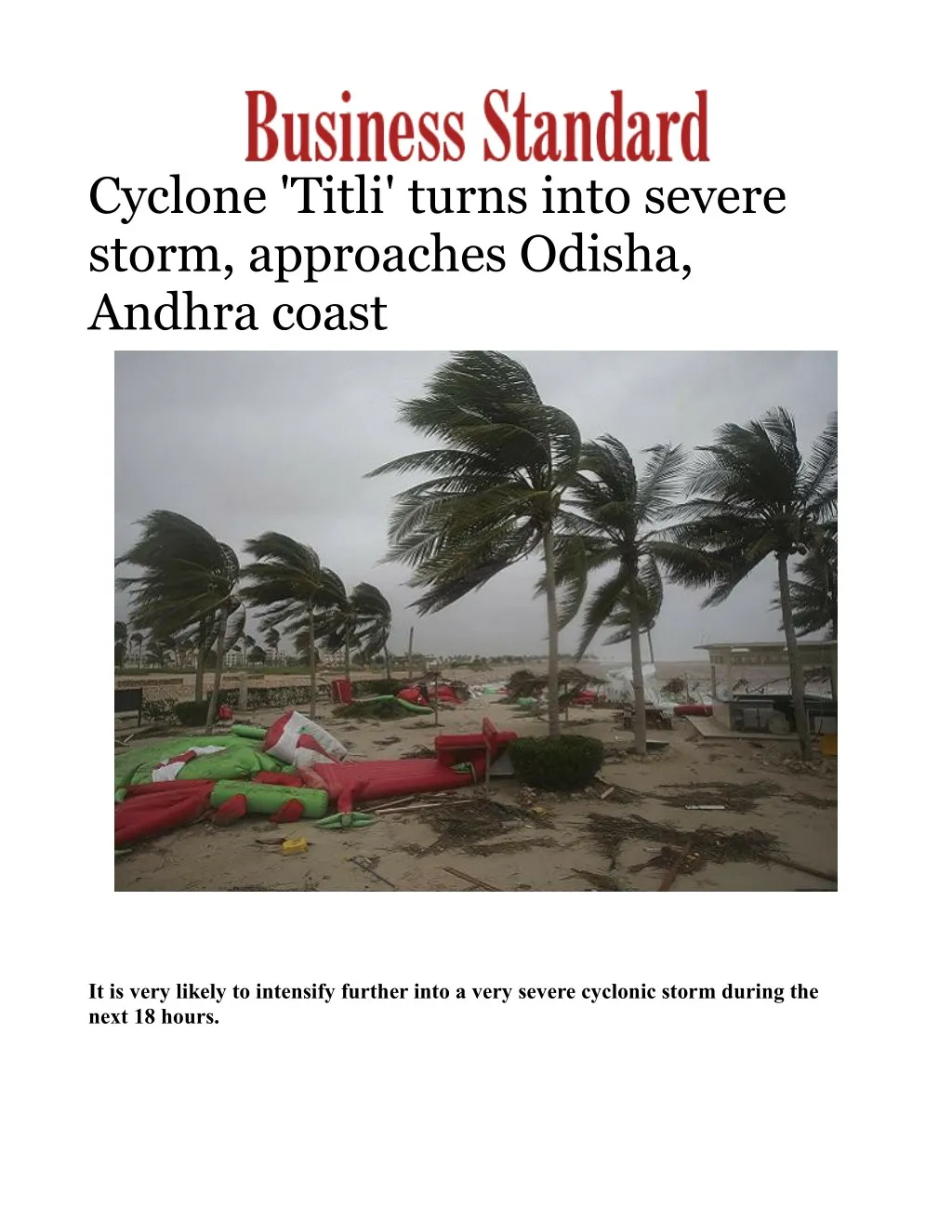
Cyclone 'Titli' turns into severe storm, approaches Odisha, Andhra coast on Business Standard. It is very likely to intensify further into a very severe cyclonic storm during the next 18 hours <br>

E N D
Cyclone 'Titli' turns into severe storm, approaches Odisha, Andhra coast It is very likely to intensify further into a very severe cyclonic storm during the next 18 hours.
Cyclone 'Titli' over the Bay of Bengal intensified into a severe cyclonic storm Wednesday and is moving towards the Odisha-Andhra Pradesh coast, triggering rainfall in several parts of Odisha, the India Meteorological Department (IMD) said. The cyclonic storm is likely to make a landfall between Gopalpur in Odisha and Kalingapatanam in Andhra Pradesh early Thursday morning at a wind speed of 145 kmph, it said.( Business Standard ) "Titli moved with a speed of about 10 kmph and intensified into a severe cyclonic storm and lay centred over the west-central Bay of Bengal, about 370 km south-southeast of Gopalpur in Odisha," the IMD said in a bulletin. It is very likely to intensify further into a very severe cyclonic storm during the next 18 hours. The storm is likely to move north-northwestwards and cross Odisha and adjoining north Andhra Pradesh coast between Gopalpur and Kalingapatnam around Thursday morning, it said. Thereafter, it is likely to re-curve northeastward, move towards Gangetic West Bengal across Odisha and weaken gradually, Director of the Meteorological Centre in Bhubaneswar, H R Biswas told PTI. While some areas in coastal Odisha recorded rainfall Wednesday, the IMD has forecast "heavy to very heavy rainfall" at several places and "extremely heavy rainfall" at isolated areas till Thursday under the impact of the severe cyclonic storm. The districts like Ganjam, Gajapati, Puri, Jagatsinghpur, Kendrapara, Khurda, Nayagarh, Cuttack, Jajpur, Bhadrak and Balasore are expected to receive heavy to very heavy rainfall till Thursday, the IMD said. It also forecast heavy to very heavy rainfall for Kandhamal, Boudh and Dhenkanal district from Thursday. The IMD said rainfall would be accompanied by gale wind speed reaching 60-70 kmph and gusting to 80 kmph along and off Odisha and north Andhra Pradesh coasts. The wind speed will gradually increase to 120-130 kmph and gusting to 145 kmph from Wednesday night along and off south Odisha coast and 70-80 kmph gusting to 95 kmph along and off north the Odisha coast, the IMD bulletin said. The sea condition is very high over the west-central Bay of Bengal. It is very likely to be phenomenal over the west-central and the adjoining north Bay of Bengal and along and off the south Odisha coast till Thursday, it said. Storm surge of a height of about 1 metre above astronomical tide is very likely to inundate low lying areas of Ganjam, Khurda and Puri districts, it said. The IMD advised total suspension of fishing operations and shifting of coastal hutment dwellers to safe places. Fishermen along the Odisha coast, and central and north Bay of Bengal were advised not to venture into sea till Friday.