Download
1 / 21
210 likes | 215 Views
This presentation introduces the five themes of geography and their importance in understanding the world. It covers the themes of location, regions, physical geography, human systems, and human-environment interaction. The presentation also discusses various map projections and their uses.

E N D
The Five Themes of GeographyA Framework for Studying the World North Carolina Geographic Alliance PowerPoint Presentations 2007
Essential Question What are the 5 themes of Geography and why do we use various map projections?
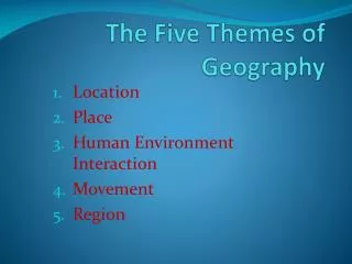
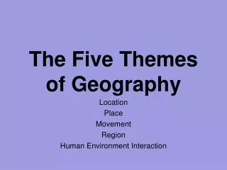
Theme 1: Location Two Types of Location • Absolute • Relative • Where is It? • Why is It There?
Absolute Location • A specific place on the Earth’s surface • Uses a grid system • Latitude and longitude • A global address
Oklahoma Absolute Location • Oklahoma City 35° N Latitude 97° W longitude
Relative Location • Where a place is in relation to another place • Uses directional words to describe • Cardinal and intermediate directions
Oklahoma • Oklahoma is bordered by Kansas and Colorado on the north, Texas on the south, New Mexico and Texas on the west, and Arkansas and Missouri on the east. • Oklahoma is one of the Southwestern States
Theme 2: Regions Regions = places united by specific characteristics Formal Regions = a region defined by a common characteristic.Ex. The Corn Belt Functional Regions = a central point and the surrounding territories linked to it.Ex. Houston Perceptual Regions = a region defined by popular feelings and images rather than by objective data Ex. The Deep South Cultural Regions = a region defined many factors such as government, social groups, economic systems, language, or religion Ex. The Middle East
Theme 3: Physical GeographyPhysical Land Characteristics • Land Features • Mountains, plains, and plateaus • Climate • Bodies of Water • Ecosystem
Physical Characteristics Photos above: Steve Pierce http://www.wetmaap.org/Cape_Hatteras/ch_tm_2.html
Theme 4: Human Systems • People • Culture • Language • Religion • Buildings and Landmarks • Cities • Movement
Movement The Mobility of • People • Goods • Ideas How Places are linked to one another and the world
Movement http://www.marad.dot.gov/Gallery/MoreheadCity/pages/Ming%20Europe.htm http://www.evertize.com/land/images/I-40-64%20interchange.JPG
Theme 5: Human- Environment Interaction How People Interact With Their Environment People . . . • Adapt to Their Environment • Modify Their Environment • Depend on Their Environment http://www.fotosearch.com/comp/corbis/DGT119/BAG0017.jpg
Human Environment Interaction http://aam.wcu.edu/grant/images/Fontana%20Dam%20Shirley.jpg http://www.dukemagazine.duke.edu/dukemag/issues/091002/images/mallc.jpg http://www.ee.duke.edu/~sag8/Duke/02-03/PiKA/Fall%20Break/Fall_Break_02.htm
From Globes to Maps 4 From Globes to Maps: To create maps, cartographers project the round earth onto a flat surface–making a map projection. There are more than a hundred kinds of map projections, some with general names and some named for the cartographers who developed them. The basic categories of map projections are shown here: planar, cylindrical,Conic, and Mercator.
From Globes to Maps 6 Cylindrical Projection A cylindrical projection is based on the projection of the globe onto a cylinder. This projection is most accurate near the Equator, but shapes and distances are distorted near the Poles.
From Globes to Maps 7 Conic Projection A conic projection comes from placing a cone over part of a globe. Conic projections are best suited for showing limited east–west areas that are not too far from the Equator. For these uses, a conic projection can indicate distances and directions fairly accurately.
Robinson Projection The Robinson projection has minor distortions. The sizes and shapes near the eastern and western edges of the map are accurate, and the outlines of the continents appear much as they do on the globe. However, the shapes of the polar areas appear somewhat distorted. Common Map Projections 3
Mercator Projection The Mercator projection, once the most commonly used projection, increasingly distorts size and distance as it moves away from the Equator. This makes areas such as Greenland and Antarctica look much larger than they would appear on a globe. However, Mercator projections do accurately show true directions and the shapes of landmasses, making these maps useful for sea travel. Common Map Projections 5