Download
1 / 109
1.09k likes | 1.19k Views
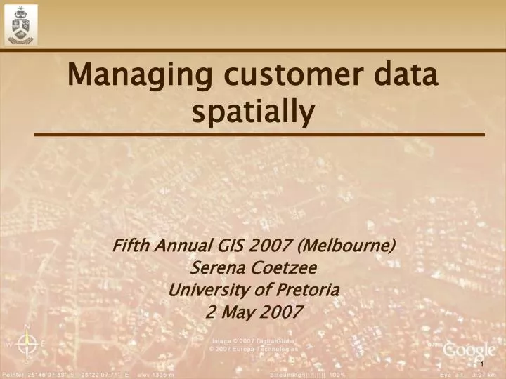
Managing customer data spatially. Fifth Annual GIS 2007 (Melbourne) Serena Coetzee University of Pretoria 2 May 2007. South Africa & Tshwane. Afrikaans, English IsiZulu IsiXhosa SiSwati Ndebele Southern Sotho Northern Sotho Tsonga SeTswana Venda Pretoria (executive)

E N D
Managing customer data spatially Fifth Annual GIS 2007 (Melbourne) Serena Coetzee University of Pretoria 2 May 2007
South Africa & Tshwane Afrikaans, English IsiZulu IsiXhosa SiSwati Ndebele Southern Sotho Northern Sotho Tsonga SeTswana Venda Pretoria (executive) Bloemfontein (judicial) Cape Town (legislative)
South Africa • 45 million people • 9 provinces • 262 municipalities • 6 metropolitan municipalities • 7 million land parcels • 6,3 million in (formal) urban areas • 40% in Gauteng • 25% in the Western Cape • 16% in Kwa-Zulu Natal • 500,000 sectional title properties • Largest address database: 3.5 million
University of Pretoria (Tukkies) • 1906 Transvaal University College • University of Pretoria • 38 000 residential students • 28 000 undergraduates • 10 000 post-graduates • 47% male, 53% female • 2 000 international students from 60 countries • Faculties • Economics & Management Sciences • Humanities • Health Sciences • Engineering, the Built Environment & Information Technology • Natural & Agricultural Sciences • Education • Law • Theology • Veterinary Sciences
History and Research Interests ReGIS, Autodesk World Spatial Datasets, PropertySPI GI Standards NAD on the grid Can we establish a virtual NAD for South Africa in the form of a data grid? + + =
Overview Managing customer data spatially • Why manage customer data spatially? • Spatially enabling customer data • Planning • Spatial Information Strategy • Customer address data model • Master address database • Implementation • Integrate the address data model • Transform customers into spatial customers • Coping with uncertainty • Operation • The address data life cycle • Using spatial customer data
Managing customer data spatially • Why manage customer data spatially? • Spatially enabling customer data • Planning • Spatial Information Strategy • Customer address data model • Master address database • Implementation • Integrate the address data model • Transform customers into spatial customers • Coping with uncertainty • Operation • The address data life cycle • Using spatial customer data
Why manage customer data spatially? The Future of I.T.: What's on Tap for 2007 and Beyond • Customer Service Surges as a Top Priority for 2007 • Business Intelligence Tops the Strategic Technology List Source: www.cioinsight.com 1 2
Why manage customer data spatially? The 30 Most Important IT Trends for 2007 Technology • The move to a new architecture marches on • Enterprise applications start losing their luster • Data quality demands attention • IT reluctantly embraces Web 2.0 • IT innovation loses traction • Business process management services and software will frustrate users • For business intelligence, the best is yet to come • IT organizations start going green Source: www.cioinsight.com 1 2 3 4 5 6 7 8
Why manage customer data spatially? “More than 25% of critical data used in large corporations is flawed due to human data-entry error, customer profile changes (e.g. change of address), poor processes and a lack of proper corporate data standards.” The result: soiled statistics, faulty forecasting and sagging sales Source: Gartner Research quoted on www.cioinsight.com
Why manage customer data spatially? “Through 2007, more than 50% of data-warehousing projects will experience limited acceptance, if not outright failure, because they will not proactively address data-quality issues.” Source: Gartner Research quoted on www.cioinsight.com
Why manage customer data spatially? Source: www.gwsae.org
Why manage customer data spatially? The insurance industry is ready for the corporate wide proliferation of geographic information systems as insurers rely on data that has a geographic component to determine accurate underwriting, risk analysis and claims management. Employ Geographic Information Systems to Manage Risk for Property and Casualty Insurers, 11 October 2006, Stephen Forte Source: www.gartner.com
Why manage customer data spatially? • Data quality • Address verification • Return to sender improvements • Business intelligence for improved customer service • Routing and deliveries • Geo-marketing • Outlet planning • Demarcation (sales areas, etc.)
Managing customer data spatially • Why manage customer data spatially? • Spatially enabling customer data • Planning • Spatial Information Strategy • Customer address data model • Master address database • Implementation • Integrate the address data model • Transform customers into spatial customers • Coping with uncertainty • Operation • The address data life cycle • Using spatial customer data
Planning Challenges • Buy-in on executive level • Continuous long term process • Customer’s perception of what his/her address should be
Planning One of our strongest weapons is dialogue. Nelson Mandela
Planning • Understand and articulate the benefits of spatial customer data • Convince non-technical executives about the benefits of spatial address data • Associate the benefits to an identified risk or business event Ready to start… 1 2 3
Planning Spatial Information Strategy People Software Contracts Business data Process $$ $$ Spatial reference data Reference Data Infrastructure (hardware & networks)
Planning Address Structuring & Cleaning Source: Watson Remembering the past (databases and data warehouse) Spatial Analysis Transactions Data People & technology Handling the present (TPS) Preparing for the future (BI, data mining, DSS, EIS, MIS, OLAP) Address capturing, for delivery New business systems
Planning Source: DM Functional Framework by DAMA Data Management Functions
Planning • Who is responsible for customer address? • Information (CIO) • Analytics (GIS) • Development (IT) • Business (CRM) • Decide why you need spatial customer data • Design the address data model
Planning Purpose: Address Verification 101 Koljander Avenue Newlands Pretoria Gauteng 28.273632 -25.792344
Planning Purpose: Deliveries
Planning Purpose: Customer profiling 101 Koljander Avenue Newlands Pretoria Gauteng 45 Nutmeg Avenue Newlands Pretoria Gauteng 28.270885 -25.790764
Managing customer data spatially • Why manage customer data spatially? • Spatially enabling customer data • Planning • Spatial Information Strategy • Customer address data model • Master address database • Implementation • Integrate the address data model • Transform customers into spatial customers • Coping with uncertainty • Operation • The address data life cycle • Using spatial customer data
Cow of many - well milked and badly fed Spanish proverb
Planning: Address data models Geographic Information – Address standard SANS1883 Address = StreetAddress | BuildingAddress | IntersectionAddress | … StreetAddress = StreetAddressPart, Locality StreetAddressPart = [CompleteStreetNumber | StreetNumberRange], CompleteStreetName Locality = PlaceName, [TownName], [MunicipalityName], [Province], [SAPOPostcode], [Country] | [CountryCode]
Planning: Address data models Geographic Information – Rural and urban addressing AS/NZS 4819:2003 An urban address includes, in order, the following: • Sub-dwelling (flat/unit) number or identifier • Level number of sub-dwelling • Private road name (if applicable) • Utility name (if applicable) • Address site name (if applicable) • Single urban address number or urban address number range • Road name • Locality • State/territory • Postcode (optional) • Country
Planning: Address data models Organization for the Advancement of Structured Information Standards (OASIS) • www.oasis-open.org • Members • Over 5,000 Members from 100+ countries of OASIS • Software vendors, industry organizations, governments, universities and research centers, individuals • Co-operation with other standards bodies • Best known for web services, e-business, security and document format standards • Open and royalty-free standards
Planning: Address data models OASIS Customer Quality Information TC • http://www.oasis-open.org/committees/ciq • Chairman: Ram Kumar, Mastersoft, Australia • XML Specifications • for defining, representing, interoperating and managing party information • name, address, party specific information including party relationships • open, vendor neutral, industry and application independent, • "Global" (international) • Extensible Address Language (xAL) to define a party’s address(es)
Planning: Address data models xNAL (xNL + xAL) Model
Planning: Address data models xAL Model
Planning: Address data models • Customer’s perception and preferences • 14 Castle Pine Crescent (English) • 14 Castle Pine Singel (Afrikaans) • 477 Chopin Street, Glenstantia (Post Office) • 477 Chopin Street, Constantia Park (Surveyed) • 17 Glenvista Street, Woodhill (colloquial) • 17 Glenvista Street (erf 672), Pretoriuspark Ext 8 (registered at the deeds office)
Managing customer data spatially • Why manage customer data spatially? • Spatially enabling customer data • Planning • Spatial Information Strategy • Customer address data model • Master address database • Implementation • Integrate the address data model • Transform customers into spatial customers • Coping with uncertainty • Operation • The address data life cycle • Using spatial customer data
Planning: Master address database • Source: official vs unofficial • Maintenance cycle • Coverage • Data model • Level of detail • Address • Address Range • Street • Suburb • Postcode and/or post office • Region • Country
Planning: Master address database Cadastral Addresses • Based on cadastral boundaries • Street numbers sourced from relevant official bodies • Link street address to property information • owner, price, bond information, etc. • Accommodates for anomalies (panhandle, skip numbers) • Address verification, routing, deliveries, customer profiles 12B 2 4 8 10 16 12A GORDON STREET
Planning: Master address database Address Range • Street numbers surveyed at street corners • Street numbers evenly allocated in between • Includes street numbers that do not exist • Cannot link the street address to property information • Routing, deliveries, customer profiles • Not good enough for address verification 2 4 6 8 10 12 14 16 2 16 GORDON STREET GORDON STREET
Planning: Master address database Suburb or Region
Planning: Master address database Postcode and/or post office
Planning: Master address database • Mapping to customer address data model • Plan for the future • Master address database independent • Increasing levels of detail • Accessibility by all departments • Tools • Knowledge Management • What address information is available? • How do I access the address information? • What can I do with the address information? • What tools are available? • How is the address captured?
Managing customer data spatially • Why manage customer data spatially? • Spatially enabling customer data • Planning • Spatial Information Strategy • Customer address data model • Master address database • Implementation • Integrate the address data model • Transform customers into spatial customers • Coping with uncertainty • Operation • The address data life cycle • Using spatial customer data
Implementation: Integrate data model • Address is not an attribute of the customer! • Link an address entity/object to the customer
Implementation: Integrate data model Source: GINIE project
It is a capital mistake to theorize before one has data. Sir Arthur Conan Doyle, “A Scandal in Bohemia”, The Adventures of Sherlock Holmens 1891
Managing customer data spatially • Why manage customer data spatially? • Spatially enabling customer data • Planning • Spatial Information Strategy • Customer address data model • Master address database • Implementation • Integrate the address data model • Transform customers into spatial customers • Coping with uncertainty • Operation • The address data life cycle • Using spatial customer data