Download
1 / 44
440 likes | 567 Views
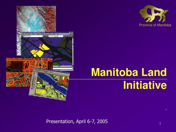
Province of Manitoba. Manitoba Land Initiative. Presentation, April 6-7, 2005. This presentation will include a brief history of the development of the Manitoba Land Initiative and include a policy perspective for the sharing of data and:

E N D
Province of Manitoba Manitoba Land Initiative . Presentation, April 6-7, 2005
This presentation will include a brief history of the development of the Manitoba Land Initiative and include a policy perspective for the sharing of data and: Give some insight into the internal operations of the warehouse site with an emphasis on data related to Southern Manitoba. Introduction
The (MLI) • Health, • Finance - LTO, • Intergovernmental Affairs, • Land Management Services, • Conservation/Water Stewardship, • Energy, Science and Technology. • Agriculture, Food & Rural Initiatives, • Transportation and Government Services, • Industry, Economic Development and Mines • What is the MLI : • A Co-operative Provincial Government Initiative for the development of a digital on-line process to house, display and distribute Provincial geospatial data.
History There was a need for Manitoba to: • investigate a method for housing its own geospatial information (1999-2000). • collectively think about many department’s geospatial data products as a single corporate asset. • develop mechanisms for the collection, storage and dissemination of its data products. • create a interdepartmental structure for developing processes for a Manitoba data sharing and delivery service.
DATABASE … controlled electronic exchange of land related information, regardless of location, technology, and managing organization... Conservation / Water Stewardship MB Government Intranet Manitoba Land Initiative Core Data topology cadastral orthophotos land use transportation …….. Metadata catalogue Land related knowledge - best practices - departmental projects - experts Different applica- tions Transportation Intergov.Affairs IT&M
Internal and External Use INTRANET Provincial Use WAREHOUSE Manitoba Land Initiative Core Data topology cadastral orthography land use transportation …….. Metadata catalogue Land related knowledge - best practices - departmental projects - experts INTERNET Public Access - Distribution requirements - User/license/disclaimer agreement
MLI delivery understanding: • All data is a corporate asset and its ownership never changes. • Data contributors can advance their core geospatial datasets into the system at any time. • Data contributors determine what datasets they release to the system.
Results of the process are: • A cross departmental, cross functional relationship for digital data sharing. • A corporate partnership of departments was formalized and a provincial working group was established. • Data sharing, data integration and standards development between departments for geospatial data products. • A provincial mandate for the MLI process was instituted that provides for the development and provincial framework for the management of lands related information.
MLI Achievements The process has: • Raised the profile of land related systems • Integrated on-line access to land data • Improved our data currency processes • Provided a process for electronic transactions internally and externally • Provided smaller departments with equal access to data • Provided internal and external user time and cost savings
The Warehouse Site MLI - Core Maps Download Collections: Admin. BoundariesBase MapsCadastralDigital Elevation ModelsDigital ImageryEnvironmentForest InventoryGeographical NamesGeology MappingLand Use/Cover MapsMunicipal MapsProv. Highways & PTHsQuarter Section GridsSoil ClassificationTopographic MapsTown & Village PlansWater Related Maps Comments
Summary • Future program development is advancing the MLI’s technical capabilities • Data continues to flow into the warehouse at an increased rate (approximately 80 Gb) • Human resource commitments continue by all user groups. As of March 1, 2005 there are 5600 registered users.
Some Future Activities • Striving to achieve a more seamless mapping and mapping framework. • Continue to accept geospatially related data sets • Investigate partnership relationships with other data products (NFIS), Intergraphand others.
MLI Data Warehouse: Overview http://mli.gov.mb.ca
MLI - GIS data types • Line work used for topographic maps • Networks - highways, power grids, rivers and streams • Points for site locations, addresses • Polygons for Cadastral, Property mapping • Raster for Ortho photos, Remote sensing • Referential - overview maps, metadata
Metadata management Spatial Metadata Management System (SMMS) is being implemented with the assistance of Geoconnections.
Web Map Publisher A pilot project is currently being completed with Intergraph , to evaluate and possibly implement this Web Map product as the next generation data access tool.
In conclusion • The Manitoba Land Initiative (MLI) is a active and on-going program for the effective collection, storage and dispensing of digital geospatial data across the Manitoba government and to the public. • The site: http://mli.gov.mb.ca • Thank you!