Download
1 / 20
210 likes | 237 Views
GIS Lecture: Projections. Outline. Map Projections Coordinate Systems. Map Projections. Map Projections and Distortion. Mathematical transformation that behaves as if it were projecting features of the world onto one of three surfaces: a plane, cone, or cylinder.

E N D
Outline • Map Projections • Coordinate Systems
Map Projections and Distortion • Mathematical transformation that behaves as if it were projecting features of the world onto one of three surfaces: a plane, cone, or cylinder
When Projection Is Important • Measurements used to make important decisions • Comparing shapes, areas, distances, or directions of map features • Feature and image themes are aligned New York New York Los Angeles Los Angeles Projection: MercatorDistance: 3,124.67 miles Projection: Albers Equal AreaDistance: 2,455.03 miles Actual distance: 2,451 miles
When Projection Is Not Important • Business applications • Not of critical importance • Concerned with the relative location of different features • On large scale maps - street maps • Distortion may be negligible • Map covers only a small part of the Earth's surface.
Projection vs. Coordinate System • Projection = the method used for flattening the paper on the spherical earth • Coordinate System = • the method for referencing specific locations • - on a sphere (Geographic Coordinates) - on that flattened paper (Rectangular Coord)
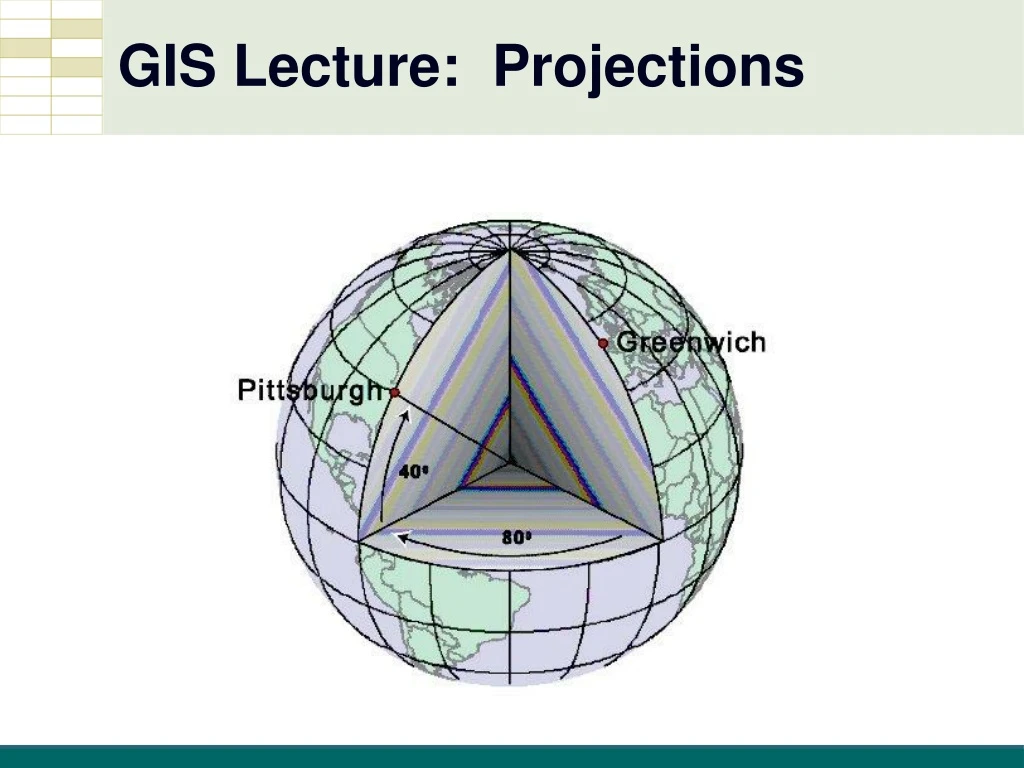
Geographic Coordinates • Geographic Coordinate System (GCS) • Spherical coordinates • “Un-Projected” • Angles of rotation of a radius anchored at earth’s center • Latitude and Longitude
Latitude and Longitude • Longitude (Meridians) • Latitude (Parallels)
Latitude and Longitude • Longitude (prime meridian) 0 • Latitude (equator) 0
Latitude and Longitude • Coordinates Pittsburgh, PA USA 40°26’2”N latitude -80°0’58”W longitude 40 -80
Rectangular Coordinates • Used for locating an intersection on a flat sheet of paper • Cartesian Coordinates (X,Y) Y X<0 Y>0 X>0 Y>0 (0,0) X X<0 Y<0 X>0 Y<0
State Plane Coordinates • Used by local US Governments • All positive coordinates in feet
State Plane Coordinates • Zones • 125 zones, following state and county boundaries • At least one for each state
Universal Transverse Mercator (UTM) • Coordinate system used by U.S. Military • Covers entire world • Metric coordinates
Summary • Map Projections • Coordinate Systems