Download
1 / 51
560 likes | 866 Views
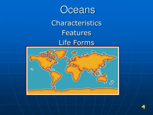
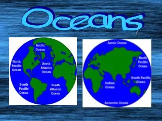
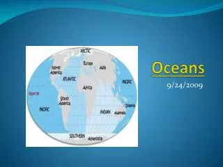
Oceans. What do you know about the oceans?. Arctic Ocean. Baltic Sea. Persian Gulf. Bay of Fundy. Atlantic Ocean. Pacific Ocean. Indian Ocean. Antarctic Ocean. Oceans cover 2/3 of the Earth’s surface. Fig. 16.1, p.400.

E N D
Arctic Ocean Baltic Sea Persian Gulf Bay of Fundy Atlantic Ocean Pacific Ocean Indian Ocean Antarctic Ocean Oceans cover 2/3 of the Earth’s surface. Fig. 16.1, p.400
Topography more varied with larger elevation changes than on the Earth’s surface. 15CO, p.374
Mid-oceanic ridges Trenches Island arcs Hot spots
Highest mountain Mt. Everest 8848 meters Average elevation of continents 840 meters Sea level Average depth of oceans – 3800 meters Floor of central oceans about – 5000 meters Deepest ocean trench Mariana trench – 11,000 meters Millions of square kilometers Percent of Area Fig. 15.3, p.377
How is the bathymetry determined? Sonar: measuring the time sound waves take to return to ship • Known facts: • travel time to bottom and back • Speed of sound in sea water The distance is determined by plugging these values into a simple formula
Satellite altimetry • Dips and bumps are due to variations in gravitational force • Sea surface copies the ocean floor surface • Differences are measured using the time radar signals take to travel through the atmosphere, hit the ocean’s surface, bounce back, and travel back to the satellite
Geosat satellite • Launched in 1985 • Orbits the Earth in about 14 hours • The Earth rotates • Satellite map of the Earth’s topography, 1.5 years For every increase of 1000 meters on the seafloor, there is 1 meter increase in height of water.
Continental margins: where land meets the sea Atlantic Ocean: plate boundary is in the center of the ocean basin, away from the continental margin
Variations in temperature: From north to south due to the Sun’s radiation
Changes in the Sun’s angle cause variations in the amount of solar energy reaching Earth’s surface.
Temperature: warmer at equator cooler near the poles Surface temperature variations
Temperature variations within ocean basins: sketch and describe Ocean basins
Salinity of Seawater • Water is bipolar • The cation sodium attaches to the negative side • The anion chlorine attaches to the positive side • The figure illustrates dissolved salt
Source of salts? Chemical weathering of rocks (dissolved load) Volcanic activity: outgassing
Do you think salinity varies within ocean basins or is the same? On the surface? Within the basin?
Precipitation and Evaporation Red-precipitation Blue-evaporation
Density: how heavy something is relative to its size • What factors change the density of sea water? Temperature: increase, decreases density Salinity: increase, increases density
Diatom-phytoplankton Plankton: microscopic animals and plants • bottom of the food chain • Use basic nutrients from sea water to produce skeletons and soft tissue • phytoplankton produce greater than 50% Zooplankton Copepod-1mm Dinoflagellate- 250 microm.
The Gulf Stream Benjamin Franklin described in 1770 Much more complex
On the surface Fig. 16.12, p.406
Upwelling Orange and yellow are areas of high chlorophyll concentrations Phytoplankton?
Wind driven Wind blows water away from shore Cold nutrient-rich water is “pulled” to the surface Upwelling
Nutrients are produced by bacterial decay of material Phosphates, nitrates, carbonates Provide nutrients for plankton (base of the food chain) Upwelling: bottom waters are nutrient rich
Supplies basic nutrients for single-celled organisms Diatoms (plants) Offshore Ireland Upwelling: significance Red: highest concentration
Gravitational force of the moon causes the oceans to bulge • Periodic rise and fall of large bodies of water • The Earth turns on its axis, taking the moon about 25 hours to make one obit in our sky • Two tidal peaks and troughs
Tides Fluctuations due to the interaction of the sun, moon and Earth Centrifugal force of the Earth helps cause tides Nova Scotia’s Bay of Funday
Spring Tides • Full or new moon • Sun and moon are aligned • Strongest
Neap Tides • Occur during quarter moons • The position of the sun and moon are at right angles • Gravitational pull cancels • Small increase or decrease of water level
Why is the ocean blue? • Intensity of water at different depths • Absorptions is greater for longer wave lengths-red • Ocean is blue • Most of the light is absorbed in the few meters of water