Download
1 / 41
410 likes | 433 Views
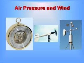
Air Pressure and Wind. Atmospheric pressure. Force exerted by the weight of the air above Decreases with increasing altitude Units of measurement Millibar (mb) – standard sea level pressure is 1013.2 mb Inches of mercury – standard sea level pressure is 29.92 inches of mercury. Wind.

E N D
Atmospheric pressure • Force exerted by the weight of the air above • Decreases with increasing altitude • Units of measurement • Millibar (mb) – standard sea level pressure is 1013.2 mb • Inches of mercury – standard sea level pressure is 29.92 inches of mercury
Wind • Horizontal movement of air • Out of areas of high pressure • Into areas of low pressure • Controls of wind • Pressure gradient force • Isobars – lines of equal air pressure • Pressure gradient – pressure change over distance
Wind • Controls of wind • Coriolis effect • Friction
Wind • Upper air winds • Generally blow parallel to isobars – called geostrophic winds • Jet stream • "River" of air • High altitude • High velocity (120-240) kilometers per hour
Low Pressure Zone Formation Warm air rises Creates a low pressure zone At the Earth’s surface, air “feeds” the low pressure zone, moves counterclockwise High Pressure Zone Formation Cool air sinks Creates a high pressure zone At the Earth’s surface, winds blow clockwise Rotating Air Bodies
Rotating Air Bodies • Bends in the polar jet create troughs and ridges • Forms cyclones and anticyclones
Rotating Air Bodies • Cyclones • Low pressure zone in polar jet trough • Winds at surface flow counterclockwise towards the core • Air is updrafted and cooled • Forms clouds, rain and upper level outflow of air
Rotating Air Bodies • Anticyclones • High pressure zone at ridge of polar jet • Air converges in upper atmosphere • Descends towards the ground • Flows outward at surface • Dry, windy conditions
General atmospheric circulation • Idealized global circulation • Equatorial low pressure zone • Rising air • Abundant precipitation
General atmospheric circulation • Idealized global circulation • Subtropical high pressure zone • Subsiding, stable, dry air • Location of great deserts • Air traveling equatorward from the subtropical high produces the trade winds • Air traveling poleward from the subtropical high produces the westerly winds
General atmospheric circulation • Idealized global circulation • Subpolar low pressure zone • Warm and cool winds interact • Polar front – an area of storms
General atmospheric circulation • Idealized global circulation • Polar high pressure zone • Cold, subsiding air • Air spreads equatorward and produces polar easterly winds • Polar easterlies collide with the westerlies along the polar front
General atmospheric circulation • Influence of continents • Seasonal temperature differences disrupt the • Global pressure patterns • Global wind patterns • Influence is most obvious in the Northern Hemisphere
General atmospheric circulation • Influence of continents • Monsoon • Seasonal change in wind direction • Occur over continents • During warm months • Air flows onto land • Warm, moist air from the ocean • Winter months • Air flows off the land • Dry, continental air
Local winds • Produced from temperature differences • Small scale winds • Types • Land and sea breezes • Mountain and valley breezes • Chinook and Santa Ana winds
Wind measurement • Two basic measurements • Direction • Winds are labeled from where they originate • Direction indicated by either • Compass points (N, NE, etc.) • Scale of 0º to 360º • Prevailing wind comes more often from one direction • Speed • often measured with a cup anemometer
Wind measurement • Changes in wind direction • Associated with locations of • Cyclones • Anticyclones • Often bring changes in • Temperature • Moisture conditions
Normal conditions in the tropical Pacific Ocean • Surface winds move from east to west • From high pressure in S. America to low pressure in Australia • Drags water westward • Warm water pools in the western Pacific
Every 3 – 8 years, system reverses • Called the Southern Oscillation • Trade winds weaken or reverse • Warm water migrates from Australia to S. America • Arrives in time for Christmas – Corriente del Niño
What is El Niño? • Basically, it's a giant puddle (or pod) of heated water that sloshes across the Pacific Ocean • Similar to an iceberg • Bulge on the surface • Most of “pod” beneath the surface • Due to difference in density • National Geographic’s Model
ENSO - El Niño-Southern Oscillation • Typically lasts 1 year • May last up to 3 • In multi-year events, first year not as affected • Affects both hemispheres
Recognizing an El Niño • Sea Surface Temperatures (SST) • Normal: 6-8° C warmer in the western tropical Pacific than in the eastern tropical Pacific • Check SST to see if in “normal” range
La Niña • Return to “normal” conditions from an El Niño strong • Produces: • Strong currents • Powerful upwelling • Chilly and stormy conditions along S. American coast • Eastern Pacific cools rapidly, Western Pacific warms rapidly • Renewed Trade Wind activity spreads the cooler eastern Pacific waters westward
Global distribution of precipitation • Relatively complex pattern • Related to global wind and pressure patterns • High pressure regions • Subsiding air • Divergent winds • Dry conditions • e.g., Sahara and Kalahari deserts
Global distribution of precipitation • Related to global wind and pressure patterns • Low pressure regions • Ascending air • Converging winds • Ample precipitation • e.g., Amazon and Congo basins
Global distribution of precipitation • Related to distribution of land and water • Large landmasses in the middle latitudes often have less precipitation toward their centers • Mountain barriers also alter precipitation patterns • Windward slopes receive abundant rainfall from orographic lifting • Leeward slopes are usually deficient in moisture