Download
1 / 18
180 likes | 186 Views
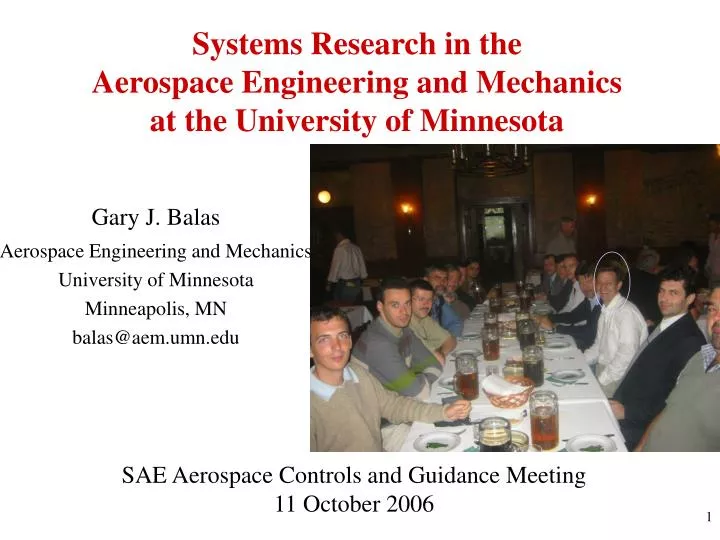
Systems Research in the Aerospace Engineering and Mechanics at the University of Minnesota. Gary J. Balas Aerospace Engineering and Mechanics University of Minnesota Minneapolis, MN balas@aem.umn.edu. SAE Aerospace Controls and Guidance Meeting 11 October 2006.

E N D
Systems Research in theAerospace Engineering and Mechanicsat the University of Minnesota Gary J. Balas Aerospace Engineering and Mechanics University of Minnesota Minneapolis, MN balas@aem.umn.edu SAE Aerospace Controls and Guidance Meeting 11 October 2006
University of MinnesotaAerospace Engineering and Mechanics Systems Faculty • Gary Balas , Department Head • Robust control, real-time embedded systems, flight control • William Garrard • Modeling, flight control, parachutes • Yiyuan Zhao • Optimization, air traffic control, rotorcraft • Demoz Gebre-Egziabher • Navigation, GPS, sensor fusion • Bernard Mettler • Real-time control, planning, rc helicopters and planes
Current Research • “Control Reconfiguration and Fault Detection and Isolation Using Linear, Parameter Varying Techniques,” NASA Langley Research Center, NASA Aviation Safety Program, Dr. Christine Belcastro Technical Monitor • “Stability and Control of Supercavitating Vehicles,” ONR, Dr. Kam Ng Program Manager • Special Session at the 2006 AIAA Gudiance, Navigation and Control Conference entitled “Modeling and Control of High-Speed Underwater Vehicles.” • “Development of Analysis Tools for Certification of Flight Control Laws,” joint work with Andy Packard at UC Berkeley and Pete Seiler at Honeywell. This research is being funded by AFOSR. • Workshop on “Real Time Control of Hybrid Systems: Design, Implementation, Verification, and Validation” in Budapest June 27-28, 2006 sponsored by NSF, Hungarian Academy of Science and Unisaino, Benevento, Italy.
Navigation and Guidance Research Demoz Gebre-Egziabher Department of Aerospace Engineering and Mechanics University of Minnesota, Twin Cities
High Integrity Navigation • Design and validate high integrity navigation systems for the DoDs Joint Precision Approach and Landing System (JPALS) • Precise over bounds on navigation errors. • Fault detection and isolation algorithms • Methods for fusing information from multiple navigation sensors (GPS, INS, baro-altimeter) • Sponsor: Lockheed Martin Tail-Hook Target = 3’ x 3’ box which moves with the aircraft carrier JPALS Performance Specifications: Accuracy = 1.1 m Vertical Alarm Limit Integrity = 10-7 Probability Hazardously Misleading Information Time to Alarm = 1 sec.
UAV/RPV as ITS Sensor Platforms • Explore capabilities enabled by Uninhabited Aerial Vehicles (UAV) or Remotely Piloted Vehicles (RPV) in Intelligent Transportation Systems (ITS) applications • Data gathering, surveillance. • Develop “turn-key” sensors and systems which enable use of then in ITS applications • Explore regulatory and technical issues associated with safely operating RPV/UAV close to the National Airspace System (NAS) Controlled Airspace Boundaries (Blue) Synthetic Vision Display developed at U of M as part of this research for remote operation situational awareness of small aerial vehicles. Display fuses satellite imagery and a GIS data base with an open source flight simulator
Micro- and Nano-Satellite Design GPS Antenna Solar Cell • Design of systems and algorithms for ultra-short baseline GPS attitude determination systems for micro- and nano-satellites. • Baselines on the order of one-wavelength. • Non-aligned antenna arrays. • Modification of COTS components • Sponsor: US Air Force Research Labs, Space Vehicle Directorate (University Nanosat Program) Minnesat
William L. Garrard Dynamics and Control of Aerospace Vehicles Flight Mechanics of Parachute Systems
Azimuth Pointing Control Of A Balloon-Borne Stabilized Platform
Guidance and Control of Autonomous Vehicles October 6, 2006 Bernard Mettler Assistant Professor Department of Aerospace Engineering and Mechanics University of Minnesota
Requirements for Autonomous Vehicle Operation • Mobility and agility are fundamental to autonomous vehicles • negotiating complex terrain environments • handle difficult operational conditions (i.e. atmospheric disturbances) • making full use of vehicle dynamic capabilities • Involves interplay between lower-level flight control and higher-level trajectory planning • Requires technique that integrate local and global scales Receding Horizon Trajectory Optimization with a Cost-to-go Function • Principle • perform trajectory optimization over finite horizon T • capture discarded trajectory tail with a cost-to-go (CTG) J(x(t+T)) • Provides a rigorous framework to combine on- and offline optimization • Offline (near real time O(secs)): computation of CTG • Online: computation of the control action • Goal: Approach the performance of infinite horizon optimization with less computational burden • Key question: how to compute the CTG function ?
Cost-to-go Computation • Finite-state model to capture vehicle maneuvering capabilities. Example: • Quantized speeds: v1, v2, … • Capabilities at each speed represented by feasible turning and linear accelerations • Discrete headings (π/4 resolution) • Compute cost-to-go function with Dynamic Programming Examples cost-to-go Maps goal: circle “o” heading North Open space CTG Space with Obstacles CTG Trajectories based on CTG
Ongoing Work Key Features • Computationally efficient: • CTG computed O(secs) • No special environment model required (works with digital elevation map) • Captures global features of planning problem from standpoint of vehicle capabilities • Environment is “resolved” by characteristic vehicle motions • Provides a way to partition the environment (virtual roadmaps) • Accurate CTG map can be used directly with a control policy • Provides a framework to study interplay between spatial constraints and dynamic behavior • Find adequate level of approximations in CTG computation, i.e., given vehicle capabilities and operational requirements, determine: • Resolution of cost-to-to map, number/type of motion primitives • Length of the optimization horizon and update interval • Exploit global CTG structures • Partitions and “virtual roadmaps” are based on vector field characteristics • Enable high-level decision making (tactical) • Develop efficient algorithms for online optimization • Robustness to stochastic effects • Uncertainty about environment knowledge • Disturbances CTG Partitions/Structures
Indoor Flight Experiment Facility Indoor flight lab setup • Vision based tracking system used for aircraft positioning and attitude • No on-board instrumentation required • Makes possible to use micro helicopters and airplanes • Create controlled experimental conditions • Scenarios with real or virtual 3D environments • Jets to simulate wind disturbances • Interactive human-autonomous experiments Other Aircraft under Investigation Test Helicopter with cameras E-Flight Blade CX (200g) with Vicon’s MX 40 cameras Micron FP Helicopter (50g) Plantraco Butterfly (3g)
Current Research Activities of Yiyuan J. ZhaoUniversity of Minnesota Distributed Dynamic Optimization Across Airborne Networks Optimal UAV Flights in Wind
Distributed Dynamic Optimization Across Airborne Networks • Airborne Networks: Ad Hoc Wireless Networks Among Aircraft • Each Vehicle Calculates Its Own Optimal Flight Trajectory • To optimize a performance index, to achieve a certain team task • To avoid conflicts with each other
Wind Gradients Thermals Mountain Waves Optimal Unmanned Aerial Vehicle Flight in Wind • Potential Benefits of Wind Energy Utilization in UAV Flight • Reduced fuel consumption/prolonged flight/increased range