Download
1 / 20
200 likes | 272 Views
Managing Patch Edge Fuel Effects Fire Spread in a Fragmented Landscape. By: Jacob J. LaCroix, Soung-Ryoul Ryu, Qinglin Li, Daolan Zheng, and Jiquan Chen. Introduction. Forests are unique in overall structure No two forests can be classified in the same way based on remote sensing

E N D
Managing Patch Edge Fuel Effects Fire Spread in a Fragmented Landscape By: Jacob J. LaCroix, Soung-Ryoul Ryu, Qinglin Li, Daolan Zheng, and Jiquan Chen
Introduction • Forests are unique in overall structure • No two forests can be classified in the same way based on remote sensing • The author decides on how to best represent a forest in a GIS model from the many natural and man made features • Usually depends on the variable one is interested in studying to determining which ones are okay to leave in or not include • It would be nice to be able to identify the influence of a feature on the dependent variable
Introduction to CNF • One of our primary study sites in Northern Wisconsin, Chequamegon National Forest • We have done both real field data collection and theoretic modeling with this site (Zheng and Chen 2000) and (Watkins et. al. 2002) • Some things that we know about it are: • It is highly fragmented, heavily harvested and intensely used for recreation • Numerous small patches and edges dominate the structure of the forest • Therefore with a fire spread study, edge fuel dynamics should influence fire fuel loading • Logical to try and consider its effects
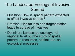
Fire with Edges • However, edges are not easy to quantify or model • Patch edge dynamics are essentially unique in space and time and we cannot measure every patch. • Harper et al. (2005) synthesized edge literature, defined terms and encourage us to look at forest edge dynamics from a landscape perspective and with ecological processes that may be influenced by edges • Examine fire spread in this way, in a WI landscape where the edge feature is strong
Landscape Approach • Assigning all edge fuels together, given a range of low, medium and high fuel loading scenarios relative to the dominate classification of the current forest • Allows us to keep the high connectivity of the feature in relation to other fuels on the landscape, which is important for fire spread and other processes such as plant and animal edge dynamics
Brush Red Pine Hardwood Slash Edge Water Chequamegon National Forest
Objectives • To determine what impact fuels in edges will have on burned area and rate of spread • To determine the level of landscape loading of the current classification without edges • Impact of the feature • To make patch level inferences about other landscape features with high connectivity • Examples: Man made: roadsides, power line corridors, railroads, and hiking trails or Natural: timberline, meadows, and riparian zones. • If a majority of patches from those features were assigned to fuel loadings at a high, medium or low level based on the range of the current classification, what would be the result
Edge Assumptions • Best based on newly created i.e. clear cut forest edges dynamics • 75% of our landscape is forested fuel assignments • Helps infer what if a majority of patch assignments were low, medium or high in this edge structure.
Assumptions/Simplifications • Freezes edge dynamics at one point in time • Distance of Fuel Influence (DFI) set at 30m is likely smaller than the probable entire Distance of Edge Influence (DEI) • 30m is subjective but is the smallest distance resolution of the model; okay fit from literature • Equal on both sides of the edge • Forms a uniform 60m belt or corridor on the landscape • No gradient along the DFI • We only manipulate fuel in the edge and not moisture or wind in the edge • One regional set of weather inputs applies to all
Justifications for Fuel Loading Scenarios • At new forest edge creation: (Harper et al 2005) • Snags and logs from tree mortality/damage: increase fuel • Primary process responses • Productivity increases: raising fuels • Decomposition increases: lowering potential fuels • Primary structural responses • Canopy cover, tree density and biomass decrease: decreases fuels • Downed wood increases: increasing fuels • Secondary process response • Recruitment, growth and mortality increase: increases fuels • Secondary structural response • Sapling density, under story cover increase: increasing fuel • Hkjhkj • Khkjhkj • Ljhlklk • Ljlkjlk • Lkjlkjl • lkjlkj
Methods • FARSITE Model of fire spread based on CNF • 5 layer GIS map, manipulated the fuel layer • Based on the current 4 fuel categories • Created 4 landscapes • 1 - No edges assigned - 4 fuels • 3 – Where same edge buffer was defined: 30m to either side of the edge • Absorbed all patches less than 60m in the 4 landscapes • 3 custom fuels, with a range of loadings for forests, were placed into this edge area, one at a time • Giving each edge landscape 5 fuels • April 2004 Weather-no rain for a 7 day duration • Eliminates the rain effect • 16 systematic fire locations to represent the entire landscape
Visual Landscape Comparison No Edge Landscape Edge Landscape
Landscape Comparisons % Area in each classification Landscapes scenarios Anderson’s fuel model #’sCustom fuel model #’s Brush Red Pine Hardwood Slash Low Medium High 5 8 10 11 20 21 22 Control No Edge Fuel 24.5 14.5 52.5 8.5 0 0 0 Edge Low Fuel Loading 15.2 8.9 42.3 4.4 29.2 0 0 Edge Medium Fuel Loading 15.2 8.9 42.3 4.4 0 29.2 0 Edge High Fuel Loading 15.2 8.9 42.3 4.4 0 0 29.2
Fuel Assignment Comparison Model Fuel Loading Rate of Spread Flame Length # tons/ac ft/min ft 1hr 10hr 100hr 5 Brush 1.00 0.50 0.00 14.0 3.5 20 Low 0.75 0.50 1.25 1.0 0.6 8 Red Pine 1.50 1.00 2.50 2.2 1.1 21 Medium 1.46 0.20 0.07 4.9 1.6 11 Slash 1.50 4.51 5.51 6.7 3.5 10 Hardwood 3.01 2.00 5.01 8.2 4.8 22 High 4.51 3.00 7.51 12.4 7.0
ANOVA Results Source DF Sum of Squares Mean Square F-Value P-value Model 18 17,880,234 993,346 34.34 < 0.0001 Error 45 1,301,820 28,929 Corrected Total 63 19,182,054 R-Square = 0.932 Source DF ANOVA SS Mean Square F-value P-Value Landscape 3 14,238,072 4,746,024 164.06 < 0.0001 Location 15 3,642,162 242,810 8.39 < 0.0001
Conclusions • Patch edge fuels influence the rate of fire spread and improve our classification accuracy • current classification is equivalent to a landscape loading that produces rates of fire spread and flame lengths between medium and high-level edge loading scenarios • This data allows us to predict what may happen if similar or more landscape features with high connectivity are included in fuel classification, when fire encounters it • Managers can use this information to control fires by altering fuel in edges during normal harvesting operations
Acknowledgments • Funding provided by the Joint Fire Science Project • LEES Lab • Questions