Download
1 / 61
610 likes | 615 Views
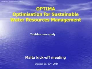
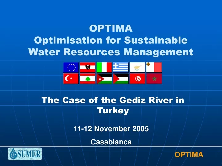
OPTIMA Optimisation for Sustainable Water Resources Management. The Case of the Gediz River in Turkey. 11-12 November 2005 Casablanca. Population : 1.700.000. Istanbul. Extent : 18000 km 2. Gediz Basin. Izmir. Water Supply : 1100 MCM 647 m 3 per capita.

E N D
OPTIMAOptimisation for Sustainable Water Resources Management The Case of the Gediz River in Turkey 11-12 November 2005 Casablanca
Population:1.700.000 Istanbul Extent:18000 km2 Gediz Basin Izmir Water Supply: 1100 MCM647 m3 per capita Water Demand: 886 MCM521 m3 per capita
Boundaries and Municipalities Akhisar Saruhanli Manisa Golmarmara Menemen Turgutlu Salihli Ahmetli Alasehir Kemalpasa IZMIR
KEY ISSUES Demographic Change Basin Population 1,5 % /year 19702000 “1.100.000” “1.700.000” INTERNAL MIGRATION RURAL TO URBAN: RAPID URBANIZATION Urban population 2% /year Rural population 0.7% /year Land Use Change • Urban Areas 2% /year • Industrial Areas 10% /year INCREASING WATER DEMAND: COMPETITION AMONG USERS
KEY ISSUES Supply (61mm)Demand (49.6mm) • Domestic demand0.15 mm/year,2% • Industrial demand0.3 mm/year,10% “NO WATER MAY BE LEFT FOR FURTHER ALLOCATION!”
Discharges W. Q. CLASS IV (acc. Turkish W.Q.C. Standards) Water Quality 60% of Surface Water 30% of Ground Water “VERY POLLUTED!!”
SUMER CONTRIBUTION IN OPTIMA PROJECT C07 SUMER, TURKEY SUMER will contribute to; • the data compilation and analysis tasks, primarily for the hydrology andwater resources components, • assist with model implementation, • run the Turkish case study forthe Gediz river basin.
SUMER CONTRIBUTION IN OPTIMA PROJECT Gediz Case Study: Start month:12 End month: 30 Total effort: 34 Deliverables: D08.1: Gediz River: Problem Analysis Month: 25 D08.2: Gediz River: Optimization Results Month: 34
WP05 LAND USE CHANGE: REMOTE SENSING AND GIS DATA DEM SOIL MAP RIVER LAND COVER
WP05 LAND USE CHANGE: REMOTE SENSING AND GIS DATA METEO FLOW by DSI FLOW by EIE
WP05 LAND USE CHANGE: REMOTE SENSING AND GIS DATA ~30m spatial resolution Landsat TM (1987) ~30m spatial resolution Landsat ETM (2000)
WATERWARE STUDIES Topology is reviewed and updated Settlements are included Domestic water demands are added Groundwater extractions from wells for domestic demand are included Demand and release time series of reservoirs and irrigation districts are re-evaluated River Basin Object entry and editing is in progress Water quality data (BOD loads) of settlements and industrial districts are compiled The producer (farmers) selling prices of crops and their yields are compiled
Gordes Tributary Afsar Buldan Demirkopru Adala Irrig. Alasehir Irrig. Marmara Lake Ahmetli Irrig. Kumcay Tributary Nif Tributary Wetland Menemen Irrig. Bay of Izmir Topological View of the Previous Baseline Gediz Scenario
Gordes Tributary Buldan Afsar Demirkopru Adala Irrig. Alasehir Irrig. Marmara Lake Ahmetli Irrig. Nif Tributary Kumcay Tributary Wetland Menemen Irrig. Bay of Izmir Topological View of the Recent Baseline Gediz Scenario
WATERWARE STUDIES River Basin Objects Reservoirs: 1) Demirkopru: supplies irrigation water, flood prevention, energy production during the irrigation season. 2) Afsar: provides irrigation water to Alasehir lowlands. 3) Buldan: provides irrigation water to Alasehir lowlands. 4) Marmara Lake 5) Gordes (under construction): supplies domestic water for the city of Izmir in addition to providing irrigation water within the basin. 6) Yigitler (under construction): supplies industrial water for the industrial district of Kemalpasa.
RESERVOIRS BULDAN AFSAR DEMIRKOPRU GORDES? MARMARA YIGITLER? Bay of Izmir
River Basin Objects Industrial Districts: • Manisa Ind. Zone • Kemalpasa Ind. Zone • Memenen Leather Ind. Diversions: • Adala Weir • Ahmetli Weir • Emiralem Weir • Buldan Weir • Comlekci Weir Irrigation Districts : 1) Adala Left Bank 2) Adala Right Bank 3) Ahmetli Left Bank 4) Ahmetli Right Bank 5) Menemen Left Bank 6) Menemen Right Bank 7) Sarigol 8) Alasehir Wetland: • Izmir Bird Paradise
IRRIG. DISTRICTS,WEIRS,IND. ZONES and WETLAND Adala Alasehir Irrig. Adala Irrig. Comlekci Ahmetli Ahmetli Irrig. Kemalpasa Ind. Zone Manisa Org. Ind. Zone Emiralem Wetland Menemen Leather Ind. Menemen Irrig. Bay of Izmir
Yields and Average Farmer’s Prices of Crops No data is available for BOD loads of irrig. return flows Source: Menemen Agr. Hydr. Center
Daily BOD Loads of Industrial Discharges Source: Nen Eng.&Cons., December 2001
River Basin Objects Subcatchments: • Demirkopru Upstream • Buldan Upstream • Afsar Upstream • Medar • Nif • Gordes • Yigitler Settlements : 1) Manisa (Gov. Centre) 2) Akhisar 3) Salihli 4) Turgutlu 5) Kemalpasa 6) Menemen 7) Saruhanli 8) Alasehir 9) Izmir 10) Golmarmara 11) Ahmetli Aquifers: • Salihli-Turgutlu • Menemen • Sarikiz • Alasehir
SUBCATCHMENTS and SETTLEMENTS Buldan Deliinis Afsar Gordes Alasehir Salihli Golmarmara Medar Yigitler Ahmetli Akhisar Nif Saruhanli Turgutlu Kemalpasa Menemen Bay of Izmir
Domestic Demand of Settlements ** Values from Bank of Provinces
BOD Loads of Domestic Returns of Settlements Source: Nen Eng.&Cons., December 2001
The aquifers identified in WaterWare (WRM) and their parameters.
GROUNDWATER:AQUIFERS IDENTIFIED Groundwater coupling? Sarikiz Menemen Salihli_Turgutlu Alasehir
Subcatchments Outflow TS The year of TS is 1991 Observed stream gauging station data are used Some small subcatchments are taken into account like lateral inflows to the reaches (Sarma, Taytan, Tabak) For Buldan and Afsar Subcatchments the observed inflows to the reservoirs are used, BUT there is some inconsistencies, hence those subcatchments may be re-evaluated with RRM
Summary of the Existing Situation and Ongoing Trends in the Gediz Basin In the Gediz Basin, there are: • agricultural, • domestic • industrial activities which supply their water needs directly from surface waters and thegroundwater system
Summary of the Existing Situation and Ongoing Trends in the Gediz Basin Irrigation : The major consumptive water use in the Gediz is irrigation, realized in four major districts. In addition, a downstream wetland called the “Bird Paradise” is also connected to the Menemen Left Bank irrigation scheme. The intensive irrigation activities in the basin are supported by three reservoirs and a set of weirs which divert the flow to irrigation channels. On the other hand, there are also many wells exploiting the groundwater either under normal conditions for small irrigation systems or in cases of emergency like droughts .
Summary of the Existing Situation and Ongoing Trends in the Gediz Basin Irrigation : The irrigation schemes are operated on open channel conveyance systems. Most of the farmers prefer “flooding” methods for irrigation at the field. The dominant crop pattern in irrigation districts is cotton, table grapes and maize; however, their percentage with respect to irrigated areas changes every year, depending on the income expected by farmers.
Summary of the Existing Situation and Ongoing Trends in the Gediz Basin Domestic and Industrial Water Use: Domestic and industrial demands in the Gediz Basin are generally met through groundwater sources. All the municipalities in the basin supply their domestic water through groundwater, thereby putting these resources under stress. There are also three major industrial districts, nearby Manisa, Menemen and Kemalpasa municipalities,supplying their demand by groundwater. Unfortunately, their consumption rates and fixed costs for pumping are not monitored and recorded; only rough estimates are available.
Gediz Baseline Scenario Building and Preliminary Results of WRM
Assumptions of Modeling Practice Flow TS used as input are from the year of 1991 There was limited irrigation at this year Initial storages of reservoirs and aquifers:In the baseline scenario, the initial storages of the reservoirs are selected such that they preserve almost the same amount of water at the beginning and at the end of the year, namely, at the start and at the end of a model simulation; 20%
Assumptions of Modeling Practice Conveyance losses of demand nodes: No Irrigation System Change: conveyance loss: 10 % evaporation losses: 5%, return flow losses: 5%. Irrigation demand time series and reservoir releases: The daily demand time series of irrigation districts are computedby the CROPWAT(FAO) for Windows 4.3. The real release time series at that year are used