Download
1 / 42
420 likes | 546 Views
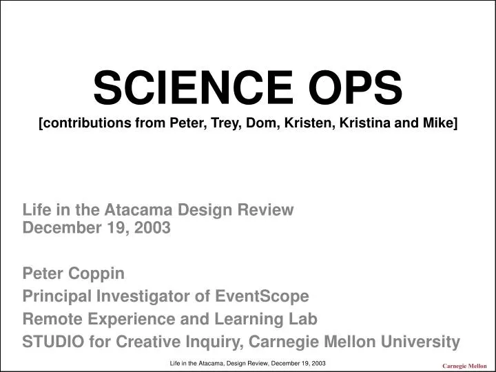
SCIENCE OPS [contributions from Peter, Trey, Dom, Kristen, Kristina and Mike]. Life in the Atacama Design Review December 19, 2003 Peter Coppin Principal Investigator of EventScope Remote Experience and Learning Lab STUDIO for Creative Inquiry, Carnegie Mellon University. Last Year.

E N D
SCIENCE OPS[contributions from Peter, Trey, Dom, Kristen, Kristina and Mike] Life in the Atacama Design ReviewDecember 19, 2003 Peter Coppin Principal Investigator of EventScope Remote Experience and Learning Lab STUDIO for Creative Inquiry, Carnegie Mellon University Carnegie Mellon
Last Year Carnegie Mellon
Science OPS: What is it?[Description and Motivation] How scientists get data How to understand what they have How they say what they want next How everything is labeled and correlated Long Range Traverse Interface [7 minutes] Interface to science autonomy system [7 minutes] Short range traverse interface [7 minutes] OPS Infrastructure [7 minutes] Carnegie Mellon
Specifying goals over the horizon Carnegie Mellon
15-18Apr Last Season Carnegie Mellon
Description and Motivation • <What is the thing being designed?> • An interface to specify goals to the planner during long range traverses • <What system requirements motivate it and why is it needed?> • Need a way to specify goals prior to seeing pans or hi-res images of over the horizon sites • Need an intuitive way to interface with the planner SW • Need an easy way to find data once it is retrieved Goals DEM Carnegie Mellon
Data correlation: Elevation models, pans, and other data Carnegie Mellon
GUI Overview Hi-res Image Fluorescence Pan Spec Point spec Sensors Site properties inspector Make Search Area Uplink Set pan angle Pan Down link Comm. Locomotion Encourage waypoint Run Plan Estimator Carnegie Mellon
Specify survey traverse [0800] Hi-res Image Fluorescence Pan Spec Point spec Sensors Site properties inspector Make Search Area Uplink Set pan angle Pan Down link Comm. Locomotion Encourage waypoint Run Plan Estimator Carnegie Mellon
System creates path estimate Hi-res Image Fluorescence Pan Spec Point spec Sensors Site properties inspector Make Search Area Uplink Set pan angle Pan Down link Comm. Locomotion Encourage waypoint Run Plan Estimator Carnegie Mellon
Operator adjusts requests Hi-res Image Fluorescence Pan Spec Point spec Sensors Site properties inspector Make Search Area Uplink Set pan angle Pan Down link Comm. Locomotion Encourage waypoint Run Plan Estimator Carnegie Mellon
Operator re- runs plan estimator Hi-res Image Fluorescence Pan Spec Point spec Sensors Site properties inspector Make Search Area Uplink Set pan angle Pan Down link Comm. Locomotion Encourage waypoint Run Plan Estimator Carnegie Mellon
Finalize target selection [0955] Hi-res Image Fluorescence Pan Spec Point spec Sensors Site properties inspector Make Search Area Uplink Set pan angle Pan Down link Comm. Locomotion Encourage waypoint Run Plan Estimator Carnegie Mellon
Uplink rover traverse [1000] Hi-res Image Fluorescence Pan Spec Point spec Sensors Site properties inspector Make Search Area Uplink Set pan angle Pan Down link Comm. Locomotion Encourage waypoint Run Plan Estimator Carnegie Mellon
Downlink / initial analysis Hi-res Image Fluorescence Pan Spec Point spec Sensors Site properties inspector Make Search Area Uplink Set pan angle Pan Down link Comm. Locomotion Encourage waypoint Run Plan Estimator Carnegie Mellon
Operator verifies data/ more analysis [0700] Hi-res Image Fluorescence Pan Spec Point spec Sensors Site properties inspector Make Search Area Uplink Set pan angle Pan Down link Comm. Locomotion Encourage waypoint Run Plan Estimator Carnegie Mellon
[SK] Design Considerations • <What issues dominate the design decision?> • Need interactive feedback from local planning software • Need interactive feedback regarding data volume and its relationship to the planner • Need interactive feedback regarding priorities and the planner • <What metrics are important to consider?> • Available time between each uplink • The amount of time it takes to run the planner • <What trades were examined?> • Simplicity/ speed vs. precision Carnegie Mellon
Once scientists tell the robot where to go, how will they tell the robot what samples they want returned?[Based on conversations between Peter, Dom, Trey, Kristen and Kristina] Carnegie Mellon
Science Autonomy Interface: Description and Motivation • Need a way to tune parameters that define science priorities for autonomous searches that are beyond the range of the pan [over the horizon] • Need to “train the scientists” to specify requests within the constraints of the system ? ? Carnegie Mellon
Step 1: Load images from previous traverses, other sites or orbital images More More Less Less Roundness Contrast Size Weighted Value Attribute Importance .9 .9 .2 .2 .5 .5 [[TBD]] Carnegie Mellon
Step 2: Interactively tune parameters [camera focus analogy] More More Less Less Roundness Contrast Size Weighted Value Attribute Importance .9 .9 .2 .2 .5 .5 [[TBD]] Carnegie Mellon
Step 3, groups results/ Science Map [from Trey’s Presentation] Carnegie Mellon
Slide by Dom after our brainstorm 1 Take workspace image 2 Identify potential targets 3 Evaluate each target 4 Apply scientist-defined settings 5 Select one for analysis Roundness 0.4 0.9 0.6 0.2 0.3 Contrast 0.9 0.2 0.6 0.2 0.9 Size 0.5 0.9 0.3 0.7 0.2 Weighted Value 0.8 0.4 0.5 0.3 0.7 Carnegie Mellon
[SK]Interface to science planner: Key requirements • <What is this component supposed to do?> • Translate the goals of the science team into goals for the science planner • <What properties/qualities must it exhibit?> • Enable scientists to interactively tune parameters in order to guide autonomous traverses Carnegie Mellon
Notes • Preceptor technology • Related work at JPL • Simple mockup, test on scientists, iterate • Split tasks between other rover team members Carnegie Mellon
Short range targeted searches Carnegie Mellon
Description and Motivation: • <What system requirements motivate it and why is it needed?> • Need to show correlated full resolution 3D panoramic images, hi-res images, and other data as hyperlinked knowledge maps • Specify goals • Download data • Make it easy to find data after it is downloaded • Run plan simulations • Provide analysis and measurement tools Carnegie Mellon
Hotspot represents goals to the planner Carnegie Mellon
Hotspot represents goals to the planner Carnegie Mellon
Planner generates simulated plan Carnegie Mellon
When data arrives on the server, the hotspot turns yellow Carnegie Mellon
When data is verified by scientists, the hotspot turns green Clicking the green hotspot loads new dataAll hyperlinked data is archived in .zip format Carnegie Mellon
Clicking the green hotspot loads new data Carnegie Mellon
EVENTSCOPE PORTAL TO MARS [MARS EXPLORATION ROVER] Changes and enhancements to technology [SK] EventScope Software Architecture ALLOWS SCIENTISTS TO ADD COMMENTARY TO DATA PORTAL SERVER EVENTSCOPE AUTHORING TOOL *NEW INTERFACE COMPONENTS,ROVER DATA TREE, SCENE EDITING, SAMPLE HYPERLINKS OTHER DATA AS ESP FILE [SPECTRAL, ETC.] DATA FROM JPL *REMOTE DEFAULT PRESENTATION STUDENT OR SCIENTIST CONVERSION PROCESS *STEREO IMAGE PAIRS *STEREO POINT CLAUD *VRML FILE EVENTSCOPE ESP FILE Carnegie Mellon
Technical Approach • <What are the candidate solutions?> • Web type interface • Virtual Environment within EventScope • VIZ • SAP • Large printouts with physical icons • <What is the leading solution?> Database Web/ simple GUI EventScope Virtual Environment Carnegie Mellon
Implementation Issues • <Are prototypes to be tested?> • Starting in January, 7 months of testing using data from Mars Exploration Rovers • Need plan to test long range traverse interfaces • <What are the potential failure conditions?> • Large file sizes • <What are the major schedule issues?> • Need multiple tests with rover prior to expedition Carnegie Mellon
Final thoughts[if not talking about ops infrastructure] Data structuresData correlationCommunication for both data and humans Stateside rover team member Configuration and location of OPS room Carnegie Mellon
OPS Room5 PeopleSeveral weeksGood infrastructureLow cost Carnegie Mellon
OPS Room • 5 PC’s with high end graphics cards • Meeting area • Individual work areas • 3 Projectors • GeoWall, or panoramic projector • Internet connections for laptops • Printer • Plotter • Video cameras and other documentation equipment Carnegie Mellon
<What are the candidate solutions?> • Future flight central at Ames • A room at CMU • Natural history museum Earth Theater • <What is the leading solution?> • Natural history museum Earth Theater Carnegie Mellon
Final thoughts Data structuresData correlationCommunication for both data and humans Stateside rover team member Carnegie Mellon
Implementation Issues • <Are prototypes to be tested?> • <What are the potential failure conditions?> • <What are the major schedule issues?> Carnegie Mellon